Enable Location

We need your location to show you interesting places around you

Discover nearby places

Find interesting locations and hidden gems around you

Precise directions

Get accurate directions and distances to places

Your location is never shared with other users. It's only used when you tap the location button.

Kovdozero

Log in to your account

Start exploring — it's free

Trusted by 62,442 travelers worldwide

Continue with Google
Continue with Apple
or

We will send you a code to connect

By continuing, you accept our Terms and Conditions and our Privacy Policy

Check your inbox

We've sent a pincode in your inbox. Please enter the code below.

Kovdozero

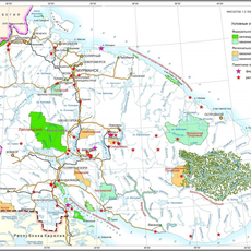
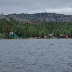
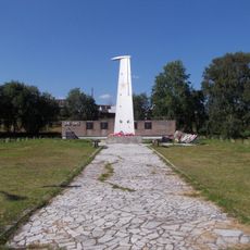
Kovdozero, lake turned reservoir in Murmansk Oblast, Russia

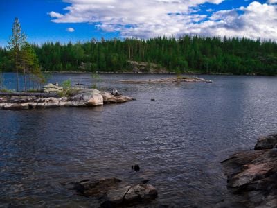
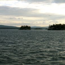
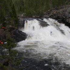
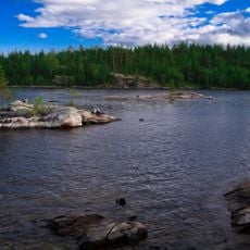
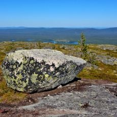
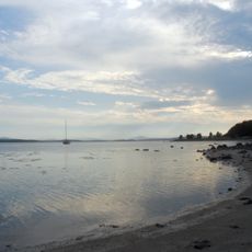
Kovdozero is a large reservoir in Murmansk Oblast with over 580 islands ranging from rocky outcrops to forested land masses. The shoreline is mostly low and wooded, featuring sandy coves and rocky sections, while surrounding forests contain spruce, pine, and birch trees.

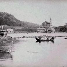
The lake's water level was raised in 1955 when it was used as a reservoir to support nearby facilities. This change significantly enlarged the water body and transformed the landscape for local communities who had long relied on it for fishing and travel.

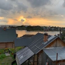
The name Kovdozero comes from Finno-Ugric language and means "fish lake". Today the water and islands remain woven into daily life for people from nearby villages who gather here to fish and spend time outdoors.

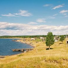
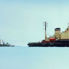
Visit in summer when ice has melted and boats can move on the water, or in winter for ice fishing on the frozen surface. Most visitors arrive by car since there are no direct public transportation routes, and should expect unpaved roads.

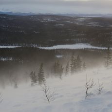
The water typically freezes by late October or early November and stays frozen until mid-May, giving the lake an entirely different character. These long ice seasons transform the surface into a smooth playground for ice fishing and winter walks found nowhere else in the region.

The community of curious travelers

AroundUs brings together thousands of curated places, local tips, and hidden gems, enriched daily by 60,000 contributors worldwide.

Start exploring
Location
Elevation above the sea
37.2 m
GPS coordinates
66.78278,32.00000
Latest update
February 9, 2026 08:23
Around this place
Lapland Biosphere Reserve
Russian Federation

Lapland Biosphere Reserve

87.7 km
Kandalaksha Nature Reserve
Russian Federation

Kandalaksha Nature Reserve

39.9 km
Kumsk Reservoir
Russian Federation

Kumsk Reservoir

97.9 km
Iovsk Reservoir
Russian Federation

Iovsk Reservoir

41.3 km
Кутса (заказник)
Russian Federation

Кутса (заказник)

77.7 km
Kandalaksha Monastery
Russian Federation

Kandalaksha Monastery

45.3 km
Church of the Nativity of John the Baptist in Kandalaksha
Russian Federation

Church of the Nativity of John the Baptist in Kandalaksha

43.2 km
Saint Nicholas church
Russian Federation

Saint Nicholas church

39.2 km
Малый Янискенгас
Russian Federation

Малый Янискенгас

87.7 km
Kandalaksha
Russian Federation

Kandalaksha

43.2 km
Колвицкий заказник
Russian Federation

Колвицкий заказник

80.2 km
Kovdaozero Reservoir
Russian Federation

Kovdaozero Reservoir

5.1 km
Bell tower of Saint Nicholas church (Kovda)
Russian Federation

Bell tower of Saint Nicholas church (Kovda)

39.2 km
Kuruvaara Quarry
Russian Federation

Kuruvaara Quarry

96.5 km
Памятник Герою Советского Союза А. Спекову
Russian Federation

Памятник Герою Советского Союза А. Спекову

46.2 km
Verman Rubezh
Russian Federation

Verman Rubezh

56.7 km
Место стоянки партизанского отряда
Russian Federation

Место стоянки партизанского отряда

46.7 km
Братская могила жертв интервенции 1918-1920 годов
Russian Federation

Братская могила жертв интервенции 1918-1920 годов

19.7 km
T-34-85 in Alakurtti
Russian Federation

T-34-85 in Alakurtti

75.2 km
Stone labyrinths in Kandalaksha
Russian Federation

Stone labyrinths in Kandalaksha

42.6 km
Памятник «Танкетка Т-27»
Russian Federation

Памятник «Танкетка Т-27»

75.5 km
Братская могила четырех советских летчиков, погибших в воздушном бою 15 октября 1944 г. (Чупа)
Russian Federation

Братская могила четырех советских летчиков, погибших в воздушном бою 15 октября 1944 г. (Чупа)

73.9 km
Обелиск железнодорожникам, погибшим в годы Великой Отечественной войны
Russian Federation

Обелиск железнодорожникам, погибшим в годы Великой Отечественной войны

46 km
Ozero Ilimyaynen Purstelampi
Russian Federation

Ozero Ilimyaynen Purstelampi

69.6 km
Palace of Culture "Metallurgist"
Russian Federation

Palace of Culture "Metallurgist"

48.5 km
Святилище на горе Кивакка (Кестеньгское с.п.)
Russian Federation

Святилище на горе Кивакка (Кестеньгское с.п.)

91 km
Нива 15 (поселение)
Russian Federation

Нива 15 (поселение)

43.2 km
Стоянка эпохи позднего неолита
Russian Federation

Стоянка эпохи позднего неолита

42.7 km
Show the full map
« Kovdozero - lake turned reservoir in Murmansk Oblast, Russia » is provided by Around Us (aroundus.com). Images and texts are derived from Wikimedia project under a Creative Commons license. You are allowed to copy, distribute, and modify copies of this page, under the conditions set by the license, as long as this note is clearly visible.

Discover hidden gems everywhere you go!

From secret cafés to breathtaking viewpoints, skip the crowded tourist spots and find places that match your style. Our app makes it easy with voice search, smart filtering, route optimization, and insider tips from travelers worldwide. Download now for the complete mobile experience.

Around Us App Screenshot

A unique approach to discovering new places

Le Figaro

All the places worth exploring

France Info

A tailor-made excursion in just a few clicks

20 Minutes

Around Us
Travel Guide & Maps
Download

Send to your phone

QR Code
1

Open the camera app on your mobile.

2

Point at the QR code with your camera. A notification will appear.

3

Tap the notification to open the link.