Enable Location

We need your location to show you interesting places around you

Discover nearby places

Find interesting locations and hidden gems around you

Precise directions

Get accurate directions and distances to places

Your location is never shared with other users. It's only used when you tap the location button.

Kumsk Reservoir

Log in to your account

Start exploring — it's free

Trusted by 62,456 travelers worldwide

Continue with Google
Continue with Apple
or

We will send you a code to connect

By continuing, you accept our Terms and Conditions and our Privacy Policy

Check your inbox

We've sent a pincode in your inbox. Please enter the code below.

Kumsk Reservoir

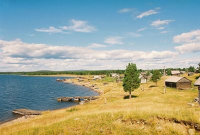
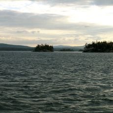
Kumsk Reservoir, reservoir in Russia

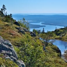
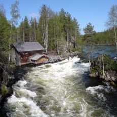
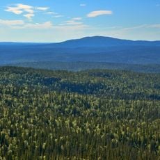
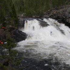
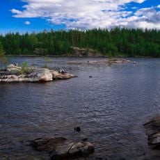
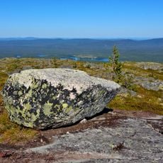
Kumsk Reservoir is a large body of water in Karelia built between 1960 and 1962 for water storage and hydroelectric power. The basin spreads across a wide area surrounded by forests and hills, with shores that slope gently toward the water.

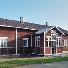
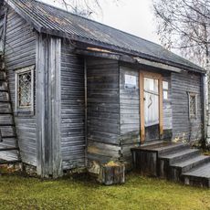
The reservoir was created in the early 1960s as part of the Soviet hydroelectric program, flooding large areas and displacing around two hundred buildings. This project fundamentally transformed the landscape and became central to regional infrastructure.

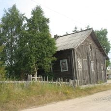
The reservoir is woven into local life, with fishing serving as an important tradition for people in nearby villages. The water shapes daily routines and food practices in the surrounding communities.

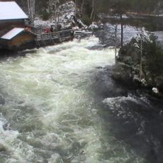
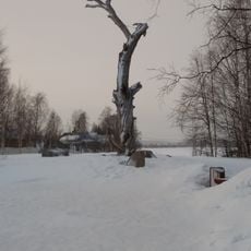
Access is best via surrounding villages, and warmer months are ideal for activities like fishing and bird watching along the water. Winter brings ice formation, which opens other possibilities, but accessibility may become more challenging during cold seasons.

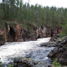
In the 1960s and 1970s, the reservoir was highly productive for fishing with annual catches around four hundred tons, yet fish populations have since declined sharply. This shift reveals how ecosystems in artificial reservoirs evolve and change over decades.

The community of curious travelers

AroundUs brings together thousands of curated places, local tips, and hidden gems, enriched daily by 60,000 contributors worldwide.

Start exploring
Location
GPS coordinates
66.00000,31.00000
Latest update
February 9, 2026 08:23
Around this place
Rukatunturi
Finland

Rukatunturi

85.4 km
Paanajärvi National Park
Russian Federation

Paanajärvi National Park

50 km
Hossa National Park
Finland

Hossa National Park

90.7 km
Oulanka National Park
Finland

Oulanka National Park

85.4 km
Nuorunen
Russian Federation

Nuorunen

37.7 km
Myllykoski
Finland

Myllykoski

77 km
Kiutaköngäs
Finland

Kiutaköngäs

85.6 km
Värikallio rock paintings
Finland

Värikallio rock paintings

94.6 km
Kovdozero
Russian Federation

Kovdozero

97.9 km
Iovsk Reservoir
Russian Federation

Iovsk Reservoir

67.3 km
Кутса (заказник)
Russian Federation

Кутса (заказник)

83.5 km
Saint Nicholas church
Russian Federation

Saint Nicholas church

113.4 km
Малый Янискенгас
Russian Federation

Малый Янискенгас

90.2 km
Памятный знак "Сосна Лённрота" (Калевала)
Russian Federation

Памятный знак "Сосна Лённрота" (Калевала)

90 km
Oulanka Research Station
Finland

Oulanka Research Station

86 km
Kovdaozero Reservoir
Russian Federation

Kovdaozero Reservoir

100.4 km
Posio Local History Museum
Finland

Posio Local History Museum

107.2 km
Bell tower of Saint Nicholas church (Kovda)
Russian Federation

Bell tower of Saint Nicholas church (Kovda)

113.3 km
Дом жилой Г.А. Леонтьевой (Калевала)
Russian Federation

Дом жилой Г.А. Леонтьевой (Калевала)

88.7 km
Verman Rubezh
Russian Federation

Verman Rubezh

112 km
Дом, в котором жила сказительница М.А. Ремшу (Калевала)
Russian Federation

Дом, в котором жила сказительница М.А. Ремшу (Калевала)

90 km
Дом жилой Ф.Н. Феклистовой и В.Н. Карху (Калевала)
Russian Federation

Дом жилой Ф.Н. Феклистовой и В.Н. Карху (Калевала)

90.6 km
T-34-85 in Alakurtti
Russian Federation

T-34-85 in Alakurtti

110.8 km
Дом инженера Моберга (Калевала)
Russian Federation

Дом инженера Моберга (Калевала)

89.8 km
Братская могила четырех советских летчиков, погибших в воздушном бою 15 октября 1944 г. (Чупа)
Russian Federation

Братская могила четырех советских летчиков, погибших в воздушном бою 15 октября 1944 г. (Чупа)

97.7 km
Памятник «Танкетка Т-27»
Russian Federation

Памятник «Танкетка Т-27»

111 km
Ozero Ilimyaynen Purstelampi
Russian Federation

Ozero Ilimyaynen Purstelampi

91.8 km
Святилище на горе Кивакка (Кестеньгское с.п.)
Russian Federation

Святилище на горе Кивакка (Кестеньгское с.п.)

30.5 km
Show the full map
« Kumsk Reservoir - reservoir in Russia » is provided by Around Us (aroundus.com). Images and texts are derived from Wikimedia project under a Creative Commons license. You are allowed to copy, distribute, and modify copies of this page, under the conditions set by the license, as long as this note is clearly visible.

Discover hidden gems everywhere you go!

From secret cafés to breathtaking viewpoints, skip the crowded tourist spots and find places that match your style. Our app makes it easy with voice search, smart filtering, route optimization, and insider tips from travelers worldwide. Download now for the complete mobile experience.

Around Us App Screenshot

A unique approach to discovering new places

Le Figaro

All the places worth exploring

France Info

A tailor-made excursion in just a few clicks

20 Minutes

Around Us
Travel Guide & Maps
Download

Send to your phone

QR Code
1

Open the camera app on your mobile.

2

Point at the QR code with your camera. A notification will appear.

3

Tap the notification to open the link.