Chest opened
+${chestReward.xp} XP
Explorer
NOUVEAU ×${chestReward.collectible.quantity}
tapez pour fermer
Chest locked

Open chests in the app

Around Us is built for your phone — chests unlock when you walk, explore and capture nearby places.

Enable Location

We need your location to show you interesting places around you

Discover nearby places

Find interesting locations and hidden gems around you

Precise directions

Get accurate directions and distances to places

Your location is never shared with other users. It's only used when you tap the location button.

Nartkala

Log in to your account

Start exploring — it's free

Trusted by 72,889 travelers worldwide

Continue with Google
Continue with Apple
or

We will send you a code to connect

By continuing, you accept our Terms and Conditions and our Privacy Policy

Check your inbox

We've sent a pincode in your inbox. Please enter the code below.

Discussion Reviews 1 Photos
19.8k Popularity

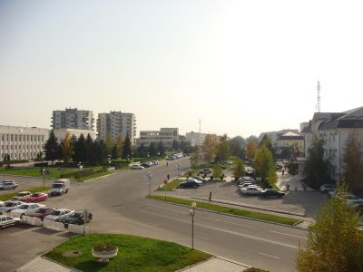
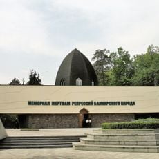
Nartkala, human settlement in Urvansky District, Kabardino-Balkar Republic, Russia

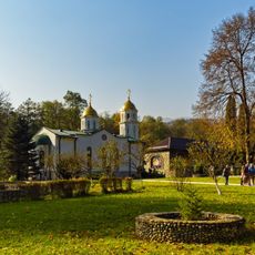
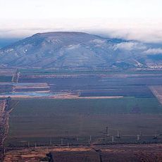
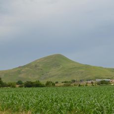
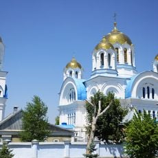
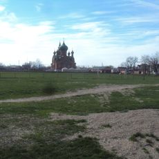
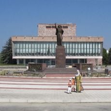
Nartkala is a city in Kabardino-Balkaria in the North Caucasus region and serves as the administrative center of Urvansky district. It is situated between two rivers on flat terrain with wide streets, green spaces, modern buildings, and well-maintained residential areas.

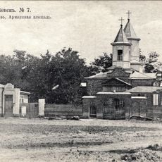
Nartkala was founded in 1913 as a railway station originally called Dokshukino after local noble families. The settlement grew rapidly in the 1920s around the station, and it was officially granted city status in 1955 before receiving its current name in 1967.

The name Nartkala comes from local languages and means fortress of heroes, as 'nart' refers to strong men from local epic tales and 'kala' means stronghold. This naming reflects how the city carries the identity and stories of the region in its very name, connecting residents to their heritage.

The city is located about 12 miles northeast of Nalchik and is well connected to other towns by road. The Dokshukino railway station provides train connections to other regions, and buses link the city with nearby villages and towns.

The city won recognition in a nationwide competition in 2005 and was named the best developed and maintained administrative center in its population category. This award shows the local commitment to the condition and order of their community.

The community of curious travelers

AroundUs brings together thousands of curated places, local tips, and hidden gems, enriched daily by 60,000 contributors worldwide.

Start exploring
Inception
1913
Elevation above the sea
305 m
GPS coordinates
43.55000,43.85000
Latest update
February 16, 2026 22:20
Around this place
Blue Lakes
Russian Federation

Blue Lakes

43.3 km
Chegem Waterfalls
Russian Federation

Chegem Waterfalls

53.1 km
City of Angels
Russian Federation

City of Angels

70.4 km
Lake Tambukan
Russian Federation

Lake Tambukan

72.2 km
Alaniya National Park
Russian Federation

Alaniya National Park

73 km
Tree of Sadness
Russian Federation

Tree of Sadness

70.4 km
Kabardino-Balkarski Nature Reserve
Russian Federation

Kabardino-Balkarski Nature Reserve

77.9 km
Baksan hydroelectric power station
Russian Federation

Baksan hydroelectric power station

38.4 km
Bezengi alpine camp
Russian Federation

Bezengi alpine camp

75 km
Nalchik Mosque
Russian Federation

Nalchik Mosque

20 km
Dzuarikau–Tskhinvali pipeline
Russian Federation

Dzuarikau–Tskhinvali pipeline

74.5 km
Богоявленский Аланский женский монастырь
Russian Federation

Богоявленский Аланский женский монастырь

69.1 km
Lysaya
Russian Federation

Lysaya

79.6 km
Mass grave of Soviet soldiers fallen in WWII, Malgobek
Russian Federation

Mass grave of Soviet soldiers fallen in WWII, Malgobek

63.2 km
Gora Zolotoy Kurgan
Russian Federation

Gora Zolotoy Kurgan

74 km
Victims of Deportation Memorial
Russian Federation

Victims of Deportation Memorial

25.8 km
Holy Ascension Cathedral
Russian Federation

Holy Ascension Cathedral

64.5 km
Saint Nicholas Church, Georgievsk
Russian Federation

Saint Nicholas Church, Georgievsk

72.5 km
Mozdok Museum of Regional Studies
Russian Federation

Mozdok Museum of Regional Studies

68.6 km
St. Nicholas Cathedral
Russian Federation

St. Nicholas Cathedral

26.5 km
Surb Poghos-Petros Armenian church in Georgievsk
Russian Federation

Surb Poghos-Petros Armenian church in Georgievsk

76.9 km
Церковь Архангела Михаила (Незлобная, Георгиевский район)
Russian Federation

Церковь Архангела Михаила (Незлобная, Георгиевский район)

73.5 km
Zhabo-Kala
Russian Federation

Zhabo-Kala

55.1 km
Koshtan-Tau
Russian Federation

Koshtan-Tau

75.9 km
Château Erken
Russian Federation

Château Erken

5.4 km
Tatartup
Russian Federation

Tatartup

38.5 km
Бассейн
Russian Federation

Бассейн

23.6 km
State Musical Theatre
Russian Federation

State Musical Theatre

20.9 km
Show the full map
Reviews
Share your experience

No review yet

Discussions
Start a discussion...

No discussion yet

« Nartkala - human settlement in Urvansky District, Kabardino-Balkar Republic, Russia » is provided by Around Us (aroundus.com). Images and texts are derived from Wikimedia project under a Creative Commons license. You are allowed to copy, distribute, and modify copies of this page, under the conditions set by the license, as long as this note is clearly visible.

Discover hidden gems everywhere you go!

From secret cafés to breathtaking viewpoints, skip the crowded tourist spots and find places that match your style. Our app makes it easy with voice search, smart filtering, route optimization, and insider tips from travelers worldwide. Download now for the complete mobile experience.

Around Us App Screenshot

A unique approach to discovering new places

Le Figaro

All the places worth exploring

France Info

A tailor-made excursion in just a few clicks

20 Minutes

Around Us
Travel Guide & Maps
Download

Send to your phone

QR Code
1

Open the camera app on your mobile.

2

Point at the QR code with your camera. A notification will appear.

3

Tap the notification to open the link.