Chest opened
+${chestReward.xp} XP
Explorer
NOUVEAU ×${chestReward.collectible.quantity}
tapez pour fermer

See the monuments around you in AR Open chests in the app

Around Us is built for your phone — point your camera at the streets and discover the monuments and places around you in augmented reality. Around Us is built for your phone — chests unlock when you walk, explore and capture nearby places.

•

Enable Location

We need your location to show you interesting places around you

Discover nearby places

Find interesting locations and hidden gems around you

Precise directions

Get accurate directions and distances to places

Your location is never shared with other users. It's only used when you tap the location button.

Chike-Taman Pass

Log in to your account

Start exploring — it's free

Trusted by 90,050 travelers worldwide

Continue with Google
Continue with Apple
or

We will send you a code to connect

By continuing, you accept our Terms and Conditions and our Privacy Policy

Check your inbox

We've sent a pincode in your inbox. Please enter the code below.

Chike-Taman Pass
Discussion Reviews 1 Photos
11.6k Popularity

Chike-Taman Pass, Mountain pass at 1246 meters in Ongudaysky District, Russia

Audio guide · About one minute
Preparing your audio guide… The audio guide could not be loaded, please retry.Sign in to listen to the audio guide

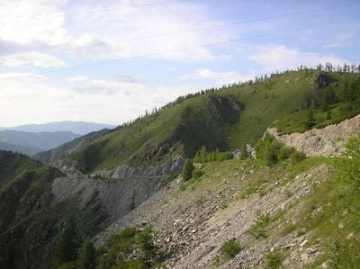
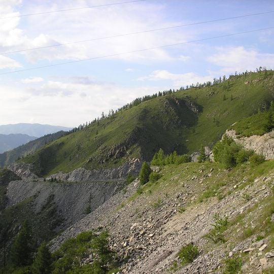
The Chike-Taman Pass is a mountain pass in the Altai Republic situated at 1,246 meters elevation with steep granite cliffs and winding roads. The route extends roughly 20 kilometers and features gradients reaching up to 14 percent in places.

The pass evolved from a dangerous horse trail into a modern connection, with the first automobile crossing occurring in 1927. The current dual-lane road was completed in 1984 and significantly improved safety and through traffic.

The ancient larch tree at the summit displays white ribbons tied by travelers following local customs of expressing gratitude to spirits.

Drivers should watch for potential rockfalls, especially during heavy rainfall or after seismic activity. The route requires full attention and safe driving skills for winding mountain stretches.

At the site of the ancient larch tree at the summit, visitors traditionally gather and leave white ribbons as personal expressions of gratitude. The northern slopes with dense rhododendron forests contrast sharply with the southern sides where yellow Altai tulips bloom in early spring.

The community of curious travelers

AroundUs brings together thousands of curated places, local tips, and hidden gems, enriched daily by 60,000 contributors worldwide.

Start exploring
Location
GPS coordinates
50.64493,86.31231
Latest update
September 17, 2026 10:34
Around this place
Russian Federation

Перевал Ёки Кобы (Иолгоп)

10.4 mi
Russian Federation

Скала Богатырь Сактыпай

8.7 mi
Russian Federation

Разрушенная ГЭС на р.Урсул

5.5 mi
Russian Federation

Урочище Кур-Кечу

9.1 mi
Russian Federation

Курганы, менигры, каменные стелы

10.4 mi
Russian Federation

Огромный курган в урочище Кур-Кечу

9.1 mi
Russian Federation

Начало подъема на перевал Чике-Таман

2.6 mi
Russian Federation

Недостроенная ГЭС

5.8 mi
Russian Federation

Вид с первала Чике-Таман

0.1 mi
Russian Federation

Долина реки Урсул

10.3 mi
Russian Federation

Игульменский порог

9 mi
Russian Federation

Лучший вид на Старый и Новый Чуйский тракт

280 ft
Russian Federation

Вид на скалу Профиль богатыря

8.4 mi
Russian Federation

Вид на камынные валуны

5 mi
Russian Federation

Вид на курганы урочища Кур-Кечу

8.8 mi
Russian Federation

Перевал Чике-Таман

120 ft
Russian Federation

Scenic viewpoint

0.3 mi
Russian Federation

Вид на долину

0.5 mi
Russian Federation

Классный вид на горы и Катунь

9 mi
Russian Federation

Scenic viewpoint

7.4 mi
Russian Federation

Вид на перевал Чике-Таман со старого Чуйского тракта

0.6 mi
Russian Federation

Поворот в «Алтайское подворье»

4.6 mi
Russian Federation

Вид на Катунь и горы

8.9 mi
Russian Federation

Трудовому подвигу строителей Чуйского тракта

130 ft
Russian Federation

Стремятся коня

9.1 mi
Russian Federation

Пушка

10.5 mi
Russian Federation

Пушка

10.6 mi
Russian Federation

Waterfall

10.1 mi
Show the full map
Reviews
Share your experience

No review yet

Discussions
Start a discussion...

No discussion yet

« Chike-Taman Pass - Mountain pass at 1246 meters in Ongudaysky District, Russia » is provided by Around Us (aroundus.com). Images and texts are derived from Wikimedia project under a Creative Commons license. You are allowed to copy, distribute, and modify copies of this page, under the conditions set by the license, as long as this note is clearly visible.

Discover hidden gems everywhere you go!

From secret cafés to breathtaking viewpoints, skip the crowded tourist spots and find places that match your style. Our app makes it easy with voice search, smart filtering, route optimization, and insider tips from travelers worldwide. Download now for the complete mobile experience.

Around Us App Screenshot
❝

A unique approach to discovering new places❞

— Le Figaro

❝

All the places worth exploring❞

— France Info

❝

A tailor-made excursion in just a few clicks❞

— 20 Minutes

Around Us
Travel Guide & Maps
Download

Send to your phone

QR Code
1

Open the camera app on your mobile.

2

Point at the QR code with your camera. A notification will appear.

3

Tap the notification to open the link.