Chest opened
+${chestReward.xp} XP
Explorer
NOUVEAU ×${chestReward.collectible.quantity}
tapez pour fermer
Chest locked

Open chests in the app

Around Us is built for your phone — chests unlock when you walk, explore and capture nearby places.

Enable Location

We need your location to show you interesting places around you

Discover nearby places

Find interesting locations and hidden gems around you

Precise directions

Get accurate directions and distances to places

Your location is never shared with other users. It's only used when you tap the location button.

Log in to your account

Start exploring — it's free

Trusted by 72,880 travelers worldwide

Continue with Google
Continue with Apple
or

We will send you a code to connect

By continuing, you accept our Terms and Conditions and our Privacy Policy

Check your inbox

We've sent a pincode in your inbox. Please enter the code below.

Чагра
Discussion Reviews Photo
1.9k Popularity

Чагра, Railway station settlement in Novokurovka rural district, Russia.

Chagra is a railway station settlement located in rural Samara Oblast that handles freight transport operations. The facility includes open storage areas for containers and wagons where railway workers manage cargo handling on a daily basis.

The station was built as part of the railway network expansion in the Volga region to connect major transport routes. It grew with the development of regional infrastructure throughout the 20th century.

Chagra station maintains traditional Russian railway operational procedures, following established protocols for cargo handling and transportation management.

The station is located in a position accessible to railway workers and logistics companies, with space for freight trains and trucks to load and unload cargo. Visitors should be aware that this is an active facility and can only be entered with permission.

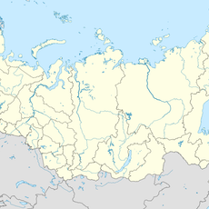
Located at coordinates 52.659056, 49.313417, Chagra serves as an inter-railway junction point, facilitating connections between different railway routes in the region.

The community of curious travelers

AroundUs brings together thousands of curated places, local tips, and hidden gems, enriched daily by 60,000 contributors worldwide.

Start exploring
Location
Сельское поселение Новокуровка
GPS coordinates
52.65906,49.31342
Latest update
December 14, 2025 11:21
Around this place
Russian Federation

Samara Bend

71.8 km
Yuri Gagarin park
Russian Federation

Yuri Gagarin park

70.9 km
Syzran Bridge
Russian Federation

Syzran Bridge

66.7 km
Frunzensky Bridge
Russian Federation

Frunzensky Bridge

77.4 km
Muromsky gorodok
Russian Federation

Muromsky gorodok

77.5 km
Экспериментальный элеватор
Russian Federation

Экспериментальный элеватор

77 km
Ascension Church
Russian Federation

Ascension Church

78.2 km
Podzhaby
Russian Federation

Podzhaby

75.1 km
Middle-Volga Integrated
Russian Federation

Middle-Volga Integrated

77.6 km
École réale de Samara
Russian Federation

École réale de Samara

77.7 km
Svyato-Bogorodicky monastery
Russian Federation

Svyato-Bogorodicky monastery

64 km
Saint Sergius of Radonezh Church in Chapayevsk
Russian Federation

Saint Sergius of Radonezh Church in Chapayevsk

44.8 km
Cathedral of the Kazan icon of the Mother of God
Russian Federation

Cathedral of the Kazan icon of the Mother of God

77.2 km
Ձերժինսկու անվան մշակույթի տուն
Russian Federation

Ձերժինսկու անվան մշակույթի տուն

78 km
Suroshnikov house
Russian Federation

Suroshnikov house

78 km
Кашпирский монастырь
Russian Federation

Кашпирский монастырь

66.6 km
Мукомольная мельница Стройкова и Якимова
Russian Federation

Мукомольная мельница Стройкова и Якимова

77.8 km
Kuybyshev Street 55, Samara
Russian Federation

Kuybyshev Street 55, Samara

78.1 km
1004 км
Russian Federation

1004 км

50.1 km
Churche of Presentation of Virgin Mary
Russian Federation

Churche of Presentation of Virgin Mary

67.2 km
Church of Demetrius of Thessaloniki
Russian Federation

Church of Demetrius of Thessaloniki

70.9 km
Stepan Razin's Cave
Russian Federation

Stepan Razin's Cave

62.1 km
Saint Nicholas Church, Osinovka
Russian Federation

Saint Nicholas Church, Osinovka

63.2 km
Samara state university botanic garden
Russian Federation

Samara state university botanic garden

70.9 km
Church of Saint Nicholas
Russian Federation

Church of Saint Nicholas

58.8 km
Chukin's house
Russian Federation

Chukin's house

72.2 km
Bogatyrskaya Sloboda
Russian Federation

Bogatyrskaya Sloboda

75.8 km
Museum of history in Bolshaya Ryazan
Russian Federation

Museum of history in Bolshaya Ryazan

67.3 km
Show the full map
Reviews
Share your experience

No review yet

Discussions
Start a discussion...

No discussion yet

« Чагра - Railway station settlement in Novokurovka rural district, Russia » is provided by Around Us (aroundus.com). Images and texts are derived from Wikimedia project under a Creative Commons license. You are allowed to copy, distribute, and modify copies of this page, under the conditions set by the license, as long as this note is clearly visible.

Discover hidden gems everywhere you go!

From secret cafés to breathtaking viewpoints, skip the crowded tourist spots and find places that match your style. Our app makes it easy with voice search, smart filtering, route optimization, and insider tips from travelers worldwide. Download now for the complete mobile experience.

Around Us App Screenshot

A unique approach to discovering new places

Le Figaro

All the places worth exploring

France Info

A tailor-made excursion in just a few clicks

20 Minutes

Around Us
Travel Guide & Maps
Download

Send to your phone

QR Code
1

Open the camera app on your mobile.

2

Point at the QR code with your camera. A notification will appear.

3

Tap the notification to open the link.