Enable Location

We need your location to show you interesting places around you

Discover nearby places

Find interesting locations and hidden gems around you

Precise directions

Get accurate directions and distances to places

Your location is never shared with other users. It's only used when you tap the location button.

Крымская эстакада

Log in to your account

Start exploring — it's free

Trusted by 63,117 travelers worldwide

Continue with Google
Continue with Apple
or

We will send you a code to connect

By continuing, you accept our Terms and Conditions and our Privacy Policy

Check your inbox

We've sent a pincode in your inbox. Please enter the code below.

Крымская эстакада
Discussion Reviews 1 Photos
1.7k Popularity

Крымская эстакада, Elevated road in Khamovniki district, Moscow, Russia

The Krymskaya Overpass is an elevated road in Moscow that bridges across the city and carries multiple lanes of traffic. The structure consists of concrete supports and handles thousands of vehicles daily as a key transportation link.

The structure was completed in 1960 and marked an important step in Moscow's traffic development during the Soviet era. Its opening significantly eased movement between different parts of the city.

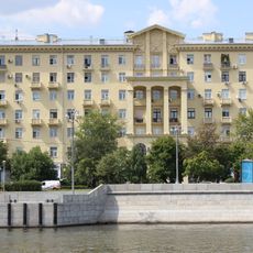
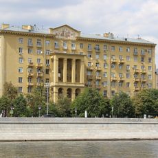
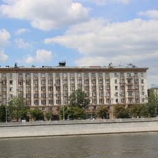
The overpass reflects Soviet engineering practices and shows how Moscow reshaped its traffic patterns during the mid-20th century. It has become part of the city's urban fabric, connecting different neighborhoods in a straightforward manner.

The overpass is accessible around the clock in both directions, allowing continuous traffic flow through the city. Pedestrians and cyclists typically use alternative routes, as the structure is mainly designed for motor vehicles.

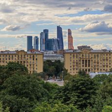
From the overpass, visitors get an unexpected perspective on the surrounding city blocks and the Moskva River in the distance. This elevated position offers views that ground-level streets cannot provide.

The community of curious travelers

AroundUs brings together thousands of curated places, local tips, and hidden gems, enriched daily by 60,000 contributors worldwide.

Start exploring
Location
Official opening
1960
Length
318 m
Width
17 m
GPS coordinates
55.73528,37.59417
Latest update
December 14, 2025 13:04
Around this place
Krymsky Bridge
Russian Federation

Krymsky Bridge

334 m
Yandex HQ
Russian Federation

Yandex HQ

383 m
Théâtre Praktika
Russian Federation

Théâtre Praktika

130 m
Museum of Moscow
Russian Federation

Museum of Moscow

212 m
Former foods warehouse on Zubovsky Boulevard
Russian Federation

Former foods warehouse on Zubovsky Boulevard

145 m
Lycée Tsarévitch-Nicolas
Russian Federation

Lycée Tsarévitch-Nicolas

78 m
Abrikosovs' house
Russian Federation

Abrikosovs' house

257 m
Russian Federation

Travnikov garden, Moscow

166 m
Protection of Our Lady church in Ostozhenka
Russian Federation

Protection of Our Lady church in Ostozhenka

288 m
Vsevolozhskiy's house
Russian Federation

Vsevolozhskiy's house

290 m
I.A. Gagarin's house
Russian Federation

I.A. Gagarin's house

365 m
Церковь Успения Пресвятой Богородицы на Остоженке
Russian Federation

Церковь Успения Пресвятой Богородицы на Остоженке

345 m
Усадьба Делессаля — Любощинской
Russian Federation

Усадьба Делессаля — Любощинской

171 m
Храм (Хамовники)
Russian Federation

Храм (Хамовники)

285 m
Жилой дом (Хамовники)
Russian Federation

Жилой дом (Хамовники)

339 m
Фрунзенская набережная 10
Russian Federation

Фрунзенская набережная 10

285 m
Ансамбль жилых домов (Хамовники)
Russian Federation

Ансамбль жилых домов (Хамовники)

211 m
Зубовский бульвар 2
Russian Federation

Зубовский бульвар 2

91 m
Kropotkinsky Lane, 10-1
Russian Federation

Kropotkinsky Lane, 10-1

361 m
Фрунзенская набережная 8
Russian Federation

Фрунзенская набережная 8

240 m
Ostozhenka, 42
Russian Federation

Ostozhenka, 42

257 m
Фрунзенская набережная 4
Russian Federation

Фрунзенская набережная 4

185 m
Ограда (Хамовники)
Russian Federation

Ограда (Хамовники)

285 m
Фрунзенская набережная 12 / Комсомольский проспект 5/2
Russian Federation

Фрунзенская набережная 12 / Комсомольский проспект 5/2

364 m
Городская усадьба Н.И. Видловского – А.В. Иванова (Хамовники)
Russian Federation

Городская усадьба Н.И. Видловского – А.В. Иванова (Хамовники)

251 m
Доходный дом с помещениями для свадеб, обедов и балов (Хамовники)
Russian Federation

Доходный дом с помещениями для свадеб, обедов и балов (Хамовники)

282 m
Pomerantsev Lane, 3
Russian Federation

Pomerantsev Lane, 3

332 m
Зубовский бульвар 15 c2
Russian Federation

Зубовский бульвар 15 c2

174 m
Show the full map
Reviews
Share your experience

No review yet

Discussions
Start a discussion...

No discussion yet

« Крымская эстакада - Elevated road in Khamovniki district, Moscow, Russia » is provided by Around Us (aroundus.com). Images and texts are derived from Wikimedia project under a Creative Commons license. You are allowed to copy, distribute, and modify copies of this page, under the conditions set by the license, as long as this note is clearly visible.

Discover hidden gems everywhere you go!

From secret cafés to breathtaking viewpoints, skip the crowded tourist spots and find places that match your style. Our app makes it easy with voice search, smart filtering, route optimization, and insider tips from travelers worldwide. Download now for the complete mobile experience.

Around Us App Screenshot

A unique approach to discovering new places

Le Figaro

All the places worth exploring

France Info

A tailor-made excursion in just a few clicks

20 Minutes

Around Us
Travel Guide & Maps
Download

Send to your phone

QR Code
1

Open the camera app on your mobile.

2

Point at the QR code with your camera. A notification will appear.

3

Tap the notification to open the link.