Enable Location

We need your location to show you interesting places around you

Discover nearby places

Find interesting locations and hidden gems around you

Precise directions

Get accurate directions and distances to places

Your location is never shared with other users. It's only used when you tap the location button.

Sea channel in Lomonosov

Log in to your account

Start exploring — it's free

Trusted by 63,108 travelers worldwide

Continue with Google
Continue with Apple
or

We will send you a code to connect

By continuing, you accept our Terms and Conditions and our Privacy Policy

Check your inbox

We've sent a pincode in your inbox. Please enter the code below.

Discussion Reviews 1 Photos
1.3k Popularity

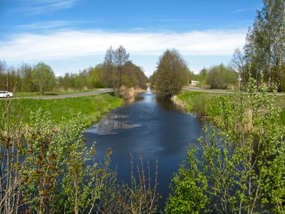
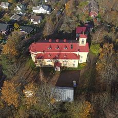
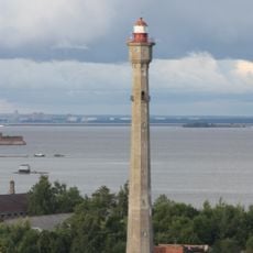
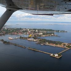
Sea channel in Lomonosov, Canal and cultural heritage site in Lomonosov, Russia.

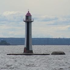
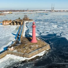
The Sea Channel in Lomonosov is an engineered waterway with two separate pool systems and lock mechanisms that transfer water between different levels. The channel runs through the landscape and connects various water bodies, with visible systems showing how water moves through the entire structure.

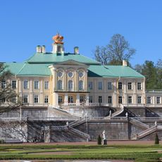
The waterway was built between 1719 and 1761 under the direction of engineer Abram Petrovich Gannibal. The project demonstrated the advanced technical capabilities of the Russian Empire during that period.

The canal gets its name from its original purpose of connecting maritime traffic, and visitors can still sense this connection to water transport when walking along it. The way water flows through the channel reflects how important this waterway was to daily life in the region.

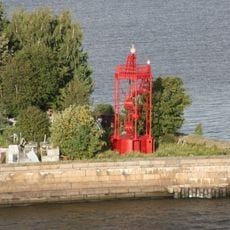
You can visit the canal along Parokhodnaya Street north of the Lower Garden, where several viewpoints allow you to see the full layout. The best time to explore is during good weather when you can walk the entire length comfortably.

The canal system uses a series of pools arranged like steps that lift water from one level to another. This bucket-like construction is a rare example of 18th-century hydraulic engineering that still functions today.

The community of curious travelers

AroundUs brings together thousands of curated places, local tips, and hidden gems, enriched daily by 60,000 contributors worldwide.

Start exploring
Location
Inception
1719
GPS coordinates
59.92740,29.76670
Latest update
December 9, 2025 20:24
Around this place
Oranienbaum ensemble with palace
Russian Federation

Oranienbaum ensemble with palace

1.7 km
Giant's Head, Sergievka
Russian Federation

Giant's Head, Sergievka

5.5 km
Sergievka
Russian Federation

Sergievka

5.5 km
Chinese Palace of Russia
Russian Federation

Chinese Palace of Russia

2.3 km
Grand Menshikov Palace in Oranienbaum ‎
Russian Federation

Grand Menshikov Palace in Oranienbaum ‎

1.6 km
The Peterstadt fortress in Oranienbaum
Russian Federation

The Peterstadt fortress in Oranienbaum

1.9 km
Palace of Peter III in Oranienbaum
Russian Federation

Palace of Peter III in Oranienbaum

1.9 km
Palace of Maximilian, Duke of Leuchtenberg (Sergievka)
Russian Federation

Palace of Maximilian, Duke of Leuchtenberg (Sergievka)

5.6 km
Michael Archangel Cathedral
Russian Federation

Michael Archangel Cathedral

1.3 km
Usadba Mordvinovyh
Russian Federation

Usadba Mordvinovyh

4.9 km
Spiridon Trimiphuntskiy church
Russian Federation

Spiridon Trimiphuntskiy church

1.5 km
Saint John Lutheran church
Russian Federation

Saint John Lutheran church

3.6 km
'Kamennoe zalo' pavilion
Russian Federation

'Kamennoe zalo' pavilion

1.6 km
Russian Federation

Martyshkino Memorial

4.5 km
South Shore of Neva Gulf
Russian Federation

South Shore of Neva Gulf

5.7 km
Petrovsky Bridge in Oranienbaum Park
Russian Federation

Petrovsky Bridge in Oranienbaum Park

1.9 km
Eleninskaya Street, 26 - Volkov mansion
Russian Federation

Eleninskaya Street, 26 - Volkov mansion

1.5 km
Shvedsky bridge
Russian Federation

Shvedsky bridge

1.2 km
Kronstadt alignment mark
Russian Federation

Kronstadt alignment mark

4.9 km
Lomonosov Canal Range Rear
Russian Federation

Lomonosov Canal Range Rear

5.1 km
Southern battery No 1
Russian Federation

Southern battery No 1

4.3 km
Havens and Quays of Kronstadt
Russian Federation

Havens and Quays of Kronstadt

5.6 km
Zubov Estate
Russian Federation

Zubov Estate

2.7 km
Lower Sea Channel range light
Russian Federation

Lower Sea Channel range light

5.7 km
Upper Sea Channel range light
Russian Federation

Upper Sea Channel range light

4.6 km
Передний маяк створа Кронштадтских маяков (бывший верхний Николаевский маяк) (Кронштадт)
Russian Federation

Передний маяк створа Кронштадтских маяков (бывший верхний Николаевский маяк) (Кронштадт)

5.8 km
Southern battery No 2 (Dzichkanetz)
Russian Federation

Southern battery No 2 (Dzichkanetz)

4.8 km
Maximov's Dacha
Russian Federation

Maximov's Dacha

2.2 km
Show the full map
Reviews
Share your experience

No review yet

Discussions
Start a discussion...

No discussion yet

« Sea channel in Lomonosov - Canal and cultural heritage site in Lomonosov, Russia » is provided by Around Us (aroundus.com). Images and texts are derived from Wikimedia project under a Creative Commons license. You are allowed to copy, distribute, and modify copies of this page, under the conditions set by the license, as long as this note is clearly visible.

Discover hidden gems everywhere you go!

From secret cafés to breathtaking viewpoints, skip the crowded tourist spots and find places that match your style. Our app makes it easy with voice search, smart filtering, route optimization, and insider tips from travelers worldwide. Download now for the complete mobile experience.

Around Us App Screenshot

A unique approach to discovering new places

Le Figaro

All the places worth exploring

France Info

A tailor-made excursion in just a few clicks

20 Minutes

Around Us
Travel Guide & Maps
Download

Send to your phone

QR Code
1

Open the camera app on your mobile.

2

Point at the QR code with your camera. A notification will appear.

3

Tap the notification to open the link.