Chest opened
+${chestReward.xp} XP
Explorer
NOUVEAU ×${chestReward.collectible.quantity}
tapez pour fermer
Chest locked

Open chests in the app

Around Us is built for your phone — chests unlock when you walk, explore and capture nearby places.

Enable Location

We need your location to show you interesting places around you

Discover nearby places

Find interesting locations and hidden gems around you

Precise directions

Get accurate directions and distances to places

Your location is never shared with other users. It's only used when you tap the location button.

Log in to your account

Start exploring — it's free

Trusted by 73,098 travelers worldwide

Continue with Google
Continue with Apple
or

We will send you a code to connect

By continuing, you accept our Terms and Conditions and our Privacy Policy

Check your inbox

We've sent a pincode in your inbox. Please enter the code below.

Светлоярский соляной купол
Discussion Reviews Photo
2.6k Popularity

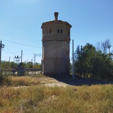
Светлоярский соляной купол, Salt dome formation in Svetloyarsky District, Russia

The Svetloyarsky salt dome is a geological formation in the Caspian lowlands that rises from depths of about 300 meters below the surface. The structure holds substantial deposits of rock salt and bischofite minerals spread across several kilometers underground.

Exploratory drilling in 1946 near Svetly Yar village led to the discovery of large rock salt deposits in the region. Extensive research operations began in 1963, establishing the site as a significant mineral extraction location.

The salt dome area encompasses multiple ethnic communities, contributing to the development of distinct traditions and local customs in the Volgograd region.

The extraction site spans several square kilometers with wells that reach hundreds of meters deep, producing both mineral types through underground leaching methods. Visitors should know this is an active mining area with corresponding safety restrictions in place.

The geological formation continuously rises, moving several millimeters upward each year. This slow movement creates surface depressions that become measurable over the span of just a few years.

The community of curious travelers

AroundUs brings together thousands of curated places, local tips, and hidden gems, enriched daily by 60,000 contributors worldwide.

Start exploring
GPS coordinates
48.45618,44.79766
Latest update
December 12, 2025 16:41
Around this place
Monument to Lenin at the entrance of the Volga-Don canal
Russian Federation

Monument to Lenin at the entrance of the Volga-Don canal

19.3 km
Mortuary in Volzhsky
Russian Federation

Mortuary in Volzhsky

33.6 km
Volga-Akhtuba Floodplain
Russian Federation

Volga-Akhtuba Floodplain

23 km
Sarpinsky
Russian Federation

Sarpinsky

23.2 km
Gasitel
Russian Federation

Gasitel

34.1 km
Old Sarepta
Russian Federation

Old Sarepta

19.3 km
Kirche in Sarepta
Russian Federation

Kirche in Sarepta

19.3 km
Church of St. Paraskeva Pyatnitsa in Volgograd
Russian Federation

Church of St. Paraskeva Pyatnitsa in Volgograd

32.1 km
Thälmann Street 7, Volgograd
Russian Federation

Thälmann Street 7, Volgograd

19.3 km
Железнодорожный вокзал станции Канальная (бывшая Тундутово)
Russian Federation

Железнодорожный вокзал станции Канальная (бывшая Тундутово)

30.6 km
House
Russian Federation

House

19.4 km
Hotel
Russian Federation

Hotel

19.4 km
Distillery
Russian Federation

Distillery

19.4 km
Central Concert Hall in Volgograd
Russian Federation

Central Concert Hall in Volgograd

34.1 km
Palace of Culture and Sience "Chemist"
Russian Federation

Palace of Culture and Sience "Chemist"

19.7 km
Thälmann Street 3, Volgograd
Russian Federation

Thälmann Street 3, Volgograd

19.2 km
Bekker's House
Russian Federation

Bekker's House

19.3 km
Obshchinnaya uprava
Russian Federation

Obshchinnaya uprava

19.4 km
Thälmann Street 5, Volgograd
Russian Federation

Thälmann Street 5, Volgograd

19.3 km
Single brothers house
Russian Federation

Single brothers house

19.2 km
Maximov brothers plant - plant management
Russian Federation

Maximov brothers plant - plant management

34 km
Maximov brothers plant - heating plant
Russian Federation

Maximov brothers plant - heating plant

33.9 km
Mass grave of the defenders of Red Tsaritsyn
Russian Federation

Mass grave of the defenders of Red Tsaritsyn

34.1 km
Dom nezamuzhnikh sester
Russian Federation

Dom nezamuzhnikh sester

19.3 km
Водонапорная башня станции Канальная (бывшая Тундутово)
Russian Federation

Водонапорная башня станции Канальная (бывшая Тундутово)

30.6 km
Kinoteatr Yubileyny
Russian Federation

Kinoteatr Yubileyny

18.4 km
Residential buildings
Russian Federation

Residential buildings

30.7 km
Dom pastora
Russian Federation

Dom pastora

19.4 km
Show the full map
Reviews
Share your experience

No review yet

Discussions
Start a discussion...

No discussion yet

« Светлоярский соляной купол - Salt dome formation in Svetloyarsky District, Russia » is provided by Around Us (aroundus.com). Images and texts are derived from Wikimedia project under a Creative Commons license. You are allowed to copy, distribute, and modify copies of this page, under the conditions set by the license, as long as this note is clearly visible.

Discover hidden gems everywhere you go!

From secret cafés to breathtaking viewpoints, skip the crowded tourist spots and find places that match your style. Our app makes it easy with voice search, smart filtering, route optimization, and insider tips from travelers worldwide. Download now for the complete mobile experience.

Around Us App Screenshot

A unique approach to discovering new places

Le Figaro

All the places worth exploring

France Info

A tailor-made excursion in just a few clicks

20 Minutes

Around Us
Travel Guide & Maps
Download

Send to your phone

QR Code
1

Open the camera app on your mobile.

2

Point at the QR code with your camera. A notification will appear.

3

Tap the notification to open the link.