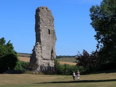
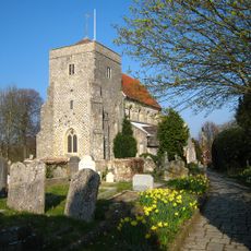
Bramber Castle, Norman motte-and-bailey castle ruins in Bramber, England
Bramber Castle is a Norman fortification dominated by an artificial mound supporting a flint-built gatehouse tower whose stone walls still rise prominently above the site. Medieval ditches and earthen embankments surround the stronghold, defining its original defensive layout.
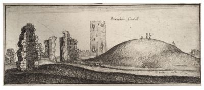
William de Braose constructed this stronghold in 1070 after the Norman Conquest to dominate a crucial river crossing and assert Norman control over the region. Later additions to the defensive ditches in the early 1200s weakened sections of the original walls.
The mound-and-ditch layout reveals how medieval fortifications were designed to dominate the surrounding valley and protect key river crossings. You can see how the earthworks shaped movement and control of the landscape.
The site sits in open ground with good views across the valley from the remaining tower structure, accessible on foot throughout the day. Visit during drier weather, as the steep mound becomes slippery after rain.
Excavations in the 1960s uncovered that defensive improvements made centuries after the castle's founding actually destabilized portions of the original walls. This archaeological discovery shows how later modifications sometimes undermined rather than strengthened older structures.
The community of curious travelers
AroundUs brings together thousands of curated places, local tips, and hidden gems, enriched daily by 60,000 contributors worldwide.