Enable Location

We need your location to show you interesting places around you

Discover nearby places

Find interesting locations and hidden gems around you

Precise directions

Get accurate directions and distances to places

Your location is never shared with other users. It's only used when you tap the location button.

Clatteringshaws Loch

Log in to your account

Start exploring — it's free

Trusted by 62,558 travelers worldwide

Continue with Google
Continue with Apple
or

We will send you a code to connect

By continuing, you accept our Terms and Conditions and our Privacy Policy

Check your inbox

We've sent a pincode in your inbox. Please enter the code below.

Clatteringshaws Loch

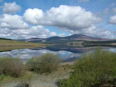
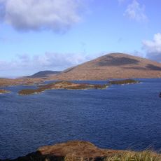
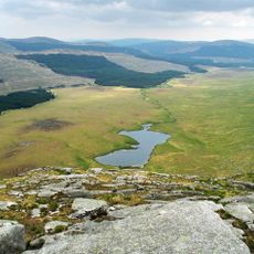
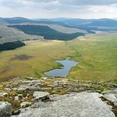
Clatteringshaws Loch, lake in the United Kingdom

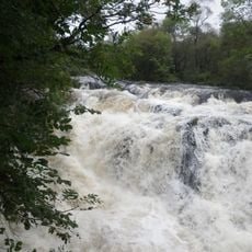
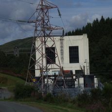
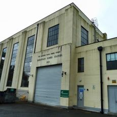
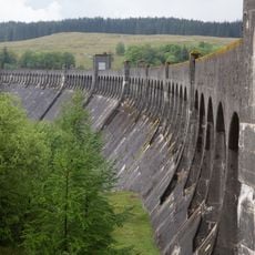
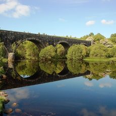
Clatteringshaws Loch is a large reservoir in Dumfries and Galloway created by a concrete dam that spans the valley. Water from the loch flows through an underground tunnel over five miles long to reach a power station called Glenlee.

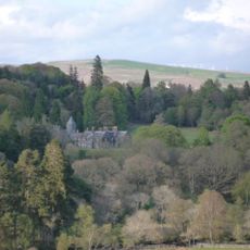
The dam was built in the early 1930s and began operation in 1935 as part of the Galloway Hydro Electric Scheme to supply electricity to the region. This hydroelectric project marked a turning point in how Scotland harnessed water power for energy.

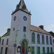
The area takes its name from the dam structure that transformed the landscape. The loch represents how communities shaped their environment to meet local energy needs and remains a landmark in regional identity.

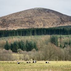
The dam has a walkway along its top from which visitors can view the water surface and surrounding hills. Forest trails nearby offer various options for walking and exploring the area.

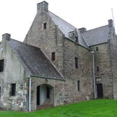
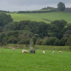
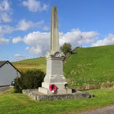
Near the reservoir stands Bruce's Stone, linked to King Robert the Bruce, who is said to have rested there after fighting in the area in 1307. The stone was donated to a Scottish heritage trust in 1932 and remains an easily overlooked piece of local history.

The community of curious travelers

AroundUs brings together thousands of curated places, local tips, and hidden gems, enriched daily by 60,000 contributors worldwide.

Start exploring
Location
Inception
1930s
Part of
Galloway hydro-electric power scheme
GPS coordinates
55.06600,-4.28400
Latest update
February 9, 2026 08:22
« Clatteringshaws Loch - lake in the United Kingdom » is provided by Around Us (aroundus.com). Images and texts are derived from Wikimedia project under a Creative Commons license. You are allowed to copy, distribute, and modify copies of this page, under the conditions set by the license, as long as this note is clearly visible.

Discover hidden gems everywhere you go!

From secret cafés to breathtaking viewpoints, skip the crowded tourist spots and find places that match your style. Our app makes it easy with voice search, smart filtering, route optimization, and insider tips from travelers worldwide. Download now for the complete mobile experience.

Around Us App Screenshot

A unique approach to discovering new places

Le Figaro

All the places worth exploring

France Info

A tailor-made excursion in just a few clicks

20 Minutes

Around Us
Travel Guide & Maps
Download

Send to your phone

QR Code
1

Open the camera app on your mobile.

2

Point at the QR code with your camera. A notification will appear.

3

Tap the notification to open the link.