Inchbuie, River island in Stirling, United Kingdom
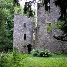
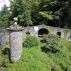
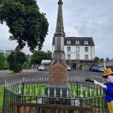
Inchbuie is a river island in the River Dochart near Killin, reached by a small footbridge that connects it to the main bank. The island holds an old burial ground with stone monuments and historic walls, situated in the middle of flowing water that surrounds it on all sides.
The island has served as a burial site since medieval times and became an important family cemetery for the MacNab clan. In the 18th century, the walls that remain today were built to enclose and protect this sacred ground.
The island served as a burial place for the MacNab clan, and their presence is visible in the carved stone figures and old walls that remain. Walking across it today, you can sense the connection between the family and this sacred ground.
Access is gained through a simple footbridge that is open to visitors and allows for a short walk across to the island. The ground is easy to navigate on foot, though it can be uneven in places and sturdy shoes are a good idea.
A carved stone figure in the West Highland style stands on this island and is one of only two known examples of this type found outside its traditional region. This rare sculpture makes the site an important record of a specific artistic tradition.
Location: Stirling
GPS coordinates: 56.46250,-4.31750
Latest update: December 21, 2025 16:05
Finlarig Castle
1.4 km
Falls of Dochart
167 m
Moirlanich Longhouse
2 km
Meall nan Tarmachan
6.7 km
Killin Stone Circle
534 m
Falls of Lochay
4 km
Bridge Of Dochart
177 m
Dochart Viaduct
334 m
Killin, Innes Bhuidhe, Burial Ground Of The Macnabs
189 m
Birchbank, Main Street, Killin
326 m
The Manse, Killin
926 m
Burial-Ground, Killin Parish Church
893 m
Killin Parish Church
802 m
Meall Dhuin Croisg
5.3 km
House Adjoining Masonic Hall, Main Street, Killin
314 m
Masonic Hall, Main Street, Killin
310 m
Ashlea, Main Street, Killin
341 m
Creag Mhor
6.1 km
Glengarry, Main Street, Killin
331 m
Mansefield, Manse Road, Killin
343 m
Glen Ogle, 12 Arch Railway Viaduct
6 km
James Stewart Memorial Including Railings, Killin
802 m
St Fillan's Episcopal Church, Main Street, Killin
718 m
Dreadnought Place Including Ancillary Structure And Boundary Walls, Main Street, Killin
670 m
Killin, Dochart Mill
217 m
Lynedoch Including Boundary Walls, Main Street, Killin
485 m
Dreadnought Place Including Ancillary Structure And Boundary Walls, Main Street, Killin
679 m
Station House And Tarmachan Teashop, Larachbeag, Killin
688 mVisited this place? Tap the stars to rate it and share your experience / photos with the community! Try now! You can cancel it anytime.
Discover hidden gems everywhere you go!
From secret cafés to breathtaking viewpoints, skip the crowded tourist spots and find places that match your style. Our app makes it easy with voice search, smart filtering, route optimization, and insider tips from travelers worldwide. Download now for the complete mobile experience.
A unique approach to discovering new places❞
— Le Figaro
All the places worth exploring❞
— France Info
A tailor-made excursion in just a few clicks❞
— 20 Minutes