Chest opened
+${chestReward.xp} XP
Explorer
NOUVEAU ×${chestReward.collectible.quantity}
tapez pour fermer
Chest locked

Open chests in the app

Around Us is built for your phone — chests unlock when you walk, explore and capture nearby places.

Enable Location

We need your location to show you interesting places around you

Discover nearby places

Find interesting locations and hidden gems around you

Precise directions

Get accurate directions and distances to places

Your location is never shared with other users. It's only used when you tap the location button.

Consett

Log in to your account

Start exploring — it's free

Trusted by 72,876 travelers worldwide

Continue with Google
Continue with Apple
or

We will send you a code to connect

By continuing, you accept our Terms and Conditions and our Privacy Policy

Check your inbox

We've sent a pincode in your inbox. Please enter the code below.

Consett
Discussion Reviews 4 Photos
67.5k Popularity

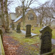
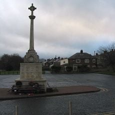
Consett, Industrial town in County Durham, England

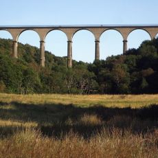
Consett is a town in County Durham, northeastern England, sitting at an elevation of 270 meters above sea level. The setting consists of moorlands and valleys that stretch across the surrounding countryside.

The settlement grew from a village of 145 residents in 1841 into a major steel manufacturing center. The works supplied steel for structures such as Blackpool Tower.

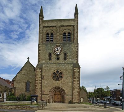
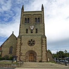
The Empire Theatre, built as one of County Durham's oldest performance venues, presents stage productions and film screenings throughout the year. The town's name likely derives from old land ownership patterns or an early settlement form.

Regular bus connections run to Newcastle upon Tyne, Durham City, and the Metro Centre. The elevated position often brings cooler temperatures and changeable weather.

The Consett Salvation Army Corps Band, formed in December 1879, holds the distinction of being the first Salvation Army band in the world. This musical milestone took place in a small northeastern English town.

The community of curious travelers

AroundUs brings together thousands of curated places, local tips, and hidden gems, enriched daily by 60,000 contributors worldwide.

Start exploring
Location
GPS coordinates
54.85000,-1.83000
Latest update
December 13, 2025 18:07
Around this place
Longovicium
United Kingdom

Longovicium

6.1 km
Hownsgill Viaduct
United Kingdom

Hownsgill Viaduct

2.1 km
Hamsterley Hall
United Kingdom

Hamsterley Hall

6 km
Vindomora
United Kingdom

Vindomora

4.9 km
Shotley Hall
United Kingdom

Shotley Hall

3 km
Shotley Park
United Kingdom

Shotley Park

3.2 km
Church of St Mary Magdalene
United Kingdom

Church of St Mary Magdalene

3.9 km
Church of St Ebba
United Kingdom

Church of St Ebba

4.9 km
Church of St John
United Kingdom

Church of St John

5 km
War Memorial in Annfield Plain Park
United Kingdom

War Memorial in Annfield Plain Park

6 km
Pontop Hall
United Kingdom

Pontop Hall

4.9 km
Annfield Plain Library
United Kingdom

Annfield Plain Library

5.8 km
Christ Church, Consett
United Kingdom

Christ Church, Consett

487 m
Shotley Low Quarter War Memorial
United Kingdom

Shotley Low Quarter War Memorial

5.1 km
Allensford Mill Farmhouse And Adjacent Outbuildings
United Kingdom

Allensford Mill Farmhouse And Adjacent Outbuildings

3.4 km
Milestone About 300 Metres South Of West Fines Wood
United Kingdom

Milestone About 300 Metres South Of West Fines Wood

3.4 km
Milestone Opposite South End Of Hollinside Terrace
United Kingdom

Milestone Opposite South End Of Hollinside Terrace

5.7 km
War Memorial at the Civic Centre
United Kingdom

War Memorial at the Civic Centre

894 m
Milestone Circa 50 Metres North Of Junction With Eliza Lane
United Kingdom

Milestone Circa 50 Metres North Of Junction With Eliza Lane

5.3 km
Terris Novalis
United Kingdom

Terris Novalis

651 m
Milestone About 200 Metres East Of Rowley Cottage
United Kingdom

Milestone About 200 Metres East Of Rowley Cottage

3.5 km
Former Lead Mine Reservoir About 100 Metres East Of Dean Howl Farm
United Kingdom

Former Lead Mine Reservoir About 100 Metres East Of Dean Howl Farm

4.4 km
Milestone Circa 250 Mertres North Of High Alder Heads
United Kingdom

Milestone Circa 250 Mertres North Of High Alder Heads

4 km
Crooked Oak Farmhouse
United Kingdom

Crooked Oak Farmhouse

5.6 km
Milestone South West Of Broadwood Cottages
United Kingdom

Milestone South West Of Broadwood Cottages

5.8 km
Boundary Stone About 500 Metres North East Of Shotley Spa
United Kingdom

Boundary Stone About 500 Metres North East Of Shotley Spa

3.7 km
Boundary Stone At Ngr Nz 09705632, On West Side Of Mill Burn
United Kingdom

Boundary Stone At Ngr Nz 09705632, On West Side Of Mill Burn

5.9 km
Former Lead Mine Circa 300 Metres North East Of Dene Howl Farm
United Kingdom

Former Lead Mine Circa 300 Metres North East Of Dene Howl Farm

4.2 km
Show the full map
Reviews
Share your experience

No review yet

Discussions
Start a discussion...

No discussion yet

« Consett - Industrial town in County Durham, England » is provided by Around Us (aroundus.com). Images and texts are derived from Wikimedia project under a Creative Commons license. You are allowed to copy, distribute, and modify copies of this page, under the conditions set by the license, as long as this note is clearly visible.

Discover hidden gems everywhere you go!

From secret cafés to breathtaking viewpoints, skip the crowded tourist spots and find places that match your style. Our app makes it easy with voice search, smart filtering, route optimization, and insider tips from travelers worldwide. Download now for the complete mobile experience.

Around Us App Screenshot

A unique approach to discovering new places

Le Figaro

All the places worth exploring

France Info

A tailor-made excursion in just a few clicks

20 Minutes

Around Us
Travel Guide & Maps
Download

Send to your phone

QR Code
1

Open the camera app on your mobile.

2

Point at the QR code with your camera. A notification will appear.

3

Tap the notification to open the link.