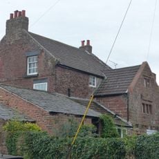
Burton Manor, Manor house in Burton, England.
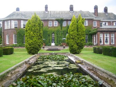
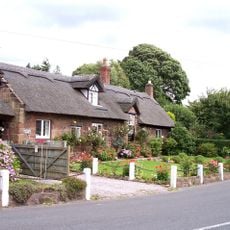
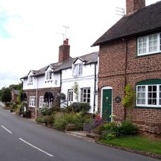
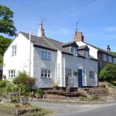
Burton Manor is a house constructed from red sandstone with green slate roofing and ornamental chimney stacks made of stone and brick. The building sits within walled gardens and landscaped grounds that form a registered historic park and garden.
The house was built in 1805 for Richard Congreve and received substantial alterations in 1904 when architect Charles Nicholson redesigned it. These changes were made for Henry Neville Gladstone, whose father served as Prime Minister.
The house served the community as an adult education center for many years, welcoming students who came to learn and live on the grounds. This educational role shaped how the place was used and valued by local people.
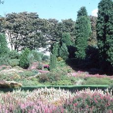
The walled garden welcomes visitors and is maintained by a local organization dedicated to preserving its features. You can explore the grounds at a leisurely pace and should expect to walk through different sections of the estate.
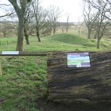
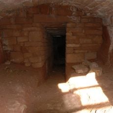
The grounds contain a historic ice house that is protected as a scheduled monument. This underground structure shows how people once preserved food during the warmest months before modern refrigeration existed.
Location: Cheshire West and Chester
GPS coordinates: 53.25960,-3.02850
Latest update: December 8, 2025 21:00
Ness Botanic Gardens
1.7 km
St Michael's Church, Shotwick
3.2 km
Shotwick Hall
3.1 km
Burton Point
1.3 km
St Nicholas' Church, Burton
330 m
Bishop Wilson's House
120 m
Front garden walls and gatepiers at Shotwick Hall
3 km
Tombchest of Robert and Martha Ellison, 10 metres southwest of south corner of tower of Church of St Michael
3.2 km
Rake Farm Cottage
83 m
Plessington Cottage
253 m
L-shaped ranges of farm buildings 60 metres north of Shotwick Hall
3 km
Ice house approximately 75 metres south west of Burton Manor
108 m
Barn End
108 m
Sundial in the churchyard of St Michael
3.2 km
Laburnam Farmhouse And Garden Walls Attached At Front
2.3 km
Footpath Guidepost At Junction Of Pipers Lane Opposite The White House
1.5 km
Group of 18 chest tombs, approximately 2 metres from the southeast corner of Church of St Nicholas
325 m
Tombchest of James Phillips, 2 metres south of the sundial in the Churchyard of St Michael
3.2 km
Former kitchen or bakehouse attached to north east corner of Shotwick Hall
3 km
K6 Telephone Kiosk In Forecourt Of Post Office (Post Office Not Included)
2.3 km
Tombchest of Rev M Reay and 4 children, 8 metres south of south porch of Church of St Michael
3.2 km
Tombchest of John Nevett Bennett, 5 metres west of south porch of St Michael's Church
3.2 km
Tombchest of William Briscoe (died 1723) and others, 4 metres west of priest's door to St Michael's Church
3.2 km
Vicarage Farmhouse
3.2 km
Tombchest of William Briscoe (died 1704) and others, 5 metres southwest of priest's door to St Michael's Church
3.2 km
Footpath Guidepost 5 Metres North Of Top Lodge
1.8 km
Goldstraw Farmhouse And Attached Farm Building To North West
2.2 km
Milestone, Chester High Road, just N of hospital entrance
3.2 kmVisited this place? Tap the stars to rate it and share your experience / photos with the community! Try now! You can cancel it anytime.
Discover hidden gems everywhere you go!
From secret cafés to breathtaking viewpoints, skip the crowded tourist spots and find places that match your style. Our app makes it easy with voice search, smart filtering, route optimization, and insider tips from travelers worldwide. Download now for the complete mobile experience.
A unique approach to discovering new places❞
— Le Figaro
All the places worth exploring❞
— France Info
A tailor-made excursion in just a few clicks❞
— 20 Minutes