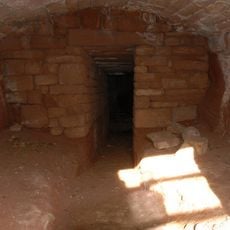
Burton Point, Iron Age promontory fort in Wirral Peninsula, England
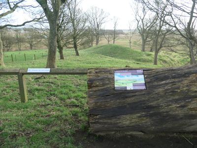
The defensive structure consists of earthworks with a bank rising 5 meters high and extending 12 meters at its base, creating a curved rampart of 68 meters.
During the early 18th century, the creation of a new channel on the Welsh side of the River Dee estuary transformed this headland into landlocked territory.
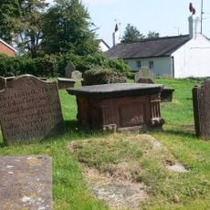
Archaeological excavations in 1878 uncovered a burial ground containing between 50 and 60 individuals, possibly connected to early Christian practices or a 1637 shipwreck.
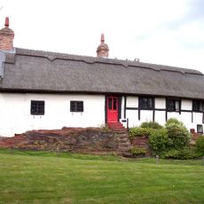
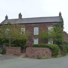
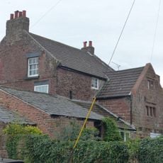
Burton Point stands 550 meters southwest of Burton Point Farm, offering views across the marshland and the River Dee estuary crossing to Basingwerk.
The fort represents one of fewer than 100 recorded promontory forts in England, making it a significant example of Iron Age defensive architecture.
Location: Cheshire West and Chester
GPS coordinates: 53.25450,-3.04572
Latest update: March 10, 2025 23:28
Flintshire Bridge
3.2 km
Burton Manor
1.3 km
Ness Botanic Gardens
2 km
St Michael's Church, Shotwick
3.8 km
Shotwick Hall
3.7 km
St Nicholas' Church, Burton
1.6 km
Old Quay House Inn
3.8 km
Front garden walls and gatepiers at Shotwick Hall
3.7 km
Tombchest of Robert and Martha Ellison, 10 metres southwest of south corner of tower of Church of St Michael
3.8 km
Rake Farm Cottage
1.3 km
Bishop Wilson's House
1.3 km
Newstead House
3.7 km
Former kitchen or bakehouse attached to north east corner of Shotwick Hall
3.7 km
Barn End
1.4 km
K6 Telephone Kiosk In Forecourt Of Post Office (Post Office Not Included)
2.5 km
Plessington Cottage
1.5 km
Sundial in the churchyard of St Michael
3.8 km
Group of 18 chest tombs, approximately 2 metres from the southeast corner of Church of St Nicholas
1.6 km
Tombchest of James Phillips, 2 metres south of the sundial in the Churchyard of St Michael
3.8 km
Footpath Guidepost At Junction Of Pipers Lane Opposite The White House
2.5 km
Laburnam Farmhouse And Garden Walls Attached At Front
2.5 km
Tombchest of Rev M Reay and 4 children, 8 metres south of south porch of Church of St Michael
3.8 km
Tombchest of John Nevett Bennett, 5 metres west of south porch of St Michael's Church
3.8 km
L-shaped ranges of farm buildings 60 metres north of Shotwick Hall
3.7 km
Ice house approximately 75 metres south west of Burton Manor
1.2 km
Tombchest of William Briscoe (died 1723) and others, 4 metres west of priest's door to St Michael's Church
3.8 km
Tombchest of William Briscoe (died 1704) and others, 5 metres southwest of priest's door to St Michael's Church
3.8 km
Goldstraw Farmhouse And Attached Farm Building To North West
2.4 kmVisited this place? Tap the stars to rate it and share your experience / photos with the community! Try now! You can cancel it anytime.
Discover hidden gems everywhere you go!
From secret cafés to breathtaking viewpoints, skip the crowded tourist spots and find places that match your style. Our app makes it easy with voice search, smart filtering, route optimization, and insider tips from travelers worldwide. Download now for the complete mobile experience.
A unique approach to discovering new places❞
— Le Figaro
All the places worth exploring❞
— France Info
A tailor-made excursion in just a few clicks❞
— 20 Minutes