Carlisle Park, Public park in Hampton, United Kingdom.
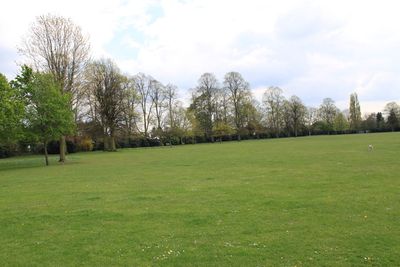
Carlisle Park is a public green space in Hampton featuring mature trees, shrubs, and flowerbeds arranged throughout its grounds. The space includes tennis courts, a bowling green, a cricket pitch, football fields, and an outdoor fitness area.
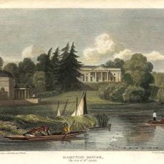
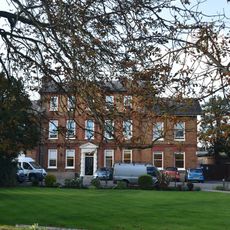
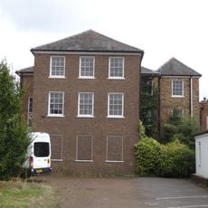
The grounds were once private estate land belonging to the 9th Earl of Carlisle, George James, before being converted to public parkland. This transformation reflects a shift from private to communal recreational use.
The park serves as a gathering place for the neighborhood, where people come to spend time together and enjoy recreational activities. The well-maintained green spaces and designated areas encourage both solitary relaxation and community interaction.
The park is easily accessible with wide pathways suitable for walking and movement between different activity areas. Visitors should note that the site is open year-round, though specific facilities may have seasonal usage patterns.
The park features a Sensory Tree Trail that guides visitors through an experience designed to engage their senses with nature. It also includes a wheelchair-accessible roundabout that ensures all visitors can enjoy play equipment safely regardless of ability.
Location: London Borough of Richmond upon Thames
GPS coordinates: 51.42190,-0.36556
Latest update: December 14, 2025 16:41
Astoria
1.2 km
Tagg's Island
1.7 km
Garrick's Temple to Shakespeare
1.1 km
Garrick's Villa
1.1 km
Platt's Eyot
1.4 km
St Mary's Church, Hampton
1 km
Benn's Island
1.1 km
Jolly Coopers
956 m
Grove House
772 m
Garrick's Eyot
1.2 km
St Theodore's Roman Catholic Church, Hampton
717 m
St James's Church
977 m
St Francis de Sales, Hampton Hill and Upper Teddington
1.4 km
All Saints' Hampton
812 m
Hampton Hill United Reformed Church
525 m
Old Brew House
676 m
78, High Street
861 m
Hampton Hill War Memorial
956 m
General Roy Monument
510 m
84, High Street
844 m
Conservatory To Bushy House
1.8 km
Garden House To Bushy House
1.7 km
Hampton Maternity And Child Welfare Clinic
878 m
Beveree
831 m
Milestone Opposite Boat House To East Of St Albans Lodge
1.5 km
167, High Street
958 m
Brick Boundary Walls Along Park Road And Between National Physical Laboratory And Admiralty Research Laboratory
515 m
Milestone, Upper Sunbury Road, W of Percy Street
1.2 kmVisited this place? Tap the stars to rate it and share your experience / photos with the community! Try now! You can cancel it anytime.
Discover hidden gems everywhere you go!
From secret cafés to breathtaking viewpoints, skip the crowded tourist spots and find places that match your style. Our app makes it easy with voice search, smart filtering, route optimization, and insider tips from travelers worldwide. Download now for the complete mobile experience.
A unique approach to discovering new places❞
— Le Figaro
All the places worth exploring❞
— France Info
A tailor-made excursion in just a few clicks❞
— 20 Minutes