Chest opened
+${chestReward.xp} XP
Explorer
NOUVEAU ×${chestReward.collectible.quantity}
tapez pour fermer
Chest locked

Open chests in the app

Around Us is built for your phone — chests unlock when you walk, explore and capture nearby places.

Enable Location

We need your location to show you interesting places around you

Discover nearby places

Find interesting locations and hidden gems around you

Precise directions

Get accurate directions and distances to places

Your location is never shared with other users. It's only used when you tap the location button.

Log in to your account

Start exploring — it's free

Trusted by 72,894 travelers worldwide

Continue with Google
Continue with Apple
or

We will send you a code to connect

By continuing, you accept our Terms and Conditions and our Privacy Policy

Check your inbox

We've sent a pincode in your inbox. Please enter the code below.

Chains
Discussion Reviews Photo
1.3k Popularity

Chains, Geological site in Exmoor, United Kingdom

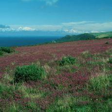
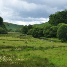
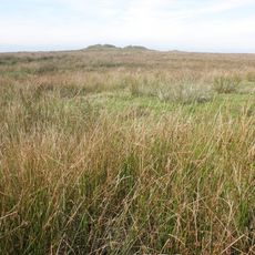
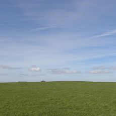
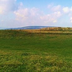
The Chains is a high plateau in the northwestern part of Exmoor National Park that rises above 1,500 feet (460 meters), with Chains Barrow marking its highest point at about 1,599 feet (487 meters). The landscape consists of open heathland interspersed with moorland and crossed by small streams.

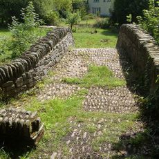
The area was developed in the 19th century by John Knight and his son, who constructed a dam across the River Barle to create Pinkery Pond for an irrigation project. This engineering work permanently altered how water was managed across the region.

Scientists examine pollen sequences preserved in the peat layers of The Chains to understand vegetation patterns throughout the Flandrian period.

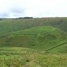
The area sits within a triangular zone between Simonsbath, Challacombe, and Lynton with multiple walking paths crossing the heathland. The open terrain offers little shelter from weather, so visitors should prepare for changing conditions.

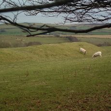
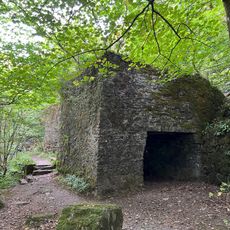
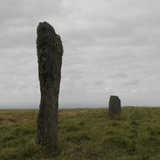
Long Chains Combe contains several standing stones designated as protected monuments, bearing witness to prehistoric activity in the area. These markers stand within a landscape where transitions between ancient woodland types remain visible today.

The community of curious travelers

AroundUs brings together thousands of curated places, local tips, and hidden gems, enriched daily by 60,000 contributors worldwide.

Start exploring
GPS coordinates
51.16670,-3.80000
Latest update
December 14, 2025 18:10
Around this place
Exmoor National Park
United Kingdom

Exmoor National Park

3.5 km
Watersmeet House
United Kingdom

Watersmeet House

6.3 km
Cow Castle
United Kingdom

Cow Castle

7.2 km
Simonsbath House
United Kingdom

Simonsbath House

4.3 km
Barle Valley
United Kingdom

Barle Valley

1.9 km
St Petrock's Church, Parracombe
United Kingdom

St Petrock's Church, Parracombe

7.2 km
Roborough Castle
United Kingdom

Roborough Castle

3.8 km
Church of St Luke
United Kingdom

Church of St Luke

4.4 km
Church of St John the Baptist
United Kingdom

Church of St John the Baptist

7.2 km
Simonsbath Bridge At Ngr Ss 7720 3909
United Kingdom

Simonsbath Bridge At Ngr Ss 7720 3909

4.4 km
Church of Holy Trinity
United Kingdom

Church of Holy Trinity

6.5 km
Church of St Brendan
United Kingdom

Church of St Brendan

5.4 km
Methodist Chapel And Youth Centre
United Kingdom

Methodist Chapel And Youth Centre

5.9 km
Lyn Model Railway
United Kingdom

Lyn Model Railway

7.2 km
Orchard House And Attached Front Boundary Wall
United Kingdom

Orchard House And Attached Front Boundary Wall

7.2 km
Hillside House And Front Terrace Wall And Railings
United Kingdom

Hillside House And Front Terrace Wall And Railings

7.2 km
Footbridge Circa 30 Metres North East Of Town Farmhouse
United Kingdom

Footbridge Circa 30 Metres North East Of Town Farmhouse

5.3 km
Pair Of Lime Kilns Approximately 200 Metres To East Of Watersmeet House
United Kingdom

Pair Of Lime Kilns Approximately 200 Metres To East Of Watersmeet House

6.3 km
Royal Castle Lodge  (Formerly The Lodge)
United Kingdom

Royal Castle Lodge (Formerly The Lodge)

7.2 km
Emmett's Grange
United Kingdom

Emmett's Grange

5.6 km
Summerhouse And Attached Retaining Wall And Terrace With Railings
United Kingdom

Summerhouse And Attached Retaining Wall And Terrace With Railings

7.2 km
Bonnicott
United Kingdom

Bonnicott

7.2 km
Dean Farmhouse
United Kingdom

Dean Farmhouse

6.8 km
'Five Barrows', group of eight barrows
United Kingdom

'Five Barrows', group of eight barrows

5.7 km
Packhorse Bridge Approximately 30 Metres To West Of Leeford Bridge (That Part In Brendon Cp)
United Kingdom

Packhorse Bridge Approximately 30 Metres To West Of Leeford Bridge (That Part In Brendon Cp)

6.5 km
Lyn Long Stones
United Kingdom

Lyn Long Stones

5.4 km
Round barrow SE of Down Linhay
United Kingdom

Round barrow SE of Down Linhay

7.1 km
Four round barrows on Muxworthy Ridge
United Kingdom

Four round barrows on Muxworthy Ridge

5.1 km
Show the full map
Reviews
Share your experience

No review yet

Discussions
Start a discussion...

No discussion yet

« Chains - Geological site in Exmoor, United Kingdom » is provided by Around Us (aroundus.com). Images and texts are derived from Wikimedia project under a Creative Commons license. You are allowed to copy, distribute, and modify copies of this page, under the conditions set by the license, as long as this note is clearly visible.

Discover hidden gems everywhere you go!

From secret cafés to breathtaking viewpoints, skip the crowded tourist spots and find places that match your style. Our app makes it easy with voice search, smart filtering, route optimization, and insider tips from travelers worldwide. Download now for the complete mobile experience.

Around Us App Screenshot

A unique approach to discovering new places

Le Figaro

All the places worth exploring

France Info

A tailor-made excursion in just a few clicks

20 Minutes

Around Us
Travel Guide & Maps
Download

Send to your phone

QR Code
1

Open the camera app on your mobile.

2

Point at the QR code with your camera. A notification will appear.

3

Tap the notification to open the link.