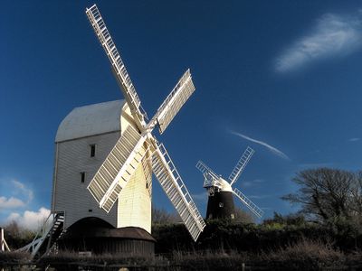
Clayton Windmills, Grade II listed windmills in Clayton, England.
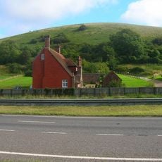
The Clayton Windmills are two structures named Jack and Jill, standing on elevated ground above the village. Both buildings feature working historical machinery and are accompanied by a mid-century house built on the property.
Jack Windmill was built in 1866 as a tower mill and replaced an earlier milling operation. The older site was mostly demolished, though a roundhouse from that era survives on the grounds.
The site represents a connection between agricultural heritage and contemporary design in the local landscape. Visitors can see how traditional milling skills remain embedded in the working machinery and the way the structures relate to the surrounding countryside.
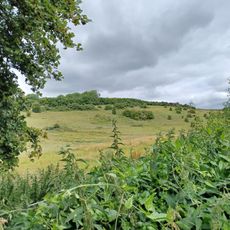
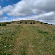
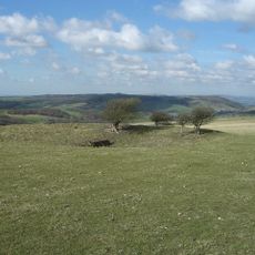
Access and visits are available under specific conditions, so it is worth checking ahead before planning a trip. The site sits on elevated ground with views across the surrounding landscape.
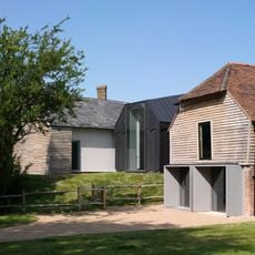
The restoration work at the site earned architectural recognition for its innovative approach. The project demonstrates how contemporary techniques can respectfully address conservation challenges.
Location: Hassocks
GPS coordinates: 50.90520,-0.14750
Latest update: December 9, 2025 18:43
Chattri
2.3 km
Danny House
2.4 km
Wings Place
2.8 km
St John the Baptist's Church, Clayton
721 m
Ditchling Museum of Art + Craft
2.9 km
St Cosmas and St Damian Church, Keymer
2.2 km
Church of the Transfiguration, Pyecombe
1.4 km
The Parish Church of St Margaret, Ditchling
2.9 km
The Bull Hotel
2.9 km
Hobbs Cottage
1.7 km
Pyecombe Manor
1.9 km
The White Horse Hotel
2.8 km
Wolstonbury
2 km
Clayton Tunnel North Portal Tunnel Cottage
855 m
Keymer War Memorial
2.2 km
Wolstonbury Camp: a Ram's Hill type enclosure on Wolstonbury Hill and associated later remains
2 km
Cross dyke and bowl barrow 310m south east of Wolstonbury Camp
1.8 km
Hautboys
1.7 km
The Old Manor House
2.2 km
The Old School House
1.3 km
Little Danny Farmhouse
2.2 km
Ditchling War Memorial
2.8 km
Roman road and 18th century coaching road N of Pyecombe church
1.1 km
Romano-British farmstead, field system and trackway on Wolstonbury Hill
1.8 km
Hillfort, a beacon and dewpond on Ditchling Beacon
2.8 km
Round barrows W of Ditchling Beacon
1.1 km
Redhouse Farmhouse
2.7 km
Cotterlings
2.8 kmVisited this place? Tap the stars to rate it and share your experience / photos with the community! Try now! You can cancel it anytime.
Discover hidden gems everywhere you go!
From secret cafés to breathtaking viewpoints, skip the crowded tourist spots and find places that match your style. Our app makes it easy with voice search, smart filtering, route optimization, and insider tips from travelers worldwide. Download now for the complete mobile experience.
A unique approach to discovering new places❞
— Le Figaro
All the places worth exploring❞
— France Info
A tailor-made excursion in just a few clicks❞
— 20 Minutes