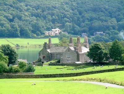
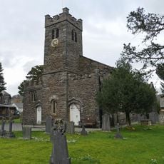
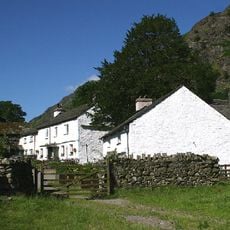
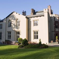
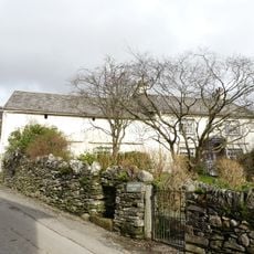
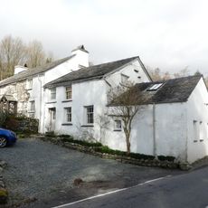
Coniston Hall, English country house in Coniston, England.
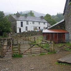
Coniston Hall is a stone country house on the western bank of Coniston Water, featuring traditional architectural elements and a slate roof. The building combines residential and agricultural functions within a single structure built according to local methods.
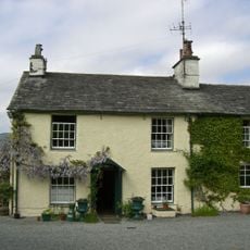
The house was built in the late 16th century and received its Grade II* listing in 1953, highlighting its architectural value. This classification recognized the building as an example of historical craftsmanship and regional construction practice.
The building shows traditional craftsmanship methods of the region, using local stone and slate materials. The construction style reflects building traditions that have been common in this area for centuries.
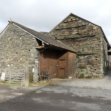
The site is managed by the National Trust and now houses a farmhouse and sailing club facilities. Visitors should be aware that this remains an actively used private property where access may be restricted.
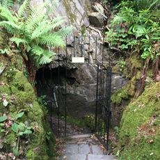
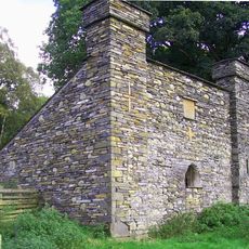
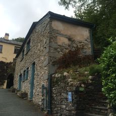
A separately listed historic toilet building survives on the grounds several meters south of the main house. This outbuilding shows how everyday life and sanitation were organized in earlier centuries.
Location: Coniston
GPS coordinates: 54.35780,-3.07167
Latest update: December 11, 2025 11:06
Brantwood
940 m
Ruskin Museum
1.4 km
Coniston copper mines
3.1 km
Carron Crag
2.9 km
Lawson Park
1.8 km
St Luke's Church, Torver
2.9 km
Low Water Beck
3 km
Church House Public House
2.9 km
Church of St Andrew
1.2 km
Monk Coniston
2.4 km
Memorial cross to John Ruskin approximately 23 metres east of St Andrew's Church
1.2 km
Low Yewdale Farmhouse and Cottage
2.9 km
Coniston War Memorial
1.3 km
Privy approximately 13 metres to south of Coniston Hall, Coniston
19 m
Monk Coniston
2.4 km
Lodge and former stable approximately 70 metres to south of Brantwood, Coniston
943 m
Two bloomeries, 340m and 570m NNE of Hoathwaite Landing on Coniston Water
800 m
Icehouse approximately 30 metres to north of Brantwood, Coniston
928 m
Eye Catcher Approximately 202 Metres North East Of Sheperd Bridge
1.7 km
Dixon Ground Farmhouse and outbuilding
1.4 km
S.V. Gondola Stores
1.8 km
Boon Crag Farmhouse
2.3 km
High Bank Ground Farmhouse and barn
1.3 km
Outbuilding approximately 30 metres to south of Brantwood, Coniston
945 m
Atkinson Ground House
2.1 km
Bowanstead
671 m
Barn to north west of Dixon Ground Farmhouse
1.4 km
Cairns and enclosure on The Rigg, Banishead
2.5 kmVisited this place? Tap the stars to rate it and share your experience / photos with the community! Try now! You can cancel it anytime.
Discover hidden gems everywhere you go!
From secret cafés to breathtaking viewpoints, skip the crowded tourist spots and find places that match your style. Our app makes it easy with voice search, smart filtering, route optimization, and insider tips from travelers worldwide. Download now for the complete mobile experience.
A unique approach to discovering new places❞
— Le Figaro
All the places worth exploring❞
— France Info
A tailor-made excursion in just a few clicks❞
— 20 Minutes