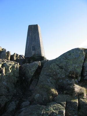
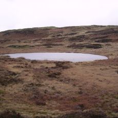
Carron Crag, Fell summit in Grizedale Forest, Lake District, England.
Carron Crag is a summit in Grizedale Forest within the Lake District and features a trig point with rock formations at its top. The location is reached by several well-marked walking paths that wind through the forested slopes.
The area was documented by writer Alfred Wainwright in his guide to the outlying hills of the Lake District. This attention helped establish the location as a recognized walking destination.
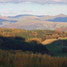
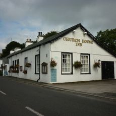
The summit is part of popular walking routes through Grizedale Forest and serves as a destination for day hikers exploring the area. Many visitors follow the paths that have become established over generations of exploration.
Visitors should wear sturdy shoes since the paths can be uneven and moisture is common in the forest. The best conditions for hiking occur during dry weather when underfoot conditions are most secure.
The summit holds a collection of roughly 70 artistic sculptures integrated into the natural landscape. One of these works stands beside the trig point, creating an unexpected blend of art within the outdoor setting.
Location: Cumbria
Elevation above the sea: 314 m
GPS coordinates: 54.33980,-3.03972
Latest update: December 14, 2025 11:42
Grizedale Forest
1 km
Brantwood
2 km
Esthwaite Water
4.2 km
Ruskin Museum
4.1 km
Coniston Hall
2.9 km
Esthwaite Lodge
3.8 km
Lawson Park
1.1 km
Top o'Selside
3 km
St Luke's Church, Torver
4.1 km
Dale Park Beck
2.3 km
Grizedale Beck
2.3 km
Church House Public House
4 km
Church of St Andrew
4 km
All Saints Church
2.4 km
Monk Coniston
4.1 km
Memorial cross to John Ruskin approximately 23 metres east of St Andrew's Church
3.9 km
Coniston War Memorial
4 km
Two bloomeries, 340m and 570m NNE of Hoathwaite Landing on Coniston Water
2.5 km
Monk Coniston
4.1 km
Lodge and former stable approximately 70 metres to south of Brantwood, Coniston
2 km
Privy approximately 13 metres to south of Coniston Hall, Coniston
2.9 km
Eye Catcher Approximately 202 Metres North East Of Sheperd Bridge
4.2 km
Icehouse approximately 30 metres to north of Brantwood, Coniston
2 km
Boon Crag Farmhouse
4.2 km
High Bank Ground Farmhouse and barn
2.9 km
Atkinson Ground House
3.4 km
Outbuilding approximately 30 metres to south of Brantwood, Coniston
2 km
Bowanstead
3.6 kmVisited this place? Tap the stars to rate it and share your experience / photos with the community! Try now! You can cancel it anytime.
Discover hidden gems everywhere you go!
From secret cafés to breathtaking viewpoints, skip the crowded tourist spots and find places that match your style. Our app makes it easy with voice search, smart filtering, route optimization, and insider tips from travelers worldwide. Download now for the complete mobile experience.
A unique approach to discovering new places❞
— Le Figaro
All the places worth exploring❞
— France Info
A tailor-made excursion in just a few clicks❞
— 20 Minutes