Enable Location

We need your location to show you interesting places around you

Discover nearby places

Find interesting locations and hidden gems around you

Precise directions

Get accurate directions and distances to places

Your location is never shared with other users. It's only used when you tap the location button.

Top o'Selside

Log in to your account

Start exploring — it's free

Trusted by 62,468 travelers worldwide

Continue with Google
Continue with Apple
or

We will send you a code to connect

By continuing, you accept our Terms and Conditions and our Privacy Policy

Check your inbox

We've sent a pincode in your inbox. Please enter the code below.

Top o'Selside

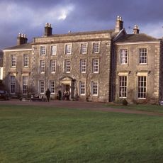
Top o'Selside, Mountain summit in Lake District, England

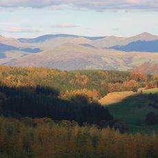
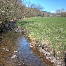
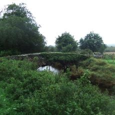
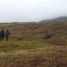
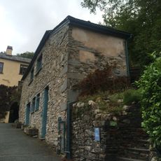
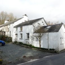
Top o'Selside is a mountain summit in Cumbria located between Coniston Water and Windermere lakes, reaching about 335 meters in elevation. The terrain offers open views across lakes and mountain valleys, with paths running through moorland and over ridges.

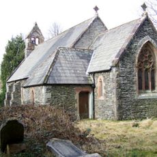
The mountain area played a role in local medieval history when groups controlled the region and used the terrain for their activities. The area has been a destination for walkers exploring the fells for centuries.

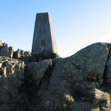
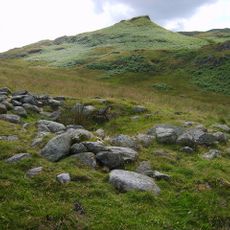
The summit features in hiking guides and offers views across the surrounding lakes and valleys that visitors encounter along their route. The path passes by stone cairns that walkers have used for generations to mark their way through the fells.

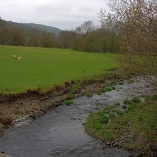
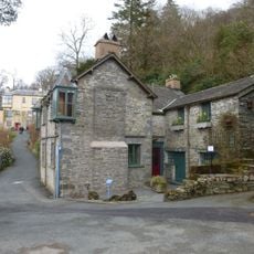
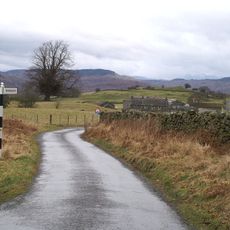
The climb starts from a parking area on the western side and follows a roughly two-mile path to the summit. The terrain can be muddy in places, so good footwear is needed as the route crosses moorland and hillsides.

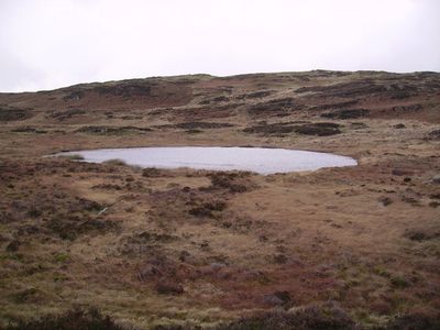
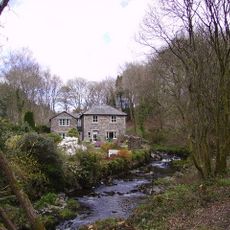
Near the summit sits a small lake that formed between ridges left behind by two separate glaciers moving down different valleys. This geological feature shows how different ice masses once shaped the valley and left their mark on the landscape.

The community of curious travelers

AroundUs brings together thousands of curated places, local tips, and hidden gems, enriched daily by 60,000 contributors worldwide.

Start exploring
Elevation above the sea
335 m
GPS coordinates
54.31764,-3.06522
Latest update
December 14, 2025 18:40
Around this place
Grizedale Forest
United Kingdom

Grizedale Forest

3.7 km
Brantwood
United Kingdom

Brantwood

4 km
Coniston Hall
United Kingdom

Coniston Hall

4.5 km
Rusland Hall
United Kingdom

Rusland Hall

4.4 km
Carron Crag
United Kingdom

Carron Crag

3 km
Lawson Park
United Kingdom

Lawson Park

3.4 km
St Luke's Church, Torver
United Kingdom

St Luke's Church, Torver

3.3 km
St John the Baptist's Church, Blawith
United Kingdom

St John the Baptist's Church, Blawith

4 km
Dale Park Beck
United Kingdom

Dale Park Beck

2.9 km
Force Beck
United Kingdom

Force Beck

3.8 km
Grizedale Beck
United Kingdom

Grizedale Beck

2.9 km
Church of St Paul
United Kingdom

Church of St Paul

3.8 km
Church House Public House
United Kingdom

Church House Public House

3.4 km
All Saints Church
United Kingdom

All Saints Church

3.1 km
Memorial cross to John Ruskin approximately 23 metres east of St Andrew's Church
United Kingdom

Memorial cross to John Ruskin approximately 23 metres east of St Andrew's Church

5.7 km
Rusland Pool Bridge
United Kingdom

Rusland Pool Bridge

4.5 km
Rook How Friends' Meeting House And Cottage
United Kingdom

Rook How Friends' Meeting House And Cottage

3.4 km
Dike, circles and cairns on Bleaberry Haws
United Kingdom

Dike, circles and cairns on Bleaberry Haws

4.8 km
Stable To North East Of Rook How Meeting House
United Kingdom

Stable To North East Of Rook How Meeting House

3.4 km
Privy approximately 13 metres to south of Coniston Hall, Coniston
United Kingdom

Privy approximately 13 metres to south of Coniston Hall, Coniston

4.5 km
Lodge and former stable approximately 70 metres to south of Brantwood, Coniston
United Kingdom

Lodge and former stable approximately 70 metres to south of Brantwood, Coniston

4 km
Low Longmire Farm And Five Associated Agricultural Buildings
United Kingdom

Low Longmire Farm And Five Associated Agricultural Buildings

5 km
Two bloomeries, 340m and 570m NNE of Hoathwaite Landing on Coniston Water
United Kingdom

Two bloomeries, 340m and 570m NNE of Hoathwaite Landing on Coniston Water

3.7 km
Icehouse approximately 30 metres to north of Brantwood, Coniston
United Kingdom

Icehouse approximately 30 metres to north of Brantwood, Coniston

4 km
Cairns and enclosure on The Rigg, Banishead
United Kingdom

Cairns and enclosure on The Rigg, Banishead

5.3 km
Outbuilding approximately 30 metres to south of Brantwood, Coniston
United Kingdom

Outbuilding approximately 30 metres to south of Brantwood, Coniston

4 km
Bowanstead
United Kingdom

Bowanstead

5 km
High Bank Ground Farmhouse and barn
United Kingdom

High Bank Ground Farmhouse and barn

5.2 km
Show the full map
« Top o'Selside - Mountain summit in Lake District, England » is provided by Around Us (aroundus.com). Images and texts are derived from Wikimedia project under a Creative Commons license. You are allowed to copy, distribute, and modify copies of this page, under the conditions set by the license, as long as this note is clearly visible.

Discover hidden gems everywhere you go!

From secret cafés to breathtaking viewpoints, skip the crowded tourist spots and find places that match your style. Our app makes it easy with voice search, smart filtering, route optimization, and insider tips from travelers worldwide. Download now for the complete mobile experience.

Around Us App Screenshot

A unique approach to discovering new places

Le Figaro

All the places worth exploring

France Info

A tailor-made excursion in just a few clicks

20 Minutes

Around Us
Travel Guide & Maps
Download

Send to your phone

QR Code
1

Open the camera app on your mobile.

2

Point at the QR code with your camera. A notification will appear.

3

Tap the notification to open the link.