·

Enable Location

We need your location to show you interesting places around you

Discover nearby places

Find interesting locations and hidden gems around you

Precise directions

Get accurate directions and distances to places

Your location is never shared with other users. It's only used when you tap the location button.

Log in to your account

Start exploring — it's free

Trusted by 62,727 travelers worldwide

Continue with Google
Continue with Apple
or

We will send you a code to connect

By continuing, you accept our Terms and Conditions and our Privacy Policy

Check your inbox

We've sent a pincode in your inbox. Please enter the code below.

Cwm Clydach National Nature Reserve

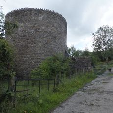
Cwm Clydach National Nature Reserve, National nature reserve in South Wales, United Kingdom.

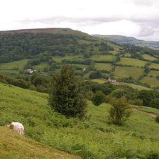
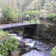
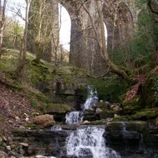
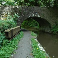
Cwm Clydach National Nature Reserve is a protected nature reserve in a steep gorge in South Wales with ancient beech forests and several streams. The site covers about 25 hectares and features narrow valleys with diverse vegetation and rocky slopes.

The area was protected by the Nature Conservancy Council to preserve its ancient semi-natural beech woodlands. Natural Resources Wales now manages the reserve and maintains its ecological value.

The site maintains educational panels throughout the reserve to inform visitors about local wildlife, plant species, and conservation methods.

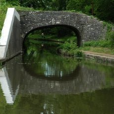
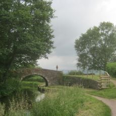
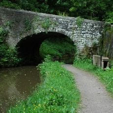
The reserve has several walking trails of varying difficulty connected to parking areas at the main entrances. The paths link to public roads and the national cycleway, offering options for visitors of different abilities.

The reserve is home to rare whitebeam trees growing on limestone outcrops and provides refuge for bird species including pied flycatchers, nuthatches, and green woodpeckers. This combination of uncommon plants and specialized bird life makes the area particularly valuable for wildlife enthusiasts.

The community of curious travelers

AroundUs brings together thousands of curated places, local tips, and hidden gems, enriched daily by 60,000 contributors worldwide.

Start exploring
GPS coordinates
51.80600,-3.13600
Latest update
December 14, 2025 14:44
Around this place
Monmouthshire and Brecon Canal
United Kingdom

Monmouthshire and Brecon Canal

3.3 km
Ogof y Daren Cilau
United Kingdom

Ogof y Daren Cilau

3 km
Clydach Gorge
United Kingdom

Clydach Gorge

1.2 km
Mynydd Llangatwg
United Kingdom

Mynydd Llangatwg

2.9 km
Nantyglo Round Towers
United Kingdom

Nantyglo Round Towers

3.6 km
Clydach House
United Kingdom

Clydach House

2.1 km
Gilwern Hill, Monmouthshire
United Kingdom

Gilwern Hill, Monmouthshire

2.7 km
Smart's Bridge
United Kingdom

Smart's Bridge

1.3 km
Parish Church of St Elli
United Kingdom

Parish Church of St Elli

2.7 km
Ty-uchaf Farmhouse Including Yard Wall And Stile Between House And Barn Range
United Kingdom

Ty-uchaf Farmhouse Including Yard Wall And Stile Between House And Barn Range

2.6 km
Blaen Pig quarries
United Kingdom

Blaen Pig quarries

3.8 km
Berea United Reformed Chapel
United Kingdom

Berea United Reformed Chapel

3.9 km
Nant Dyar Railway Viaduct
United Kingdom

Nant Dyar Railway Viaduct

1.5 km
Former Pump House at Dunlop Semtex Factory
United Kingdom

Former Pump House at Dunlop Semtex Factory

3.2 km
Market Hall Cinema
United Kingdom

Market Hall Cinema

2.9 km
Bailey Street Congregational Chapel
United Kingdom

Bailey Street Congregational Chapel

2.9 km
Brynmawr and District Museum
United Kingdom

Brynmawr and District Museum

2.7 km
Brynmawr Library
United Kingdom

Brynmawr Library

2.8 km
Bridge 102 over the Brecknock & Abergavenny Canal
United Kingdom

Bridge 102 over the Brecknock & Abergavenny Canal

4.1 km
Bridge 105 over the Brecknock & Abergavenny Canal including Iron Sign
United Kingdom

Bridge 105 over the Brecknock & Abergavenny Canal including Iron Sign

3.4 km
Bridge 107 over the Brecknock & Abergavenny Canal including Iron Sign
United Kingdom

Bridge 107 over the Brecknock & Abergavenny Canal including Iron Sign

3.3 km
Sw Roundhouse At Roundhouse Farm
United Kingdom

Sw Roundhouse At Roundhouse Farm

3.7 km
Bridge 106 over the Brecknock & Abergavenny Canal including Iron Sign
United Kingdom

Bridge 106 over the Brecknock & Abergavenny Canal including Iron Sign

3.3 km
Limekilns at Auckland House
United Kingdom

Limekilns at Auckland House

3.3 km
Pen-pedair-heol Bridge (Canal Bridge No 110)
United Kingdom

Pen-pedair-heol Bridge (Canal Bridge No 110)

4.2 km
Three Arch Viaduct of former Merthyr, Tredegar and Abergavenny Railway
United Kingdom

Three Arch Viaduct of former Merthyr, Tredegar and Abergavenny Railway

780 m
Dark Bridge (Canal Bridge No 109)
United Kingdom

Dark Bridge (Canal Bridge No 109)

4.3 km
Former Boiler House At Dunlop Semtex Factory
United Kingdom

Former Boiler House At Dunlop Semtex Factory

2.9 km
Show the full map
« Cwm Clydach National Nature Reserve - National nature reserve in South Wales, United Kingdom » is provided by Around Us (aroundus.com). Images and texts are derived from Wikimedia project under a Creative Commons license. You are allowed to copy, distribute, and modify copies of this page, under the conditions set by the license, as long as this note is clearly visible.

Discover hidden gems everywhere you go!

From secret cafés to breathtaking viewpoints, skip the crowded tourist spots and find places that match your style. Our app makes it easy with voice search, smart filtering, route optimization, and insider tips from travelers worldwide. Download now for the complete mobile experience.

Around Us App Screenshot

A unique approach to discovering new places

Le Figaro

All the places worth exploring

France Info

A tailor-made excursion in just a few clicks

20 Minutes

Around Us
Travel Guide & Maps
Download

Send to your phone

QR Code
1

Open the camera app on your mobile.

2

Point at the QR code with your camera. A notification will appear.

3

Tap the notification to open the link.