Enable Location

We need your location to show you interesting places around you

Discover nearby places

Find interesting locations and hidden gems around you

Precise directions

Get accurate directions and distances to places

Your location is never shared with other users. It's only used when you tap the location button.

Cotuit Hall

Log in to your account

Start exploring — it's free

Trusted by 62,245 travelers worldwide

Continue with Google
Continue with Apple
or

We will send you a code to connect

By continuing, you accept our Terms and Conditions and our Privacy Policy

Check your inbox

We've sent a pincode in your inbox. Please enter the code below.

Cotuit Hall

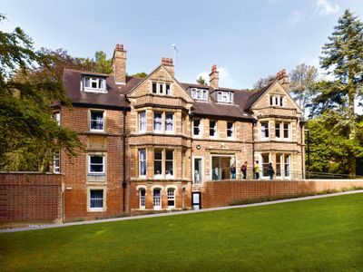
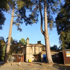
Cotuit Hall, International education hall in Headington Hill, England

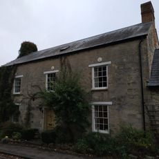
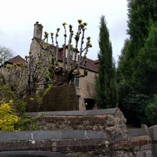
Cotuit Hall is a Victorian building on Pullens Lane with high ceilings, stone details, and large windows that typify 1890s educational architecture. Today it serves as a residential facility for students aged 16-18 pursuing A-level and International Baccalaureate courses with the EF International Academy.

The building was commissioned in 1892 by Arthur Sampson Napier, a Merton College Fellow and English professor, and designed by architect Harry Wilkinson Moore. It later served as a school facility and children's home before becoming part of an international education academy in recent times.

Today the building houses students from around the world who live and study together within its walls. This international community shapes daily life here and creates a space where different languages and customs naturally mix.

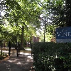
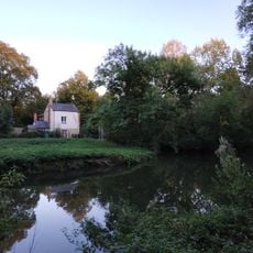
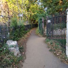
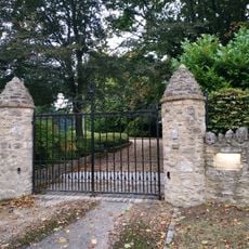
The building is located in a quiet area of Headington and is easily accessible by foot or public transport. Keep in mind this is a private educational facility, so access to the grounds may be restricted to students and staff.

The building takes its name from a village on the Cape Cod coast in Massachusetts, though the exact connection between this Oxford structure and its American namesake remains a mystery. This puzzling origin makes the property a curious crossroads of English and American heritage.

The community of curious travelers

AroundUs brings together thousands of curated places, local tips, and hidden gems, enriched daily by 60,000 contributors worldwide.

Start exploring
GPS coordinates
51.76030,-1.22700
Latest update
December 14, 2025 16:47
Around this place
Headington Hill Hall
United Kingdom

Headington Hill Hall

645 m
Headington Shark
United Kingdom

Headington Shark

957 m
Mesopotamia
United Kingdom

Mesopotamia

1 km
South Park
United Kingdom

South Park

1 km
The Oxford Artisan Distillery
United Kingdom

The Oxford Artisan Distillery

917 m
St Clement's Church, Oxford
United Kingdom

St Clement's Church, Oxford

1.1 km
Headington Hill Park
United Kingdom

Headington Hill Park

782 m
The Vines, Oxford
United Kingdom

The Vines, Oxford

90 m
St Anthony of Padua, Oxford
United Kingdom

St Anthony of Padua, Oxford

418 m
Bridge Over Headington Road At Headington Hill Hall
United Kingdom

Bridge Over Headington Road At Headington Hill Hall

684 m
The Warneford Hospital Chapel
United Kingdom

The Warneford Hospital Chapel

1.1 km
The Britannia Public House
United Kingdom

The Britannia Public House

907 m
New Marston War Memorial
United Kingdom

New Marston War Memorial

631 m
White Lodge And Sunny Lodge Wall Fronting Osler Road
United Kingdom

White Lodge And Sunny Lodge Wall Fronting Osler Road

893 m
Boundary Wall Of The Court
United Kingdom

Boundary Wall Of The Court

995 m
St Clement's, Oxford War Memorial
United Kingdom

St Clement's, Oxford War Memorial

1.1 km
Boundary Wall Of Manor House
United Kingdom

Boundary Wall Of Manor House

905 m
Stone In Warneford Lane Opposite The Entrance To The Warneford Hospital
United Kingdom

Stone In Warneford Lane Opposite The Entrance To The Warneford Hospital

936 m
8, Dunstan Road
United Kingdom

8, Dunstan Road

968 m
Hilltop
United Kingdom

Hilltop

591 m
Kings Mill
United Kingdom

Kings Mill

905 m
Manor House, Including The Stable Block To The East
United Kingdom

Manor House, Including The Stable Block To The East

797 m
The Court
United Kingdom

The Court

980 m
Stone On The South Side Of Headington Road 50 Yards East Of Hilltop
United Kingdom

Stone On The South Side Of Headington Road 50 Yards East Of Hilltop

559 m
Stone At The Junction Of Marston Road And The Footpath To Pullens Lane
United Kingdom

Stone At The Junction Of Marston Road And The Footpath To Pullens Lane

766 m
Garden Wall Of Manor Farmhouse
United Kingdom

Garden Wall Of Manor Farmhouse

956 m
Stone On The North Side Of Headington Hill 20 Yards To The East Of The Bridge
United Kingdom

Stone On The North Side Of Headington Hill 20 Yards To The East Of The Bridge

651 m
Headington Hill Hall Lodge House
United Kingdom

Headington Hill Hall Lodge House

580 m
Show the full map
« Cotuit Hall - International education hall in Headington Hill, England » is provided by Around Us (aroundus.com). Images and texts are derived from Wikimedia project under a Creative Commons license. You are allowed to copy, distribute, and modify copies of this page, under the conditions set by the license, as long as this note is clearly visible.

Discover hidden gems everywhere you go!

From secret cafés to breathtaking viewpoints, skip the crowded tourist spots and find places that match your style. Our app makes it easy with voice search, smart filtering, route optimization, and insider tips from travelers worldwide. Download now for the complete mobile experience.

Around Us App Screenshot

A unique approach to discovering new places

Le Figaro

All the places worth exploring

France Info

A tailor-made excursion in just a few clicks

20 Minutes

Around Us
Travel Guide & Maps
Download

Send to your phone

QR Code
1

Open the camera app on your mobile.

2

Point at the QR code with your camera. A notification will appear.

3

Tap the notification to open the link.