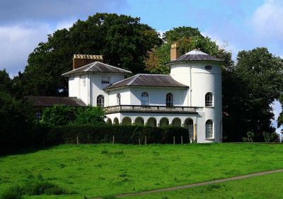
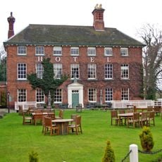
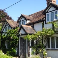
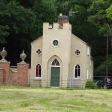
Cronkhill, Grade I listed country house in Atcham, England.
Cronkhill is a country house in Atcham with white stucco walls built as a rectangular two-story structure that incorporates a round tower and a square tower connected by a front loggia. The rooms are arranged within these distinct sections, with each tower serving a different purpose.
Architect John Nash designed and built this house in 1802 for Francis Walford, who worked as an agent for Baron Berwick. This project marked a turning point in English architecture by introducing Italian design concepts to England's country house tradition.
The design draws from Italian countryside villas, shaping how the rooms and outdoor spaces feel when you walk through them. The curved and straight towers joined by the front loggia create a sense of rural Italian elegance that becomes clear as you explore.
The estate is maintained by the National Trust and welcomes visitors during designated periods of the year, primarily through guided tours. It helps to check opening times in advance since access is limited to specific dates.
Each tower of the house contains a specialized room with different purposes, carefully integrated into the building's vertical structure. This functional arrangement demonstrates a thoughtful adaptation of Italian design to English living habits of the era.
Location: Atcham
Architectural style: Italianate architecture
Website: https://nationaltrust.org.uk/attingham-park-estate-cronkhill
GPS coordinates: 52.67030,-2.68778
Latest update: December 10, 2025 20:03
Attingham Park
2.1 km
St Andrew's Church, Wroxeter
2.7 km
Longner Hall
2.8 km
Cound Hall
3.9 km
St Eata's Church, Atcham
1 km
Cantlop Bridge
2.8 km
The Mytton and Mermaid Hotel
1.1 km
All Saints Church, Berrington
1.5 km
The Old Post Office
2.7 km
Cound War Memorial
3.7 km
Atcham Bridge
1.1 km
Village Pump And Trough Approximately 10 Metres To South Of Numbers 66 And 72
2.8 km
Entrance Screen And East And West Front Lodges To Attingham Park
1.2 km
Cound Arbour Bridge
3.6 km
Milestone Approximately 40 Metres To The South Of Milestone Cottage
3.3 km
Milestone Approximately 70 Metres To East Of North Lodge
3.7 km
Milepost Approximately 50 Metres To North Of Number 39, Venusbank
2.9 km
Back Lodge
1.9 km
Tern Lodge And Adjoining Wall
2.3 km
Milestone Approximately 10 Metres To North-West Of Emstrey Cottages
2.1 km
Site of Roman town of Wroxeter (Viroconium)
3 km
Shropshire Union Canal North West Entrance To Berwick Tunnel
3.8 km
Churchyard gates, gate piers and approximately 3 metres of flanking walls approximately 10 metres to west of west tower of Church of St Andrew
2.7 km
Estate Bridge Approximately 120 Metres To South East Of Attingham Park
2.2 km
Milestone, 260m NW Wroxeter crossroads
2.8 km
Milepost, London Road; by Emstrey Cemetery
3.5 km
Milestone, Betton Abbots, S of Yewtree Cottages
1.8 km
Milestone, between B Abbots & Cantlop Bridge
2.1 kmVisited this place? Tap the stars to rate it and share your experience / photos with the community! Try now! You can cancel it anytime.
Discover hidden gems everywhere you go!
From secret cafés to breathtaking viewpoints, skip the crowded tourist spots and find places that match your style. Our app makes it easy with voice search, smart filtering, route optimization, and insider tips from travelers worldwide. Download now for the complete mobile experience.
A unique approach to discovering new places❞
— Le Figaro
All the places worth exploring❞
— France Info
A tailor-made excursion in just a few clicks❞
— 20 Minutes