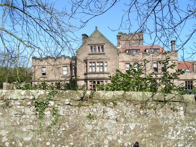
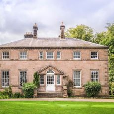
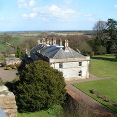
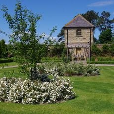
Ellingham Hall, Northumberland, 17th-century country house in Ellingham, England.
Ellingham Hall is a 17th-century country house situated on extensive grounds in rural Northumberland. The property contains multiple rooms for events and accommodation across its sprawling estate.
The Haggerston family built this house in the 1600s with hidden passages designed to shelter Catholic priests during the Reformation. It later served as a boys' preparatory school from 1955 to 1988.
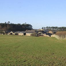
The Women's Land Army transformed the estate during World War II, converting tennis courts into cultivation fields and reception rooms into food storage facilities.
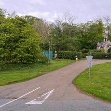
The house is accessible via local roads and easily reached from nearby towns. Visitors should know that the property operates primarily for private events and weddings.
The estate has local connections to World War II efforts when portions of the grounds were converted to support food production. These changes left marks on how the land is arranged today.
Location: Ellingham
GPS coordinates: 55.52690,-1.72717
Latest update: December 13, 2025 11:44
Preston Tower
1.2 km
Adderstone Hall
5.4 km
Rock Hall
6.3 km
Charlton Hall
3.6 km
Church of St Maurice
374 m
Church of St James
5.8 km
Church of St Hilda
4.8 km
Lucker War Memorial
4.9 km
Doxford Farmhouse
2.8 km
Waiting Shed And Up Platform At Chathill Station
1.7 km
Milepost Circa 200 Yards South Of Newstead Road End
2.6 km
Cup and ring marked rocks on Wandylaw Moor, 1km west of Wandylaw
3.6 km
Milepost 100 Metres South Of Newtonbarns
5.2 km
Signal Box At Chathill Station
1.7 km
North Charlton medieval village and open field system
3.1 km
Cross On North Side Of B6347 120 Metres West Of A1 Junction
3 km
Preston Tower (New)
1.2 km
South Lodge And Gateway To Preston Tower
1.4 km
Chathill Station And Down Platform
1.7 km
Twizell North Lodge
5.2 km
Mile Post 700 Metres North Of Prickly Bridge
5.6 km
Former Goods Shed On East Of Railway Immediately North Of B 1340
4.9 km
Milepost Circa 100 Yard South East Of Twizell North Lodge
5 km
Milepost, Rayheugh in loop of old road
3.9 km
Milepost, Warenford
4.5 km
Paddock Walls And Dovecote Circa 60 Yards North Of Lucker Hall
4.9 km
Milepost, North Sunderland
5.4 km
Milepost, Brownieside
2.3 kmVisited this place? Tap the stars to rate it and share your experience / photos with the community! Try now! You can cancel it anytime.
Discover hidden gems everywhere you go!
From secret cafés to breathtaking viewpoints, skip the crowded tourist spots and find places that match your style. Our app makes it easy with voice search, smart filtering, route optimization, and insider tips from travelers worldwide. Download now for the complete mobile experience.
A unique approach to discovering new places❞
— Le Figaro
All the places worth exploring❞
— France Info
A tailor-made excursion in just a few clicks❞
— 20 Minutes