Enable Location

We need your location to show you interesting places around you

Discover nearby places

Find interesting locations and hidden gems around you

Precise directions

Get accurate directions and distances to places

Your location is never shared with other users. It's only used when you tap the location button.

Elsdon Castle

Log in to your account

Start exploring — it's free

Trusted by 62,932 travelers worldwide

Continue with Google
Continue with Apple
or

We will send you a code to connect

By continuing, you accept our Terms and Conditions and our Privacy Policy

Check your inbox

We've sent a pincode in your inbox. Please enter the code below.

Discussion Reviews 1 Photos
2k Popularity

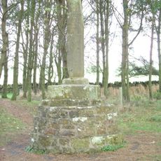
Elsdon Castle, Medieval fortress in Elsdon, England

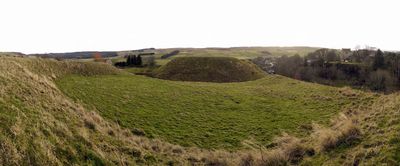
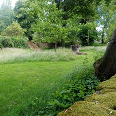
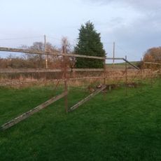
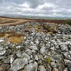
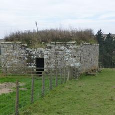
Elsdon Castle is a medieval fortress built as a motte-and-bailey structure, with a large earthen mound and a crescent-shaped outer enclosure. The site was designed to control and protect the surrounding area as a fortified strongpoint.

The castle was founded in 1076, shortly after the Norman conquest of England, as part of a widespread fortification campaign. It marks a turning point in English military architecture and territorial control.

The fortification demonstrates Norman building traditions that spread across England after the 1066 conquest. Visitors can still see how this architectural style shaped the landscape and reflects the defensive needs of its time.

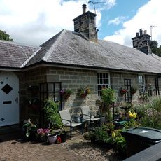
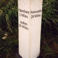
Access to the site is free and available year-round, making it convenient for a brief visit. The nearby village of Elsdon provides parking and basic amenities for visitors.

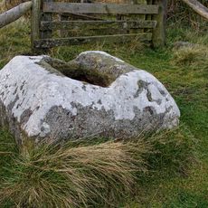
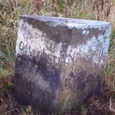
Archaeological work at the site uncovered a Roman stone from the High Rochester fort, revealing how builders reused material from earlier structures. This practical approach to construction offers insight into Norman building methods.

The community of curious travelers

AroundUs brings together thousands of curated places, local tips, and hidden gems, enriched daily by 60,000 contributors worldwide.

Start exploring
Location
GPS coordinates
55.23580,-2.09970
Latest update
December 9, 2025 12:22
Around this place
Otterburn Hall
United Kingdom

Otterburn Hall

5.4 km
Otterburn Mill
United Kingdom

Otterburn Mill

5 km
Elsdon Tower
United Kingdom

Elsdon Tower

203 m
Percy Cross
United Kingdom

Percy Cross

6 km
St Cuthbert's Church, Elsdon
United Kingdom

St Cuthbert's Church, Elsdon

256 m
St John the Evangelist's Church, Otterburn
United Kingdom

St John the Evangelist's Church, Otterburn

5.2 km
Church of St Cuthbert
United Kingdom

Church of St Cuthbert

6.4 km
East Woodburn Bridge
United Kingdom

East Woodburn Bridge

7 km
Milestone, East Otterburn
United Kingdom

Milestone, East Otterburn

4.7 km
Milestone Circa 400 Yards North West Of Ottercops Road End
United Kingdom

Milestone Circa 400 Yards North West Of Ottercops Road End

4.9 km
Fountain Base C.80 Yards South Of Otterburn Tower
United Kingdom

Fountain Base C.80 Yards South Of Otterburn Tower

5 km
Tenters C.40 Yards South-East Of Otterburn Mill
United Kingdom

Tenters C.40 Yards South-East Of Otterburn Mill

5 km
Bastle at The Raw Farm
United Kingdom

Bastle at The Raw Farm

4.5 km
The Vicarage
United Kingdom

The Vicarage

5.1 km
4 And 5, Bank Foot
United Kingdom

4 And 5, Bank Foot

4.8 km
Gatepiers, Garden Walls, Railings And Sundial, Circa 30 Yards South Of Overacres
United Kingdom

Gatepiers, Garden Walls, Railings And Sundial, Circa 30 Yards South Of Overacres

2.9 km
Gate And Gateway By South Lodge To Otterburn Hall
United Kingdom

Gate And Gateway By South Lodge To Otterburn Hall

5.2 km
Winter's Gibbet and adjacent crossbase of Steng Cross
United Kingdom

Winter's Gibbet and adjacent crossbase of Steng Cross

3.7 km
Round cairn 340m west of The Beacon
United Kingdom

Round cairn 340m west of The Beacon

6.9 km
Milestone Circa A Quarter Of A Mile West Of Raylees
United Kingdom

Milestone Circa A Quarter Of A Mile West Of Raylees

2.7 km
Milestone C.1/2 Mile West-North-West Of Otterburn
United Kingdom

Milestone C.1/2 Mile West-North-West Of Otterburn

6 km
Steng Cross
United Kingdom

Steng Cross

3.7 km
Bleach House Circa 20 Yards South East Of Otterburn Mills
United Kingdom

Bleach House Circa 20 Yards South East Of Otterburn Mills

5 km
South Lodge to Otterburn Hall
United Kingdom

South Lodge to Otterburn Hall

5.3 km
Milestone Circa 1000 Yards South Of Blaxter Cottages
United Kingdom

Milestone Circa 1000 Yards South Of Blaxter Cottages

3.6 km
Manside defended settlement and medieval cross
United Kingdom

Manside defended settlement and medieval cross

4.9 km
Sundial C.50 Yards South-East Of Otterburn Tower
United Kingdom

Sundial C.50 Yards South-East Of Otterburn Tower

5 km
Bastle, 500m west of High Shaw
United Kingdom

Bastle, 500m west of High Shaw

4.7 km
Show the full map
Reviews
Share your experience

No review yet

Discussions
Start a discussion...

No discussion yet

« Elsdon Castle - Medieval fortress in Elsdon, England » is provided by Around Us (aroundus.com). Images and texts are derived from Wikimedia project under a Creative Commons license. You are allowed to copy, distribute, and modify copies of this page, under the conditions set by the license, as long as this note is clearly visible.

Discover hidden gems everywhere you go!

From secret cafés to breathtaking viewpoints, skip the crowded tourist spots and find places that match your style. Our app makes it easy with voice search, smart filtering, route optimization, and insider tips from travelers worldwide. Download now for the complete mobile experience.

Around Us App Screenshot

A unique approach to discovering new places

Le Figaro

All the places worth exploring

France Info

A tailor-made excursion in just a few clicks

20 Minutes

Around Us
Travel Guide & Maps
Download

Send to your phone

QR Code
1

Open the camera app on your mobile.

2

Point at the QR code with your camera. A notification will appear.

3

Tap the notification to open the link.