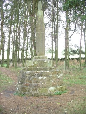
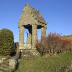
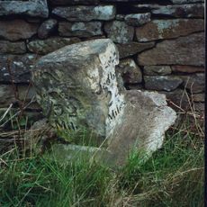
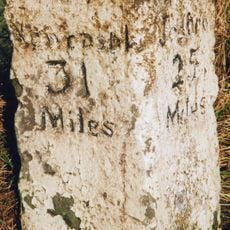
Percy Cross, Medieval memorial stone in Otterburn, England.
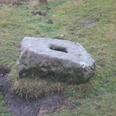
Percy Cross is a medieval memorial stone in Otterburn featuring a square stepped base made of sandstone. The structure stands about one meter tall and measures roughly two meters across, positioned near the A696 road.
The stone was built before 1400 to commemorate the Battle of Otterburn in 1388, when English and Scottish forces clashed. The memorial preserves the memory of this significant conflict in the region's past.
The monument takes its name from Henry Percy, Earl of Northumberland, reflecting the power of this family in medieval England. It stands as a visible reminder of their historical importance in the area.
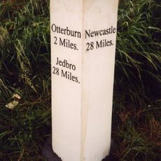
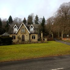
The memorial is located beside the A696 road, roughly one kilometer from Otterburn's center and easy to reach. The spot is accessible and offers a good view of the surrounding area.
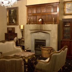
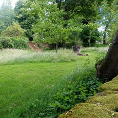
The structure includes an old fireplace frame from Otterburn Hall's kitchen, weaving local architectural history into the memorial. This recovered element shows how historical materials were preserved and reused.
Location: Otterburn
GPS coordinates: 55.23703,-2.19469
Latest update: December 14, 2025 14:43
Otterburn Hall
935 m
Elsdon Castle
6 km
Otterburn Mill
1.2 km
Elsdon Tower
5.9 km
St Cuthbert's Church, Elsdon
5.9 km
St John the Evangelist's Church, Otterburn
986 m
Church of St Cuthbert
4.6 km
Church of the Holy Trinity
5 km
Milestone South West Of Church Of The Holy Trinity At Ngr 842971
4.8 km
The Redesdale Arms
4.5 km
Milestone, East Otterburn
1.6 km
Rochester War Memorial
6 km
Fountain Base C.80 Yards South Of Otterburn Tower
1.2 km
Romano-British farmstead 330m west of Rattenraw Farm
3.3 km
Tenters C.40 Yards South-East Of Otterburn Mill
1.4 km
Gate And Gateway By South Lodge To Otterburn Hall
966 m
Milestone South Of Shittleheugh Bridge At Ngr 869943
1.7 km
4 And 5, Bank Foot
1.5 km
The Vicarage
1.1 km
Milestone C.1/2 Mile West-North-West Of Otterburn
135 m
Milestone Circa A Quarter Of A Mile West Of Raylees
4.7 km
Bleach House Circa 20 Yards South East Of Otterburn Mills
1.4 km
South Lodge to Otterburn Hall
952 m
Medieval wayside cross, 200m NNW of Brownrigg
2.3 km
Milestone By Bennetsfield Farm
3.2 km
Sundial C.50 Yards South-East Of Otterburn Tower
1.2 km
Gatepiers, Garden Walls, Railings And Sundial, Circa 30 Yards South Of Overacres
3.2 km
Milestone, Raylees
6 kmVisited this place? Tap the stars to rate it and share your experience / photos with the community! Try now! You can cancel it anytime.
Discover hidden gems everywhere you go!
From secret cafés to breathtaking viewpoints, skip the crowded tourist spots and find places that match your style. Our app makes it easy with voice search, smart filtering, route optimization, and insider tips from travelers worldwide. Download now for the complete mobile experience.
A unique approach to discovering new places❞
— Le Figaro
All the places worth exploring❞
— France Info
A tailor-made excursion in just a few clicks❞
— 20 Minutes