Foots Cray Meadows

Log in to your account

AroundUs is a community-driven map of interesting places, built by curious explorers like you. It grows with every review, story, and photo you share.
Connect to save your favorite spots, contribute locations, and create personalized routes.
By continuing, you accept our Terms and Conditions and our Privacy Policy
Add to collection
Map
Suggest a change
Share

Foots Cray Meadows, Grade II listed park in London Borough of Bexley, England.

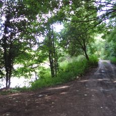
Foots Cray Meadows is a Grade II listed park spanning 97 hectares of grassland and woodland where the River Cray winds through the landscape. The waterway creates natural settings that link the suburbs of Albany Park and Sidcup together.

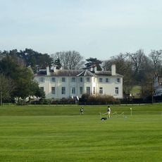
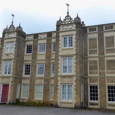
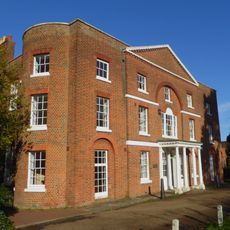
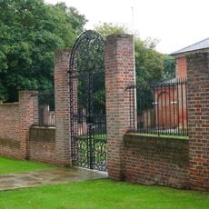
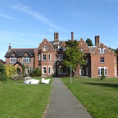
The land was part of Foots Cray Place estate until a fire destroyed the main house in 1949. Following this loss, the grounds were transformed into public parkland for the local community.

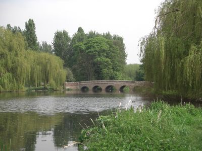
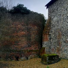
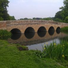
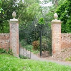
The Five Arches Bridge and Penny Farthing Bridge show how people shaped the landscape over centuries, connecting different sections and reflecting the way communities have used this land across generations.

You can enter at several points along Rectory Lane, North Cray Road, and Riverside Road. The London Loop walking path crosses through the grounds, making it easy to explore on foot.

A centuries-old sweet chestnut tree grows within the meadows, adding to the sense of time passing through the landscape. Grey wagtails and kingfishers inhabit the river waters, though visitors often walk past without noticing them.

Location: London Borough of Bexley

GPS coordinates: 51.42580,0.12710

Latest update: December 8, 2025 19:47

Photos
Around this place
Loring Hall
United Kingdom

Loring Hall

1 km
Frognal House
United Kingdom

Frognal House

1.8 km
Marlowe House
United Kingdom

Marlowe House

2 km
Lamorbey Park
United Kingdom

Lamorbey Park

1.9 km
Ruxley Gravel Pits
United Kingdom

Ruxley Gravel Pits

1.9 km
St Botolph's Church, Ruxley
United Kingdom

St Botolph's Church, Ruxley

1.6 km
Parish Church of St John the Evangelist
United Kingdom

Parish Church of St John the Evangelist

1.5 km
St Lawrence church, Sidcup
United Kingdom

St Lawrence church, Sidcup

1.9 km
Parish Church of All Saints
United Kingdom

Parish Church of All Saints

642 m
St. Andrew's
United Kingdom

St. Andrew's

663 m
Parish Church of St James
United Kingdom

Parish Church of St James

426 m
Manor House
United Kingdom

Manor House

1.7 km
Sidcup War Memorial
United Kingdom

Sidcup War Memorial

1.8 km
Sheffield Monument (In Churchyard Of Parish Church Of St John The Evangelist)
United Kingdom

Sheffield Monument (In Churchyard Of Parish Church Of St John The Evangelist)

1.5 km
The Seven Stars Public House
United Kingdom

The Seven Stars Public House

997 m
Holy Trinity Church
United Kingdom

Holy Trinity Church

2.1 km
Stable Block To Former Foots Cray Place
United Kingdom

Stable Block To Former Foots Cray Place

533 m
North Cray War Memorial
United Kingdom

North Cray War Memorial

448 m
Five Arch Bridge
United Kingdom

Five Arch Bridge

262 m
Ruxley Farmhouse
United Kingdom

Ruxley Farmhouse

1.6 km
Walls Surrounding And To West And South West Of Parish Church Of St James And Gatepiers And Gates To West Of Church
United Kingdom

Walls Surrounding And To West And South West Of Parish Church Of St James And Gatepiers And Gates To West Of Church

404 m
1st Bexleyheath Scout Group Memorial
United Kingdom

1st Bexleyheath Scout Group Memorial

1.9 km
Lodge To Hurstmere School
United Kingdom

Lodge To Hurstmere School

1.6 km
Sidcup Place (Including Ha Ha To East)
United Kingdom

Sidcup Place (Including Ha Ha To East)

1.8 km
Bowling Pavillion, Foots Cray Place
United Kingdom

Bowling Pavillion, Foots Cray Place

587 m
Two Chest Tombs To East Side Of Parish Church Of St James
United Kingdom

Two Chest Tombs To East Side Of Parish Church Of St James

446 m
Tomb Of Frances Madocks To South Side Of Parish Church Of St James
United Kingdom

Tomb Of Frances Madocks To South Side Of Parish Church Of St James

430 m
Milepost, Maidstone Road, Ruxley, E of Glebe Cottages, W of entrance to Manor Farm
United Kingdom

Milepost, Maidstone Road, Ruxley, E of Glebe Cottages, W of entrance to Manor Farm

1.5 km
Show the full map
Reviews

Visited this place? Tap the stars to rate it and share your experience / photos with the community! Try now! You can cancel it anytime.

« Foots Cray Meadows - Grade II listed park in London Borough of Bexley, England » is provided by Around Us (aroundus.com). Images and texts are derived from Wikimedia project under a Creative Commons license. You are allowed to copy, distribute, and modify copies of this page, under the conditions set by the license, as long as this note is clearly visible.

Discover hidden gems everywhere you go!

From secret cafés to breathtaking viewpoints, skip the crowded tourist spots and find places that match your style. Our app makes it easy with voice search, smart filtering, route optimization, and insider tips from travelers worldwide. Download now for the complete mobile experience.

Around Us App Screenshot

A unique approach to discovering new places

Le Figaro

All the places worth exploring

France Info

A tailor-made excursion in just a few clicks

20 Minutes