Kilpatrick Hills, Hill chain in West Dunbartonshire, Scotland
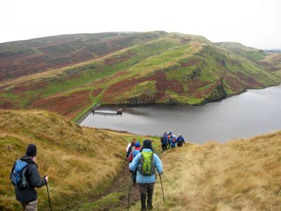
The Kilpatrick Hills form a ridge stretching between Dumbarton and Strathblane, with several peaks including Duncolm at 401 meters. The range spans several miles with varied terrain featuring rocky outcrops, valleys, and open moorland slopes.
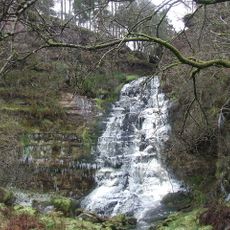
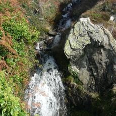
The hills formed about 340 million years ago from volcanic eruptions that created the Clyde Plateau Lavas. Glaciation in later ice ages shaped the landscape, carving valleys and sculpting the peaks we see today.
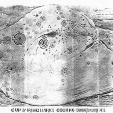
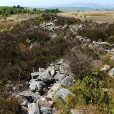
Bronze Age cup and ring marks cover rock faces throughout the area, showing that people lived here thousands of years ago. Ancient burial cairns scattered across the slopes tell stories of these early communities.
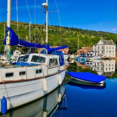
Walking and cycling routes connect the hills to nearby towns like Balloch, Dumbarton, Milton, and Bowling, all reachable by public transport. Most trails range from gentle to moderate difficulty, though some sections climb steeply depending on your chosen route.
The Whangie is a striking natural chasm cutting deep into the hillside, a curious narrow gorge that catches visitors by surprise. This unusual formation was carved by ancient glacial forces that plucked and removed massive chunks of rock from the slope.
Location: West Dunbartonshire
GPS coordinates: 55.96670,-4.43333
Latest update: December 10, 2025 15:46
Overtoun Bridge
5.9 km
Forth and Clyde Canal
5.1 km
Erskine Bridge
5.5 km
Overtoun House
5.9 km
Cochno Stone
4.3 km
Mugdock Castle
6.8 km
Mugdock Country Park
7.3 km
Craigend Castle
6.2 km
Dunglass Castle
6 km
Blantyre Monument
6.9 km
Beardmore Crane
6.7 km
County Buildings, Dumbarton
7.3 km
Ishneich
4.9 km
Grey Mare's Tail, Kilpatrick Hills
2.7 km
The Lang Cairn
4.6 km
Erskine House
5.8 km
Clydebank Library
7.4 km
Mountblow Football Pavilion, Lilac Avenue, Clydebank
5.4 km
Empire Cinema
7.2 km
Dalmuir Library
6.2 km
Erskine House, Ferry Lodge
5.8 km
Forth And Clyde Canal, Bowling Harbour, Railway Swing Bridge And Approach Viaducts
5 km
Forth and Clyde Canal: Old Kilpatrick - Linnvale
6.2 km
Forth And Clyde Canal, Bowling Basin, Drawbridge
5 km
4 Bayfield Terrace, St Pius X Roman Catholic Church And Presbytery
7.3 km
Forth And Clyde Canal, Bowling Harbour, Customs House
5.1 km
Erskine Hospital
5.9 km
Bowling, Dumbarton Road, Public Park, War Memorial
5 kmVisited this place? Tap the stars to rate it and share your experience / photos with the community! Try now! You can cancel it anytime.
Discover hidden gems everywhere you go!
From secret cafés to breathtaking viewpoints, skip the crowded tourist spots and find places that match your style. Our app makes it easy with voice search, smart filtering, route optimization, and insider tips from travelers worldwide. Download now for the complete mobile experience.
A unique approach to discovering new places❞
— Le Figaro
All the places worth exploring❞
— France Info
A tailor-made excursion in just a few clicks❞
— 20 Minutes