Milecastle 8, Roman military fortification at Tyne and Wear, England
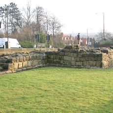
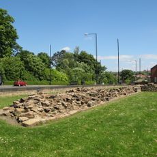
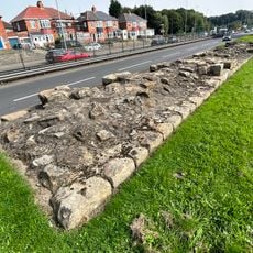
Milecastle 8 is a Roman fortification positioned along Hadrian's Wall and part of a series of small garrison posts built at intervals along the frontier line. The ruins show stone walls and reveal how these military stations were built and arranged to control movement along the border.
This fortification was built in the 2nd century AD as part of the Roman strategy to secure the northern frontier of Britain. It remained in use over time and was later repurposed during other historical periods.
This post was a crucial checkpoint where soldiers watched over the frontier and controlled who moved across the border. The objects left behind by these guards show how they lived and worked at the edge of the Roman world.
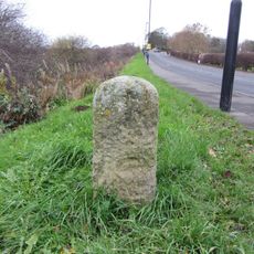
The site sits directly on the Hadrian's Wall walking path and is accessible to visitors interested in exploring the area on foot. It is wise to wear appropriate footwear and bring protection from the weather, as the landscape is open and exposed.
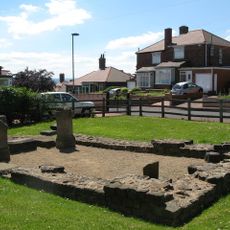
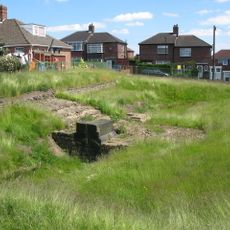
Evidence of an 18th-century milking house was found on the grounds, showing how local people later reused the old Roman foundations for their own purposes. This reveals that structures from antiquity often served new functions long after Roman times ended.
Location: Tyne and Wear
Part of: Hadrian's Wall
GPS coordinates: 54.98647,-1.70064
Latest update: December 14, 2025 18:14
The Mitre
2.3 km
Scotswood Bridge
2.3 km
Scotswood Railway Bridge
2.1 km
Blaydon Bridge
1.8 km
Milecastle 7
1.7 km
Milecastle 9
1.5 km
Royal Victoria School For The Blind
2.5 km
Temple of Antenociticus in New upon Tyne
2.7 km
Church of St Michael and All Angels
2.6 km
Church of Holy Saviour, Lemington
1.4 km
Church of St Cuthbert
2.6 km
Newburn Library
2.7 km
Newburn War Memorial
2.7 km
Holy Cross Church, Fenham
2.1 km
Newburn Hall Motor Museum
2.6 km
Benwell Waterworks Chimney
2.2 km
Roman Turret Opposite Number 800, Bishops House (denton Hall) With Section Of Hadrian's Wall
652 m
Housing Department Area Offices
2.8 km
Milestone About 21 Metres East Of Small Burn Conduit
2.7 km
Outer West Library
733 m
Vallum crossing at Benwell Fort
2.6 km
Summerhouse
2.8 km
Number 4 And Wall Adjoining To North
2.6 km
Former Whickham View Schools
1.4 km
Hadrian's Wall and vallum in wall mile 8 from Denton to Blucher
583 m
Lemington Cone
1.5 km
Bishop's House
627 m
Milepost, Hawthorn Terrace, North Walbottle, by jct to terrace at back
2.3 kmVisited this place? Tap the stars to rate it and share your experience / photos with the community! Try now! You can cancel it anytime.
Discover hidden gems everywhere you go!
From secret cafés to breathtaking viewpoints, skip the crowded tourist spots and find places that match your style. Our app makes it easy with voice search, smart filtering, route optimization, and insider tips from travelers worldwide. Download now for the complete mobile experience.
A unique approach to discovering new places❞
— Le Figaro
All the places worth exploring❞
— France Info
A tailor-made excursion in just a few clicks❞
— 20 Minutes