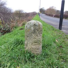
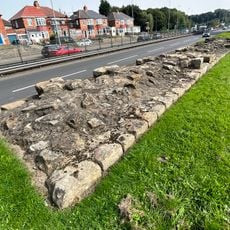
Milecastle 9, Roman fortification in West Denton, England
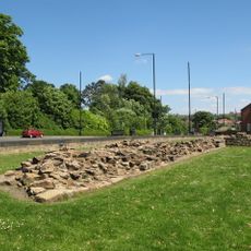
Milecastle 9 is a Roman military outpost in West Denton that served as a checkpoint along Britain's northern frontier. The remains show a rectangular layout with stone walls and gateways at the ends, designed to monitor and control movement along the border.
The outpost was built in the 2nd century AD by the Legio XX Valeria Victrix as part of Rome's defense strategy for northern Britain. It was one of many such checkpoints that formed a connected system along the frontier to manage and protect this distant edge of the empire.
The site reveals how Roman soldiers lived and worked in this frontier post through the physical layout and objects they left behind. Walking across the remains gives a sense of the daily routines that took place within these stone walls.
The site lies partly beneath modern roads A69 and B6528, so only sections are fully visible and accessible to visitors. Wear sturdy shoes as the ground can be uneven and muddy, especially after rain.
Excavations uncovered an unusual burial that raises questions about how the site was used after the Romans left. This discovery suggests the location may have held meaning for people living in the area long after its military purpose ended.
Location: Tyne and Wear
GPS coordinates: 54.99070,-1.72233
Latest update: December 14, 2025 16:47
Blaydon Bridge
2.8 km
Newburn Bridge
1.9 km
Milecastle 10
1.5 km
Milecastle 8
1.5 km
Milecastle 11
2.9 km
Church of St Michael and All Angels
1.5 km
Church of St Mary
2.1 km
Church of Holy Saviour, Lemington
2 km
Church of St Cuthbert
2.9 km
The Boathouse Public House
1.7 km
Throckley War Memorial
2.1 km
Newburn Library
1.5 km
Newburn War Memorial
1.6 km
Newburn Hall Motor Museum
1.3 km
Housing Department Area Offices
1.5 km
Milestone About 21 Metres East Of Small Burn Conduit
1.2 km
Stargate War Memorial
3 km
Roman Turret Opposite Number 800, Bishops House (denton Hall) With Section Of Hadrian's Wall
2.1 km
Outer West Library
1.5 km
Number 4 And Wall Adjoining To North
2.6 km
Former Valve House
2.7 km
Valve House West Of Junction With Coach Road
2.6 km
Former Whickham View Schools
2.7 km
Hadrian's Wall and vallum in wall mile 8 from Denton to Blucher
897 m
Lemington Cone
1.8 km
Summerhouse
2.8 km
Newburn Pumping Station
2 km
Bishop's House
2.1 kmVisited this place? Tap the stars to rate it and share your experience / photos with the community! Try now! You can cancel it anytime.
Discover hidden gems everywhere you go!
From secret cafés to breathtaking viewpoints, skip the crowded tourist spots and find places that match your style. Our app makes it easy with voice search, smart filtering, route optimization, and insider tips from travelers worldwide. Download now for the complete mobile experience.
A unique approach to discovering new places❞
— Le Figaro
All the places worth exploring❞
— France Info
A tailor-made excursion in just a few clicks❞
— 20 Minutes