Enable Location

We need your location to show you interesting places around you

Discover nearby places

Find interesting locations and hidden gems around you

Precise directions

Get accurate directions and distances to places

Your location is never shared with other users. It's only used when you tap the location button.

Newburn Bridge

Log in to your account

Start exploring — it's free

Trusted by 62,561 travelers worldwide

Continue with Google
Continue with Apple
or

We will send you a code to connect

By continuing, you accept our Terms and Conditions and our Privacy Policy

Check your inbox

We've sent a pincode in your inbox. Please enter the code below.

Newburn Bridge

Newburn Bridge, Road bridge in Tyneside, England

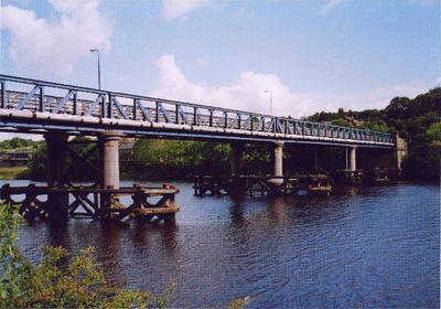
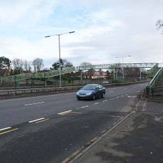
Newburn Bridge is a road bridge spanning the River Tyne with a steel lattice girder structure made up of four separate spans, supported by deep foundations that extend below the water level. The structure connects communities on both sides of the river valley.

The bridge opened in 1893 as a toll crossing, generating income from traffic passing between the two sides of the river valley. The Northumberland County Council acquired it in 1947, removing the toll requirement and making it freely accessible to the public.

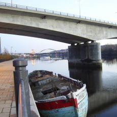
The bridge location marks an ancient crossing point of the River Tyne, where the Battle of Newburn Ford occurred in 1640.

The crossing links Newburn, Walbottle, and Throckley on the north side with Ryton, Stella, and Blaydon on the south side of the river valley. A traffic management modification in the 1960s reduced the number of lanes to decrease structural strain on the aging bridge.

The location marks where military forces crossed during the 1640s conflict at Newburn Ford, an important passage point centuries before the current bridge was constructed. This riverside site held strategic value long before becoming a modern crossing.

The community of curious travelers

AroundUs brings together thousands of curated places, local tips, and hidden gems, enriched daily by 60,000 contributors worldwide.

Start exploring
Official opening
1893
GPS coordinates
54.98000,-1.74500
Latest update
December 14, 2025 13:06
« Newburn Bridge - Road bridge in Tyneside, England » is provided by Around Us (aroundus.com). Images and texts are derived from Wikimedia project under a Creative Commons license. You are allowed to copy, distribute, and modify copies of this page, under the conditions set by the license, as long as this note is clearly visible.

Discover hidden gems everywhere you go!

From secret cafés to breathtaking viewpoints, skip the crowded tourist spots and find places that match your style. Our app makes it easy with voice search, smart filtering, route optimization, and insider tips from travelers worldwide. Download now for the complete mobile experience.

Around Us App Screenshot

A unique approach to discovering new places

Le Figaro

All the places worth exploring

France Info

A tailor-made excursion in just a few clicks

20 Minutes

Around Us
Travel Guide & Maps
Download

Send to your phone

QR Code
1

Open the camera app on your mobile.

2

Point at the QR code with your camera. A notification will appear.

3

Tap the notification to open the link.