Chest opened
+${chestReward.xp} XP
Explorer
NOUVEAU ×${chestReward.collectible.quantity}
tapez pour fermer
Chest locked

Open chests in the app

Around Us is built for your phone — chests unlock when you walk, explore and capture nearby places.

Enable Location

We need your location to show you interesting places around you

Discover nearby places

Find interesting locations and hidden gems around you

Precise directions

Get accurate directions and distances to places

Your location is never shared with other users. It's only used when you tap the location button.

Log in to your account

Start exploring — it's free

Trusted by 72,893 travelers worldwide

Continue with Google
Continue with Apple
or

We will send you a code to connect

By continuing, you accept our Terms and Conditions and our Privacy Policy

Check your inbox

We've sent a pincode in your inbox. Please enter the code below.

Priory Vale
Discussion Reviews Photo
2.3k Popularity

Priory Vale, Modern residential suburb in northern Swindon, England.

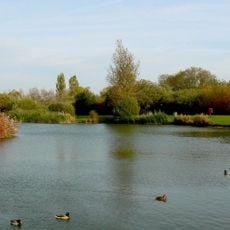
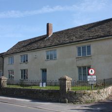
Priory Vale is a modern residential suburb comprising three distinct urban villages: Redhouse, Oakhurst, and Haydon End. The area features a mix of housing, green spaces, and neighborhood facilities spread across the landscape.

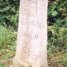
The area developed in the 1960s through planning initiatives that transformed agricultural land into residential spaces. This growth reflected wider efforts to manage the expansion of the region at that time.

The neighborhood incorporates numerous educational facilities, including Brimble Hill Primary School and Isambard Community School, serving the local population.

The area has good access to shops and schools for daily needs within or near the neighborhood. Walking and cycling routes connect the different parts of the community conveniently.

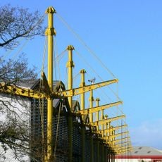
A notable feature is a dedicated footbridge crossing a major road, specifically designed for pedestrians and cyclists. This structure shows how planning shaped daily movement through the community.

The community of curious travelers

AroundUs brings together thousands of curated places, local tips, and hidden gems, enriched daily by 60,000 contributors worldwide.

Start exploring
GPS coordinates
51.59720,-1.80511
Latest update
December 13, 2025 12:25
Around this place
Swindon Steam Railway Museum
United Kingdom

Swindon Steam Railway Museum

3.9 km
Swindon and Cricklade Railway
United Kingdom

Swindon and Cricklade Railway

2.9 km
Ermin Street
United Kingdom

Ermin Street

3.5 km
Oasis Leisure Centre
United Kingdom

Oasis Leisure Centre

3.5 km
The Spectrum Building
United Kingdom

The Spectrum Building

3.6 km
Swindon Stadium
United Kingdom

Swindon Stadium

1.5 km
Mouldon Hill Country Park
United Kingdom

Mouldon Hill Country Park

1.9 km
STEAM - Museum of the Great Western Railway
United Kingdom

STEAM - Museum of the Great Western Railway

3.9 km
St Augustine, Swindon
United Kingdom

St Augustine, Swindon

3.4 km
Church of St Leonard
United Kingdom

Church of St Leonard

2.6 km
Church of St Andrew
United Kingdom

Church of St Andrew

969 m
Church of St Barnabas
United Kingdom

Church of St Barnabas

3.4 km
Church of St Mary
United Kingdom

Church of St Mary

2 km
The Queen's Tap
United Kingdom

The Queen's Tap

3.9 km
Milestone To West Of Dinton
United Kingdom

Milestone To West Of Dinton

2 km
Arkells Brewery House  Brewery House
United Kingdom

Arkells Brewery House Brewery House

3 km
19, Green Road
United Kingdom

19, Green Road

3 km
Stone Building On Island Platform At Swindon Railway Station (MLN1/77 16)
United Kingdom

Stone Building On Island Platform At Swindon Railway Station (MLN1/77 16)

3.8 km
The Great Western Hotel
United Kingdom

The Great Western Hotel

3.8 km
41, Green Road
United Kingdom

41, Green Road

3.2 km
British Rail Engineering Limited Swindon Works  No 19 Shop, And No 20 Shop (North Bay) Old N Shop
United Kingdom

British Rail Engineering Limited Swindon Works No 19 Shop, And No 20 Shop (North Bay) Old N Shop

3.9 km
Milestone On B4019
United Kingdom

Milestone On B4019

3.6 km
21, Green Road
United Kingdom

21, Green Road

3 km
Milestone On Boundary With Cricklade Parish
United Kingdom

Milestone On Boundary With Cricklade Parish

3.5 km
Evans Chest Tomb In Churchyard Of St Mary's Church, 9 Metres South Of Tower
United Kingdom

Evans Chest Tomb In Churchyard Of St Mary's Church, 9 Metres South Of Tower

2.1 km
Wiltshire Chest Tomb 4 Metres South East Of East Corner Of Chancel, Churchyard Of St Mary's Church
United Kingdom

Wiltshire Chest Tomb 4 Metres South East Of East Corner Of Chancel, Churchyard Of St Mary's Church

2.1 km
Milestone Opposite St Philip's Road
United Kingdom

Milestone Opposite St Philip's Road

2.8 km
Stables 6 Metres North Of Manor House
United Kingdom

Stables 6 Metres North Of Manor House

2.1 km
Show the full map
Reviews
Share your experience

No review yet

Discussions
Start a discussion...

No discussion yet

« Priory Vale - Modern residential suburb in northern Swindon, England » is provided by Around Us (aroundus.com). Images and texts are derived from Wikimedia project under a Creative Commons license. You are allowed to copy, distribute, and modify copies of this page, under the conditions set by the license, as long as this note is clearly visible.

Discover hidden gems everywhere you go!

From secret cafés to breathtaking viewpoints, skip the crowded tourist spots and find places that match your style. Our app makes it easy with voice search, smart filtering, route optimization, and insider tips from travelers worldwide. Download now for the complete mobile experience.

Around Us App Screenshot

A unique approach to discovering new places

Le Figaro

All the places worth exploring

France Info

A tailor-made excursion in just a few clicks

20 Minutes

Around Us
Travel Guide & Maps
Download

Send to your phone

QR Code
1

Open the camera app on your mobile.

2

Point at the QR code with your camera. A notification will appear.

3

Tap the notification to open the link.