Enable Location

We need your location to show you interesting places around you

Discover nearby places

Find interesting locations and hidden gems around you

Precise directions

Get accurate directions and distances to places

Your location is never shared with other users. It's only used when you tap the location button.

Upper Rivington Reservoir

Log in to your account

Start exploring — it's free

Trusted by 62,429 travelers worldwide

Continue with Google
Continue with Apple
or

We will send you a code to connect

By continuing, you accept our Terms and Conditions and our Privacy Policy

Check your inbox

We've sent a pincode in your inbox. Please enter the code below.

Upper Rivington Reservoir

Upper Rivington Reservoir, lake in the United Kingdom

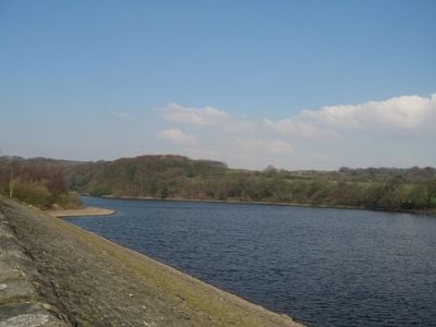
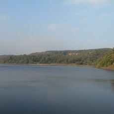
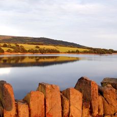
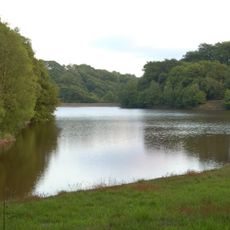
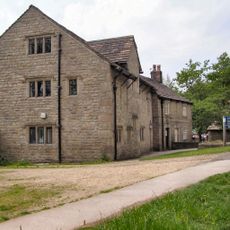
Upper Rivington Reservoir is a water body spanning about 2 miles in the West Pennine Moors with flat walking paths suitable for all ages. It forms part of a chain of three reservoirs in this area and is held back by long embankments built in the 1800s.

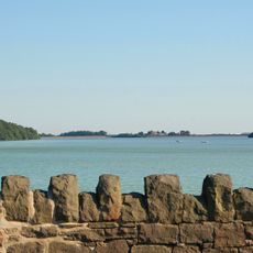
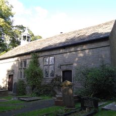
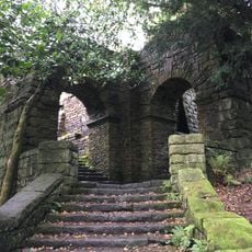
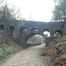
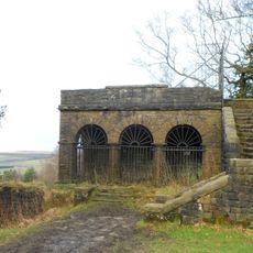
The reservoir was built between 1852 and 1857 under engineer Thomas Hawksley's design to supply water to the town of Liverpool and surrounding villages. The substantial dam structures from that era remain a defining feature of the landscape today.

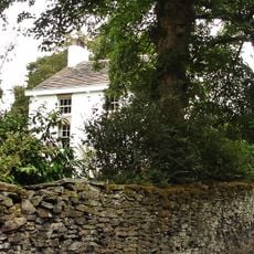
The name reflects the local river and moorland geography of this rural corner of Lancashire. You can see how residents use the surroundings for relaxed walks and quiet outdoor activities.

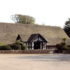
The site is easy to reach with flat terrain allowing leisurely walking at any pace, and parking is available nearby. Bring your own snacks as facilities in the immediate area are limited.

A small island sits in the middle of the water, and historically two places called Street Bottoms and Street Wood disappeared beneath the surface when the reservoir was filled. This hidden history reveals how the landscape was reshaped for modern water needs.

The community of curious travelers

AroundUs brings together thousands of curated places, local tips, and hidden gems, enriched daily by 60,000 contributors worldwide.

Start exploring
Location
Location
Location
Part of
Rivington Reservoirs
GPS coordinates
53.62889,-2.57333
Latest update
February 9, 2026 08:19
Around this place
Anglezarke Reservoir
United Kingdom

Anglezarke Reservoir

1.6 km
Rivington Hall
United Kingdom

Rivington Hall

1.2 km
Rivington Hall Barn
United Kingdom

Rivington Hall Barn

1.2 km
Lower Rivington Reservoir
United Kingdom

Lower Rivington Reservoir

1.5 km
Rivington Unitarian Chapel
United Kingdom

Rivington Unitarian Chapel

656 m
Rivington Church
United Kingdom

Rivington Church

558 m
St Paul's Church, Adlington
United Kingdom

St Paul's Church, Adlington

2.3 km
Yarrow Reservoir
United Kingdom

Yarrow Reservoir

891 m
High Bullough Reservoir
United Kingdom

High Bullough Reservoir

2.1 km
Two Archways And Associated Stone Staircases And Retaining Walls In Rivington Gardens At Sd 6390 1422
United Kingdom

Two Archways And Associated Stone Staircases And Retaining Walls In Rivington Gardens At Sd 6390 1422

1.8 km
Lever Bridge, Staircases And A Summer House In Rivington Gardens At Sd 6384 1422
United Kingdom

Lever Bridge, Staircases And A Summer House In Rivington Gardens At Sd 6384 1422

1.8 km
Loggia, Summerhouse And Associated Staircases In Rivington Gardens At Sd 6392 1431
United Kingdom

Loggia, Summerhouse And Associated Staircases In Rivington Gardens At Sd 6392 1431

1.8 km
Rivington Castle
United Kingdom

Rivington Castle

1.9 km
Adlington And District War Memorial
United Kingdom

Adlington And District War Memorial

2.4 km
Wellington Bomber Z8799 Crash site Memorial, Rivington
United Kingdom

Wellington Bomber Z8799 Crash site Memorial, Rivington

1.8 km
Rivington Pike Tower At Sd 642 137
United Kingdom

Rivington Pike Tower At Sd 642 137

2.4 km
Headless Cross
United Kingdom

Headless Cross

1.9 km
Pigeon Tower, Staircases, Stone Arches, Stone Screen And Two Gate Piers In Rivington Gardens At Sd 6397 1433
United Kingdom

Pigeon Tower, Staircases, Stone Arches, Stone Screen And Two Gate Piers In Rivington Gardens At Sd 6397 1433

1.8 km
Wilcocks Farmhouse
United Kingdom

Wilcocks Farmhouse

1.3 km
Bellhouse Circa 10 Metres West Of Church Of Holy Trinity
United Kingdom

Bellhouse Circa 10 Metres West Of Church Of Holy Trinity

503 m
Manor House
United Kingdom

Manor House

2.3 km
Moses Cocker's Farmhouse
United Kingdom

Moses Cocker's Farmhouse

1.6 km
Mounting Block In School Yard Circa 15 Metres West Of Rivington School
United Kingdom

Mounting Block In School Yard Circa 15 Metres West Of Rivington School

618 m
Hall O' Th' Hill
United Kingdom

Hall O' Th' Hill

1.9 km
Great House Farmhouse And Cottage
United Kingdom

Great House Farmhouse And Cottage

1.2 km
Fisher House
United Kingdom

Fisher House

683 m
Milestone, Grimeford
United Kingdom

Milestone, Grimeford

2 km
Milestone, opp.  Supermarket, by No. 18
United Kingdom

Milestone, opp. Supermarket, by No. 18

2 km
Show the full map
« Upper Rivington Reservoir - lake in the United Kingdom » is provided by Around Us (aroundus.com). Images and texts are derived from Wikimedia project under a Creative Commons license. You are allowed to copy, distribute, and modify copies of this page, under the conditions set by the license, as long as this note is clearly visible.

Discover hidden gems everywhere you go!

From secret cafés to breathtaking viewpoints, skip the crowded tourist spots and find places that match your style. Our app makes it easy with voice search, smart filtering, route optimization, and insider tips from travelers worldwide. Download now for the complete mobile experience.

Around Us App Screenshot

A unique approach to discovering new places

Le Figaro

All the places worth exploring

France Info

A tailor-made excursion in just a few clicks

20 Minutes

Around Us
Travel Guide & Maps
Download

Send to your phone

QR Code
1

Open the camera app on your mobile.

2

Point at the QR code with your camera. A notification will appear.

3

Tap the notification to open the link.