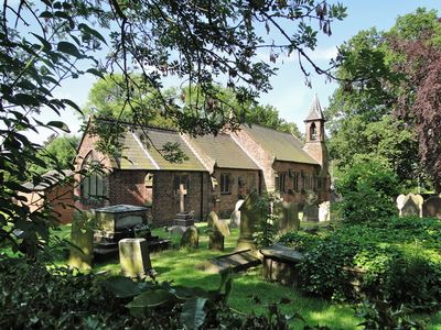
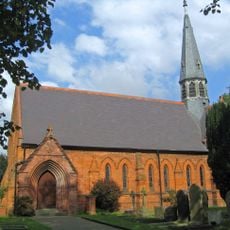
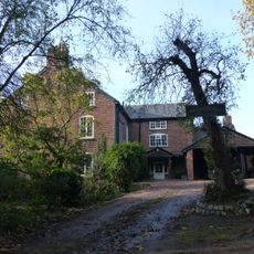
St Luke's Church, Lower Whitley, Anglican church in Lower Whitley, England
St Luke's Church is an Anglican church built of brown brick with sandstone accents and topped by a grey slate roof crowned by a stone bell turret with a slate spire. Inside, original 17th-century pews feature decorative wooden ends with ball finials, and stained glass windows from the 1860s line the walls.
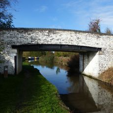
The church began as a chapel serving the Great Budworth parish and underwent major reconstruction in the late 16th century after falling into disrepair. This rebuilding created the framework for the structure we see today.
This church has served as a community gathering place for generations and continues to support religious life in the area alongside two neighbouring parish churches.
The site is accessible on foot with room to view the exterior and browse the surrounding churchyard. Access may vary depending on service schedules, so checking ahead before your visit is helpful.
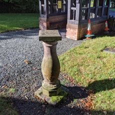
A mid-18th century sundial stands in the churchyard, marking a long connection to timekeeping in the space. The entrance lychgate features an integrated clock and functions as a First World War memorial.
Location: Whitley
Website: http://parishof.org/#!st-lukes-lower-whitley/cei
GPS coordinates: 53.30540,-2.58020
Latest update: December 14, 2025 17:02
Cogshall Hall
2 km
Dutton Horse Bridge
3.7 km
Acton swing bridge
3.2 km
Dutton Locks
3.4 km
St Michael and All Angels Church, Little Leigh
2.9 km
Frandley Quaker Meeting House and Burial Ground Wall
2.2 km
The Partridge
3.1 km
Chetwode Arms Inn
59 m
Bradley Meadow Bridge (Canal Bridge Number 206)
3.5 km
Trent and Mersey Canal bridge number 211
2.7 km
Trent and Mersey Canal bridge number 210
2.7 km
The Thatched Cottage
375 m
Black Jane Farm House
2.6 km
Trent and Mersey Canal Milepost at NGR 602 765
2.7 km
The Holly Bush Public House
2.1 km
Dutton Sluice 150 metres north east of Dutton Lock
3.2 km
Bartington Hall Farmhouse
2.8 km
Willow Bank Farmhouse
1.4 km
Trent and Mersey Canal western entrance to the Saltersford Tunnel
3.7 km
Trent and Mersey Canal, canal milepost south east of bridge number 206 at SJ61017538
3.5 km
Trent and Mersey Canal Willowgreen Bridge (Canal Bridge Number 208)
2.8 km
Stable At Wallspit
3.1 km
New Manor Farm moated site
3.7 km
Sundial in Churchyard of Church of St Luke
12 m
Milepost, Runcorn Road, Smithey Lane jct
1.9 km
Milepost, Dutton School
3.1 km
Milepost, Gibb Hill, in angle of Pole Lane and drive to Belmont Hall
3.6 km
Milepost, Bartington, SE of Bartington Hall Farm
3 kmVisited this place? Tap the stars to rate it and share your experience / photos with the community! Try now! You can cancel it anytime.
Discover hidden gems everywhere you go!
From secret cafés to breathtaking viewpoints, skip the crowded tourist spots and find places that match your style. Our app makes it easy with voice search, smart filtering, route optimization, and insider tips from travelers worldwide. Download now for the complete mobile experience.
A unique approach to discovering new places❞
— Le Figaro
All the places worth exploring❞
— France Info
A tailor-made excursion in just a few clicks❞
— 20 Minutes