The More

Log in to your account

AroundUs is a community-driven map of interesting places, built by curious explorers like you. It grows with every review, story, and photo you share.
Connect to save your favorite spots, contribute locations, and create personalized routes.
By continuing, you accept our Terms and Conditions and our Privacy Policy
Add to collection
Map
Suggest a change
Share

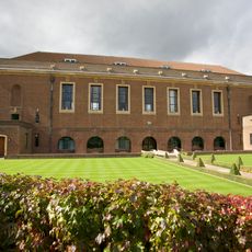
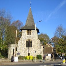
The More, Manor house in Batchworth, England.

The More is a former manor house and palace in Batchworth, England, now a scheduled archaeological monument buried beneath a private school site. The remains include brick foundations, traces of timber galleries, and floor plans of large halls spread across a wide estate at the edge of the Colne flood plain.

Cardinal Wolsey owned the estate before it passed to Henry VIII in 1531 and later became a residence for Catherine of Aragon after her marriage was annulled. The building was abandoned and demolished in 1661 after serving as a royal residence for over a century.

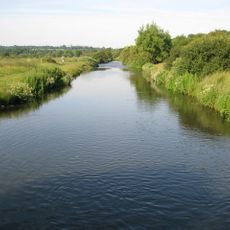
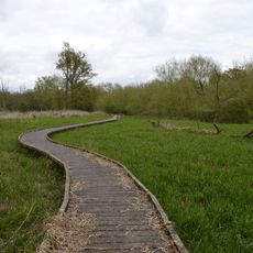
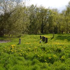
The name refers to marshland or moorland and points to the location near a flood plain. Visitors today see only the archaeological site on school grounds, where once lavish rooms and galleries stood.

The site lies beneath imported topsoil on Merchant Taylors' Prep School grounds and is not open to the public. Archaeological excavations took place between 1952 and 1955 and documented the floor plans and foundations of the former palace.

French ambassador Jean du Bellay declared in 1527 that the palace was superior to Hampton Court, highlighting the importance of the estate at that time. Inventory lists from 1547 recorded 157 items, including tapestries bearing Wolsey's coat of arms and chairs marked with Anne Boleyn's initials.

Location: Batchworth

GPS coordinates: 51.63430,-0.43936

Latest update: December 5, 2025 22:29

Photos
Around this place
Merchant Taylors' School
United Kingdom

Merchant Taylors' School

1.1 km
Moor Park
United Kingdom

Moor Park

896 m
Croxley Green Windmill
United Kingdom

Croxley Green Windmill

1.9 km
Croxley Common Moor
United Kingdom

Croxley Common Moor

937 m
The Withey Beds
United Kingdom

The Withey Beds

308 m
Batchworth Heath
United Kingdom

Batchworth Heath

308 m
Church of St Mary, Rickmansworth
United Kingdom

Church of St Mary, Rickmansworth

2 km
War Memorial About 40 Metres East of Church of St Mary
United Kingdom

War Memorial About 40 Metres East of Church of St Mary

1.9 km
Church of All Saints
United Kingdom

Church of All Saints

1.8 km
The Coach And Horses Public House
United Kingdom

The Coach And Horses Public House

2 km
K6 Telephone Kiosk Outside St Mary's Church
United Kingdom

K6 Telephone Kiosk Outside St Mary's Church

1.9 km
25 and 27, Church Street
United Kingdom

25 and 27, Church Street

2.1 km
99, Church Street
United Kingdom

99, Church Street

1.9 km
53-61, Church Street
United Kingdom

53-61, Church Street

2 km
29 and 31, Church Street
United Kingdom

29 and 31, Church Street

2.1 km
The Feathers Public House
United Kingdom

The Feathers Public House

2 km
Wilson Monument Immediately North Of Chancel Of Church Of St Mary
United Kingdom

Wilson Monument Immediately North Of Chancel Of Church Of St Mary

2 km
Ye Old Greene Manne Public House
United Kingdom

Ye Old Greene Manne Public House

1.5 km
Roman Catholic Church of Our Lady Help of Christians and St Augustine's Hall
United Kingdom

Roman Catholic Church of Our Lady Help of Christians and St Augustine's Hall

2.1 km
The Chequers Restaurant
United Kingdom

The Chequers Restaurant

2.1 km
Obelisk On South Bank In Garden Of Number 17 Moor Lane
United Kingdom

Obelisk On South Bank In Garden Of Number 17 Moor Lane

1.6 km
The Priory
United Kingdom

The Priory

2 km
Pair Of Chest Tombs With Fluted Corner Piers About 10 Metres North Of Church Of St Mary
United Kingdom

Pair Of Chest Tombs With Fluted Corner Piers About 10 Metres North Of Church Of St Mary

2 km
London Coal Duty Marker On County Boundary
United Kingdom

London Coal Duty Marker On County Boundary

1.7 km
Milestone About 35 Metres West Of Number 1 Home Farm Road (Not Listed)
United Kingdom

Milestone About 35 Metres West Of Number 1 Home Farm Road (Not Listed)

1.5 km
London Coal Duty Marker On County Boundary About 140 Metres South Of Road
United Kingdom

London Coal Duty Marker On County Boundary About 140 Metres South Of Road

1.9 km
21 And 25, Harefield Road
United Kingdom

21 And 25, Harefield Road

2 km
17, Moor Lane
United Kingdom

17, Moor Lane

1.6 km
Show the full map
Reviews

Visited this place? Tap the stars to rate it and share your experience / photos with the community! Try now! You can cancel it anytime.

« The More - Manor house in Batchworth, England » is provided by Around Us (aroundus.com). Images and texts are derived from Wikimedia project under a Creative Commons license. You are allowed to copy, distribute, and modify copies of this page, under the conditions set by the license, as long as this note is clearly visible.

Discover hidden gems everywhere you go!

From secret cafés to breathtaking viewpoints, skip the crowded tourist spots and find places that match your style. Our app makes it easy with voice search, smart filtering, route optimization, and insider tips from travelers worldwide. Download now for the complete mobile experience.

Around Us App Screenshot

A unique approach to discovering new places

Le Figaro

All the places worth exploring

France Info

A tailor-made excursion in just a few clicks

20 Minutes