Ffridd Faldwyn, Montgomery, Iron Age hillfort in Montgomery, Wales
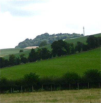
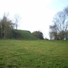
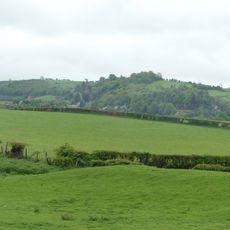
Ffridd Faldwyn is an Iron Age hillfort located on a ridge west of Montgomery that spans roughly 300 by 200 meters. The site features multiple concentric banks and ditches arranged around the hilltop, commanding views over the Severn valley below.
The hillfort was built during the Iron Age as a major settlement for the Ordovices, a Celtic tribe of the region. Excavations in the 1930s revealed the site underwent multiple phases of construction, with the earliest defenses featuring timber structures.
This location held strategic importance for regional communities who needed to control movement and trade routes through the valley. The layout suggests it served as a gathering point and hub for nearby settlements.
The site can be reached on foot via a footpath that winds through woodland from the nearby road to the base of the hill. Sturdy shoes are advisable as the terrain is uneven and can be slippery after rain.
The earthworks feature four separate ditch systems, some still rising several meters high, making it one of the most intact hillforts in Wales. This layered defense system reveals how carefully the early inhabitants planned their protection.
Location: Powys
GPS coordinates: 52.56445,-3.15706
Latest update: December 14, 2025 18:46
Montgomery Castle
500 m
Hen Domen
1.1 km
Lymore, Montgomery
1.7 km
The Old Bell
693 m
Montgomery Town Hall
721 m
St Beuno's Church
4.9 km
Church of St Michael and All Angels, Forden
4.2 km
Montgomeryshire County War Memorial
1.2 km
Caerhowel Bridge
2.3 km
St Nicholas's Church
799 m
Church of St Michael
4.7 km
The Dragon Hotel
714 m
Bridge 131 Over The Montgomeryshire Canal, Garthmyl
3.1 km
Chirbury War Memorial
4.7 km
Glansevern Hall
3.7 km
Montgomery Library
772 m
Milestone at NGR SO 2463 9319
4.8 km
Colomendy
728 m
Tan-y-castell
754 m
Broad Street Farmhouse
760 m
Milestone near junction with New Road
1 km
The Old Rectory
2.6 km
Fron Footbridge
3.4 km
Milestone At Ngr So 2410 9777
2.6 km
Milestone At Ngr So 2448 9376
4.4 km
Group Of 10 Chest Tombs Approximately 3.5 To 10 Metres South Of Chancel Of Church Of St Michael
4.8 km
Offa's Dyke: section 2/3 mile (1170m) long, N from southern boundary of Rownal Covert
2.2 km
Milestone, St Michaels Church, Chirbury
4.7 kmVisited this place? Tap the stars to rate it and share your experience / photos with the community! Try now! You can cancel it anytime.
Discover hidden gems everywhere you go!
From secret cafés to breathtaking viewpoints, skip the crowded tourist spots and find places that match your style. Our app makes it easy with voice search, smart filtering, route optimization, and insider tips from travelers worldwide. Download now for the complete mobile experience.
A unique approach to discovering new places❞
— Le Figaro
All the places worth exploring❞
— France Info
A tailor-made excursion in just a few clicks❞
— 20 Minutes