Enable Location

We need your location to show you interesting places around you

Discover nearby places

Find interesting locations and hidden gems around you

Precise directions

Get accurate directions and distances to places

Your location is never shared with other users. It's only used when you tap the location button.

Sedgefield

Log in to your account

Start exploring — it's free

Trusted by 62,851 travelers worldwide

Continue with Google
Continue with Apple
or

We will send you a code to connect

By continuing, you accept our Terms and Conditions and our Privacy Policy

Check your inbox

We've sent a pincode in your inbox. Please enter the code below.

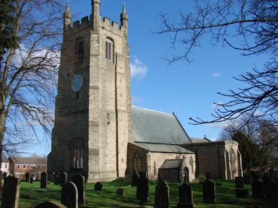
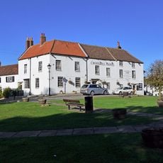
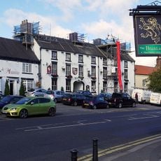
Sedgefield, Market town in County Durham, England.

Sedgefield is a market town in northeastern England with traditional stone buildings and a central market square surrounded by green landscapes. The parish administers community services from its hall, including meeting spaces, allotments, and cemetery management.

The town has Roman roots, revealed by archaeological finds showing ancient workshops and coins near the settlement. Medieval development followed, establishing the market square that remains its heart today.

The annual Shrove Tuesday Ball Game shows how locals keep a medieval football match alive, passed down through generations of residents. This event shapes the town's identity and brings the community together.

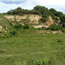
The town is easy to explore on foot, with main areas centered around the market square. Visitors should allow time for a walk through the surrounding green spaces to fully appreciate the rural setting.

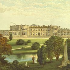
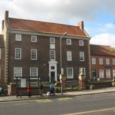
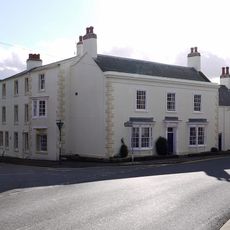
The Manor House, completed in 1707, displays Queen Anne architecture and was transformed from a private residence into rural district council offices. This conversion reflects how the building adapted to serve new administrative roles over time.

The community of curious travelers

AroundUs brings together thousands of curated places, local tips, and hidden gems, enriched daily by 60,000 contributors worldwide.

Start exploring
Location
GPS coordinates
54.65000,-1.45000
Latest update
December 20, 2025 11:33
Around this place
Wynyard Park
United Kingdom

Wynyard Park

7 km
Hardwick Hall Country Park
United Kingdom

Hardwick Hall Country Park

1.3 km
Hardwick Hall Hotel
United Kingdom

Hardwick Hall Hotel

1.3 km
The Manor House
United Kingdom

The Manor House

368 m
Church of St Edmund
United Kingdom

Church of St Edmund

380 m
Bishop Middleham Quarry
United Kingdom

Bishop Middleham Quarry

4.8 km
United Kingdom

Fishburn Grassland

4.4 km
Church of St Mary
United Kingdom

Church of St Mary

6.7 km
United Kingdom

Church of St Luke, Winterton Hospital

2 km
War Memorial, 40 Metres West of Church of St Edmund
United Kingdom

War Memorial, 40 Metres West of Church of St Edmund

367 m
United Kingdom

Golden Gates, Gate Piers, Screen Railings And Lodges To Wynyard Park

7.6 km
United Kingdom

Hope Inn

421 m
Crosshill Hotel
United Kingdom

Crosshill Hotel

353 m
Hardwick Arms Hotel
United Kingdom

Hardwick Arms Hotel

457 m
United Kingdom

Serpentine Bridge

1.2 km
Black Lion Public House And Former Stable Wing
United Kingdom

Black Lion Public House And Former Stable Wing

424 m
Nss Newsagents
United Kingdom

Nss Newsagents

408 m
Road Bridge, 15 Metres South Of The Former Sedgefield Railway Station
United Kingdom

Road Bridge, 15 Metres South Of The Former Sedgefield Railway Station

2.6 km
United Kingdom

Ruins of Church of St Thomas A Becket

5.2 km
United Kingdom

Wellington Obelisk To South East Of Wynyard Hall

7.4 km
United Kingdom

Lion Bridge To East Of Wynyard Hall

7.1 km
United Kingdom

Manorial settlement, fishponds and field system, 200m south west of Layton House

2.6 km
Sedgefield House
United Kingdom

Sedgefield House

260 m
Gothick Gatehouse To Hardwick Park
United Kingdom

Gothick Gatehouse To Hardwick Park

1 km
United Kingdom

Railway Bridge, 365 Metres West Of Elstob Crossing

4.8 km
Gate Piers, 10 Metres East Of Magistrate's Court House
United Kingdom

Gate Piers, 10 Metres East Of Magistrate's Court House

365 m
United Kingdom

Barrington Lodge

318 m
United Kingdom

4, Rectory Row

291 m
Show the full map
« Sedgefield - Market town in County Durham, England » is provided by Around Us (aroundus.com). Images and texts are derived from Wikimedia project under a Creative Commons license. You are allowed to copy, distribute, and modify copies of this page, under the conditions set by the license, as long as this note is clearly visible.

Discover hidden gems everywhere you go!

From secret cafés to breathtaking viewpoints, skip the crowded tourist spots and find places that match your style. Our app makes it easy with voice search, smart filtering, route optimization, and insider tips from travelers worldwide. Download now for the complete mobile experience.

Around Us App Screenshot

A unique approach to discovering new places

Le Figaro

All the places worth exploring

France Info

A tailor-made excursion in just a few clicks

20 Minutes

Around Us
Travel Guide & Maps
Download

Send to your phone

QR Code
1

Open the camera app on your mobile.

2

Point at the QR code with your camera. A notification will appear.

3

Tap the notification to open the link.