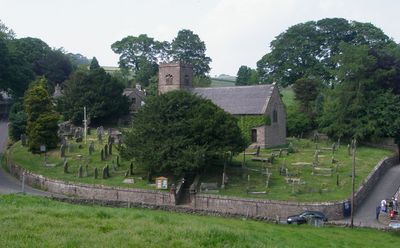
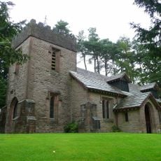
St Michael's Church, Wincle, Gothic Revival church in Wincle, England.
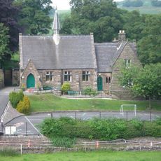
St Michael's Church is a Gothic Revival church with a three-stage tower built from coursed buff gritstone and topped with grey tile roofing. The tower features bell openings made from Kerridge stone, a material that gives the structure its distinctive appearance.
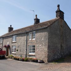
The church was built in 1882 on the site of an earlier structure from 1647. An original stone lintel from the older building remains embedded in the priest's door, creating a physical link between the two periods.
The interior reflects traditional Anglican worship through elements like an 1861 font, which visitors can see as they move through the space. The unadorned walls and simple design allow worshippers to focus on prayer and community gatherings.
The church is accessible during worship services within the Chester diocese and welcomes visitors interested in the building's architecture. Before visiting, it is worth checking current opening times to ensure the doors are open.
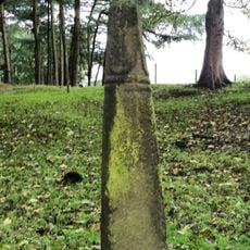
The churchyard holds the grave of a World War I soldier from the South Wales Borderers. This burial connects the quiet village to a broader historical moment and reminds visitors of the war's reach into local communities.
Location: Wincle
Inception: 1882
Architectural style: Gothic Revival
Website: http://wincle.org.uk/living_church.php
GPS coordinates: 53.19170,-2.06340
Latest update: December 14, 2025 16:45
Lud's Church
2.9 km
Shutlingsloe
3.9 km
Sutton Common BT Tower
3 km
Bosley Reservoir
3.6 km
Crag Hall
4 km
St Saviour's Church, Wildboarclough
3.8 km
Dane Bridge
1.1 km
Hug Bridge
3.7 km
Queen's Arms Inn
4 km
Eagle And Child
3.2 km
The Old Post Office
3.7 km
K6 Telephone Kiosk Outside The Old Post Office
3.6 km
School and former Schoolmaster's House
4 km
Road Bridge opposite east end of Reservoir Dam
3.3 km
Fern Lee Farmhouse
4 km
White Lee Farmhouse
1.7 km
Boundary Stone At Junction Of Wincle And Sutton Civil Parishes Ngr 9542 6786
1.9 km
Pott Lords Farmhouse
3.5 km
Wincle Church Of England Aided Primary School And Attached Schoolmaster's House
37 m
Cross Approximately 350 Metres North West Of Hall
1.7 km
Valve House in Reservoir Dam
3.4 km
Milepost, E of Berry Bank Farm access road
3.6 km
Milepost, W of Blaze Farm access road
2 km
Wayside cross 500m north of Sutton End Farm
3.2 km
Milepost, Hammerton Moss
990 m
Milepost, S of Hollinset Farm
2.5 km
Milepost, London Road; S of Queen's Arms PH
4 km
Milepost, Cluelow Cross
1.6 kmVisited this place? Tap the stars to rate it and share your experience / photos with the community! Try now! You can cancel it anytime.
Discover hidden gems everywhere you go!
From secret cafés to breathtaking viewpoints, skip the crowded tourist spots and find places that match your style. Our app makes it easy with voice search, smart filtering, route optimization, and insider tips from travelers worldwide. Download now for the complete mobile experience.
A unique approach to discovering new places❞
— Le Figaro
All the places worth exploring❞
— France Info
A tailor-made excursion in just a few clicks❞
— 20 Minutes