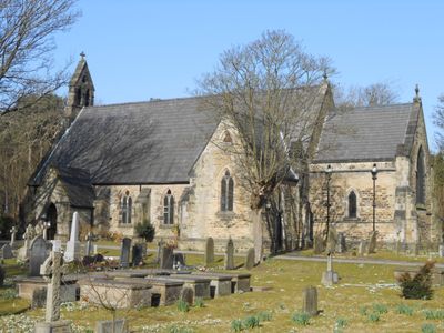
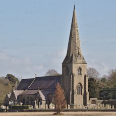
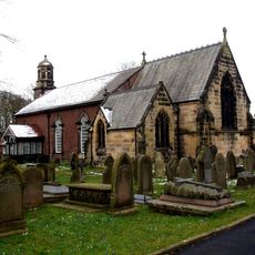
St Luke's Church, Formby, Gothic Revival church in Formby, England.
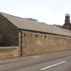
St Luke's Church is a Gothic Revival church in Formby featuring a five-bay nave, north and south transepts, a chancel, and a bellcote on the western gable. The building displays careful proportions and later received structural extensions to accommodate growing needs.
The original chapel was destroyed by a sandstorm in 1739 and rebuilt in 1854 in Gothic Revival style. The building received further extensions in 1897 to expand its capacity.
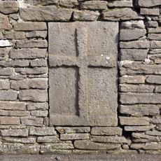
The church holds a Norman font with rope patterns and stained glass featuring medical inscriptions, reflecting how the local community blended religious faith with craftsmanship. These elements show the people's values through the objects they made and placed in this spiritual space.
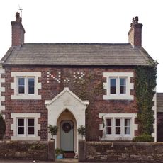
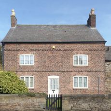
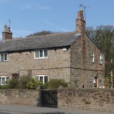
The church sits on St Luke's Church Road in Formby and is accessible to visitors. You can walk around the grounds and explore the building at your own pace.
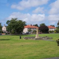
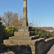
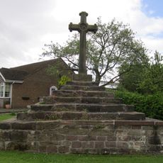
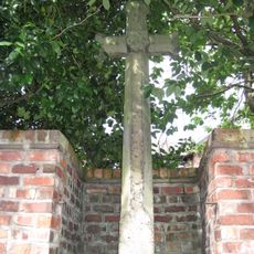
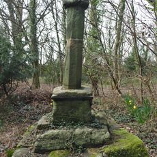
The churchyard holds the burial place of poet Percy French and contains an old cross base, village stocks, and gravestones dating back to 1666. This mix of a literary figure and historical remnants reveals layers of local life over centuries.
Location: Formby
Inception: 1897
Architects: Culshaw and Sumners
Architectural style: Gothic Revival
Website: http://stlukes.merseyside.org
GPS coordinates: 53.55210,-3.08730
Latest update: December 14, 2025 14:21
Ince Blundell Hall
5.9 km
Altcar Training Camp
3.2 km
Formby Hall
4.3 km
Sefton Coast
3.9 km
Crosby Hall, Merseyside
6.6 km
St Michael and All Angels Church, Altcar
3.9 km
St Mary's Church, Little Crosby
6.3 km
St Peter's Church, Formby
2.4 km
Formby Beach
1.6 km
Formby Red Squirrel Reserve
1.5 km
Village Farmhouse, Little Crosby
6.5 km
Presbytery and convent at St Mary's Church, Little Crosby
6.4 km
Ainsdale War Memorial
6.5 km
The Smithy, Little Crosby
6.7 km
Hightown War Memorial
3.5 km
18 & 20 Little Crosby Road
6.5 km
Well cross, Little Crosby
6.4 km
Model Farmhouse
6.6 km
Heatherlea Farmhouse and barn, Little Crosby
6.6 km
Standing cross on the village green, 30m south east of the junction of Carr House Lane and Lady Green Lane
5.1 km
Hightown Cross
3.7 km
Farm outbuilding south of Heatherlea Farmhouse
6.6 km
Cross in estate boundary wall of Crosby Hall
6.8 km
24 and 26, Little Crosby Road
6.5 km
Milestone, Church Road, nr jct with Davenham Road, by No. 49
2.2 km
Wayside cross 100m north of Liverpool Lodge, Little Crosby
6.8 km
Longton's Farmhouse
4.4 km
Milestone, Liverpool Road, 200m W of the roundabout
2.4 kmVisited this place? Tap the stars to rate it and share your experience / photos with the community! Try now! You can cancel it anytime.
Discover hidden gems everywhere you go!
From secret cafés to breathtaking viewpoints, skip the crowded tourist spots and find places that match your style. Our app makes it easy with voice search, smart filtering, route optimization, and insider tips from travelers worldwide. Download now for the complete mobile experience.
A unique approach to discovering new places❞
— Le Figaro
All the places worth exploring❞
— France Info
A tailor-made excursion in just a few clicks❞
— 20 Minutes