Sefton Coast, Protected coastal area in Merseyside, England
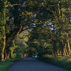
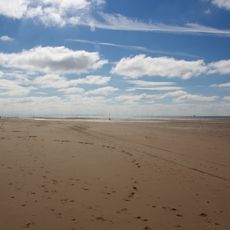
Sefton Coast is a protected coastal area stretching roughly 12 miles between Southport and Waterloo in Merseyside. The landscape combines sand dunes, evergreen woodlands, and tidal mudflats into a varied natural environment.
The site gained official protection status in 2000 due to its exceptional biological and geological qualities. This designation marked a turning point in ensuring the area's ecological features would be safeguarded for future generations.
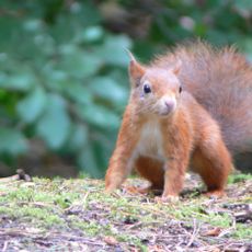
The coast serves as a refuge for animals struggling to survive elsewhere, including red squirrels that depend on the pine woodlands for food and shelter. Visitors walking through these woods develop an appreciation for how species adapt to sandy, windswept environments.
The area is accessible via designated walking trails, though certain zones remain restricted to protect sensitive habitats. Wear sturdy footwear as the ground is sandy and can be muddy in places, especially near the tidal areas.
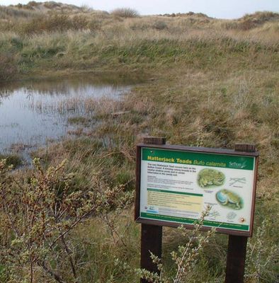
Male natterjack toads gather in spring pools among the dunes and produce distinctive calls heard locally as the Birkdale Nightingale. These loud mating calls happen mainly at night and remain a little-known natural event despite their remarkable volume.
GPS coordinates: 53.55200,-3.02900
Latest update: December 12, 2025 14:26
Scotch Piper Inn
4.9 km
Ince Blundell Hall
3.7 km
Altcar Training Camp
3.3 km
Formby Hall
3.2 km
Crosby Hall, Merseyside
5.1 km
St Michael and All Angels Church, Altcar
131 m
St Catherine's Chapel, Lydiate
4.8 km
Lydiate Hall
4.6 km
St Mary's Church, Little Crosby
4.9 km
St Luke's Church, Formby
3.9 km
St Thomas' Church, Lydiate
4.5 km
St Peter's Church, Formby
2.6 km
Formby Beach
4.7 km
Formby Red Squirrel Reserve
4.4 km
Presbytery and convent at St Mary's Church, Little Crosby
4.9 km
Downholland Hall
4.2 km
Hightown War Memorial
3.6 km
18 & 20 Little Crosby Road
5.2 km
Standing cross on the village green, 30m south east of the junction of Carr House Lane and Lady Green Lane
3.1 km
Well cross, Little Crosby
5.2 km
Hightown Cross
3.5 km
Leeds And Liverpool Canal Milestone Approximately 350 Metres South Of Haskayne Bridge
4.2 km
24 and 26, Little Crosby Road
5.2 km
Longton's Farmhouse
582 m
Milestone, Church Road, nr jct with Davenham Road, by No. 49
2 km
Leeds And Liverpool Canal Milestone Approximately 650 Metres North Of Rimmer's Bridge
5 km
Milestone, Liverpool Road, 200m W of the roundabout
1.8 km
Milestone, Lady Green, Tristram's Farm
2.9 kmVisited this place? Tap the stars to rate it and share your experience / photos with the community! Try now! You can cancel it anytime.
Discover hidden gems everywhere you go!
From secret cafés to breathtaking viewpoints, skip the crowded tourist spots and find places that match your style. Our app makes it easy with voice search, smart filtering, route optimization, and insider tips from travelers worldwide. Download now for the complete mobile experience.
A unique approach to discovering new places❞
— Le Figaro
All the places worth exploring❞
— France Info
A tailor-made excursion in just a few clicks❞
— 20 Minutes