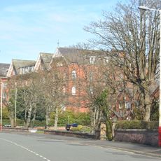
Formby Hall, Grade II* listed manor house in Formby, England
Formby Hall is a Grade II* listed manor house featuring Tudor brick gables alongside Georgian columns and decorative gardens. The building sits within woodland settings and serves as the centerpiece of a larger estate complex.
William Formby commissioned the building in 1523, though the Formby family had occupied the site since the 12th century. Later owners modified the structure, adding Georgian features that remain visible today.
The hall reflects how different owners shaped its appearance over the centuries, blending styles from different periods into a single building. Visitors walking through it can see how tastes and fashions changed across generations.
The estate features an 18-hole championship golf course, spa facilities, and multiple dining venues serving traditional English cuisine. The grounds are extensive, so visitors should wear suitable footwear and allow ample time to explore the property.
During World War II, the hall housed approximately 150 soldiers, then served as temporary housing for children from Liverpool in the 1970s. These two distinct periods show how the building responded to changing local needs over time.
Location: Formby
GPS coordinates: 53.58000,-3.04200
Latest update: December 12, 2025 09:03
Altcar Training Camp
5.8 km
Smedley Hydro
5.8 km
Sefton Coast
3.2 km
St Cuthbert's Church, Halsall
6 km
St Michael and All Angels Church, Altcar
3.4 km
St Luke's Church, Formby
4.3 km
Church of St Teresa of Avila, Birkdale
6.4 km
St Peter's Church, Formby
1.9 km
St John's Church, Birkdale
5.1 km
St Peter's Church, Birkdale
6.2 km
Formby Beach
4 km
Formby Red Squirrel Reserve
3.7 km
Halsall War Memorial
5.9 km
Ainsdale War Memorial
2.5 km
Hill Bridge (Number 24) Leeds And Liverpool Canal Hill Bridge (Number 24)
6 km
Harkers Bridge (Number 23) Leeds And Liverpool Canal Harkers Bridge (Number 23)
5.7 km
Downholland Hall
5.6 km
Sundial Approximately 10 Metres South Of Church Of St Cuthbert
6 km
Birkdale Signal Box
6.3 km
Hightown Cross
6.2 km
Standing cross on the village green, 30m south east of the junction of Carr House Lane and Lady Green Lane
6.3 km
Hightown War Memorial
6.2 km
Old Font Approximately 1 Metre South East Of Church Of St Cuthbert
6 km
Leeds And Liverpool Canal Milestone Approximately 350 Metres South Of Haskayne Bridge
5.3 km
Milestone, Church Road, nr jct with Davenham Road, by No. 49
2.6 km
Leeds And Liverpool Canal Milestone Approximately 200 Metres North Of Harker's Bridge
5.8 km
Longton's Farmhouse
3.7 km
Milestone, Liverpool Road, 200m W of the roundabout
3.9 kmVisited this place? Tap the stars to rate it and share your experience / photos with the community! Try now! You can cancel it anytime.
Discover hidden gems everywhere you go!
From secret cafés to breathtaking viewpoints, skip the crowded tourist spots and find places that match your style. Our app makes it easy with voice search, smart filtering, route optimization, and insider tips from travelers worldwide. Download now for the complete mobile experience.
A unique approach to discovering new places❞
— Le Figaro
All the places worth exploring❞
— France Info
A tailor-made excursion in just a few clicks❞
— 20 Minutes