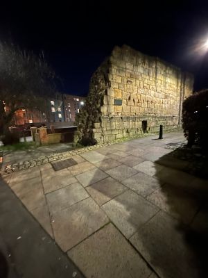
Newcastle upon Tyne town defences: section of curtain wall and town ditch between Forth Street and Hanover Street, city walls in Newcastle upon Tyne, England, UK
This section of medieval town defenses consists of stone fortifications that stretched between two modern streets in the city center. The walls were originally part of a larger defense line that included a ditch system designed to stop attackers from reaching the town.
Newcastle received permission to build these defenses in 1265, marking a key moment when the town gained the right to protect itself. The protective ditch was completed in 1316 and worked together with the walls to create a strong barrier against threats from outside.
The fortifications show Newcastle's role as an important trading town and regional power center in medieval times. Their existence reflects the confidence of a wealthy community that could afford to protect itself and its goods.
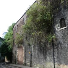
You can explore this section on foot and view the walls from the street, making it easily accessible to anyone interested. The area is active with shops and cafes nearby, so you can easily combine a visit with other activities in the city center.
Excavations uncovered stonemasons' marks showing how medieval craftsmen identified their work, along with debris from the 17th century. These findings reveal that people lived and disposed of waste at this site for many generations.
The community of curious travelers
AroundUs brings together thousands of curated places, local tips, and hidden gems, enriched daily by 60,000 contributors worldwide.