Chest opened
+${chestReward.xp} XP
Explorer
NOUVEAU ×${chestReward.collectible.quantity}
tapez pour fermer
Chest locked

Open chests in the app

Around Us is built for your phone — chests unlock when you walk, explore and capture nearby places.

Enable Location

We need your location to show you interesting places around you

Discover nearby places

Find interesting locations and hidden gems around you

Precise directions

Get accurate directions and distances to places

Your location is never shared with other users. It's only used when you tap the location button.

Log in to your account

Start exploring — it's free

Trusted by 72,877 travelers worldwide

Continue with Google
Continue with Apple
or

We will send you a code to connect

By continuing, you accept our Terms and Conditions and our Privacy Policy

Check your inbox

We've sent a pincode in your inbox. Please enter the code below.

Lowbridge Estate
Discussion Reviews Photo
1.9k Popularity

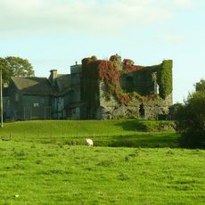
Lowbridge Estate, Georgian estate in Lake District National Park, England

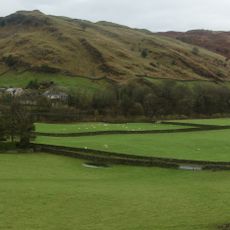
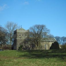
Lowbridge Estate is a country property in Cumbria that spans approximately 2000 acres. The main house contains seven bedrooms and shares the land with several secondary buildings including Lowbridge Cottage, Lowbridge Lodge, and Bridge House.

The property was built in 1761 for the Fothergill family, who owned and managed it for more than 250 years. This lengthy tenure shaped how the estate developed and was maintained over generations.

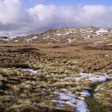
The estate has deep roots in local hunting traditions and maintains a managed red deer population following North Lakes Red Deer Group guidelines. Visitors can observe how the land supports this ongoing practice.

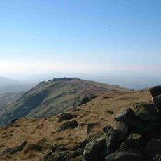
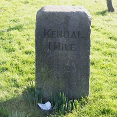
The property sits roughly 10 kilometers north of Kendal and is accessible by local roads. Visitors should arrange access beforehand since it remains a private estate in a rural setting.

The main house ranks among the largest privately managed residences in the region and operates independently from organizations like the National Trust. This independence makes it a notable example of how historic properties can remain under private stewardship.

The community of curious travelers

AroundUs brings together thousands of curated places, local tips, and hidden gems, enriched daily by 60,000 contributors worldwide.

Start exploring
Location
GPS coordinates
54.40311,-2.71419
Latest update
December 14, 2025 11:02
Around this place
Kendal Museum
United Kingdom

Kendal Museum

8.2 km
Potter Fell
United Kingdom

Potter Fell

4.1 km
Burneside Hall
United Kingdom

Burneside Hall

5.9 km
County Offices
United Kingdom

County Offices

8.2 km
Grey Crag
United Kingdom

Grey Crag

7.3 km
Shipman Knotts
United Kingdom

Shipman Knotts

8.2 km
Reston Scar
United Kingdom

Reston Scar

8 km
The Castle Dairy
United Kingdom

The Castle Dairy

8.2 km
Church of St James
United Kingdom

Church of St James

7.2 km
Hugill Fell
United Kingdom

Hugill Fell

7.6 km
Church of St John
United Kingdom

Church of St John

5.7 km
Tower of ruined chapel of St Margaret
United Kingdom

Tower of ruined chapel of St Margaret

7.2 km
Church of St Thomas
United Kingdom

Church of St Thomas

1.9 km
Elba Monument
United Kingdom

Elba Monument

7.2 km
St Oswald's Church
United Kingdom

St Oswald's Church

6.3 km
St John the Baptist's Church
United Kingdom

St John the Baptist's Church

5.7 km
Milestone On Loop Road 50 Yards South Of Junction Of Hollins Lane And Windermere
United Kingdom

Milestone On Loop Road 50 Yards South Of Junction Of Hollins Lane And Windermere

7.2 km
Milestone Approximately 40M From A685
United Kingdom

Milestone Approximately 40M From A685

7.9 km
Docker Viaduct
United Kingdom

Docker Viaduct

6.1 km
Milepost To West Of North Gateside
United Kingdom

Milepost To West Of North Gateside

1.8 km
Staveley War Memorial, Cumbria
United Kingdom

Staveley War Memorial, Cumbria

7.2 km
Milepost Opposite Memorial Hall
United Kingdom

Milepost Opposite Memorial Hall

600 m
Milestone 10 Metres East Of Junction Of Crook Road And Ratherheath Lane
United Kingdom

Milestone 10 Metres East Of Junction Of Crook Road And Ratherheath Lane

8.3 km
Gateway To South Of Tolson Hall And Attached Walls
United Kingdom

Gateway To South Of Tolson Hall And Attached Walls

6.9 km
Marker Stone On East Side Of Old Turnpike Road To South Of Shap (At Ngr 553 069)
United Kingdom

Marker Stone On East Side Of Old Turnpike Road To South Of Shap (At Ngr 553 069)

6 km
Milestone In Layby To Left Of A591 200 Metres North Of Ratherheath Lane
United Kingdom

Milestone In Layby To Left Of A591 200 Metres North Of Ratherheath Lane

7 km
Milestone, Plumgarth roundabout; opp.  'Cunswick End'
United Kingdom

Milestone, Plumgarth roundabout; opp. 'Cunswick End'

7.7 km
Milestone, Windermere Road, at top of hill out of Kendall, by Airey's Folly
United Kingdom

Milestone, Windermere Road, at top of hill out of Kendall, by Airey's Folly

7.9 km
Show the full map
Reviews
Share your experience

No review yet

Discussions
Start a discussion...

No discussion yet

« Lowbridge Estate - Georgian estate in Lake District National Park, England » is provided by Around Us (aroundus.com). Images and texts are derived from Wikimedia project under a Creative Commons license. You are allowed to copy, distribute, and modify copies of this page, under the conditions set by the license, as long as this note is clearly visible.

Discover hidden gems everywhere you go!

From secret cafés to breathtaking viewpoints, skip the crowded tourist spots and find places that match your style. Our app makes it easy with voice search, smart filtering, route optimization, and insider tips from travelers worldwide. Download now for the complete mobile experience.

Around Us App Screenshot

A unique approach to discovering new places

Le Figaro

All the places worth exploring

France Info

A tailor-made excursion in just a few clicks

20 Minutes

Around Us
Travel Guide & Maps
Download

Send to your phone

QR Code
1

Open the camera app on your mobile.

2

Point at the QR code with your camera. A notification will appear.

3

Tap the notification to open the link.