Enable Location

We need your location to show you interesting places around you

Discover nearby places

Find interesting locations and hidden gems around you

Precise directions

Get accurate directions and distances to places

Your location is never shared with other users. It's only used when you tap the location button.

Springfield

Log in to your account

Start exploring — it's free

Trusted by 62,401 travelers worldwide

Continue with Google
Continue with Apple
or

We will send you a code to connect

By continuing, you accept our Terms and Conditions and our Privacy Policy

Check your inbox

We've sent a pincode in your inbox. Please enter the code below.

Springfield, Industrial town in Windsor County, Vermont.

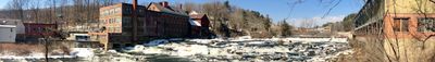
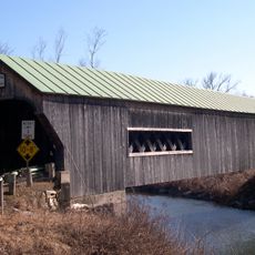
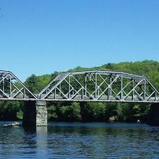
Springfield sits in Windsor County, Vermont and is crossed by the Black River, which drops dramatically over a short distance creating waterfalls. This water power shaped the town's early economy and character.

The town was founded in 1761 and later developed into an industrial center when major machinery manufacturing arrived. This shift toward production drew workers and shaped the community's growth for generations.

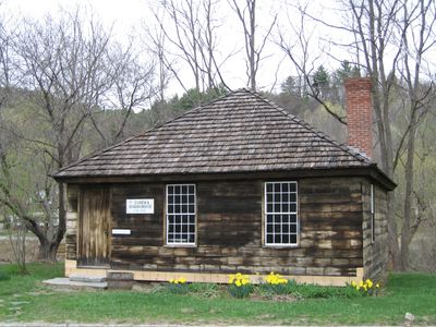
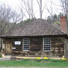
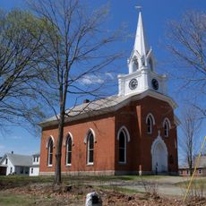
The Eureka Schoolhouse from 1790 remains visible in town as a symbol of early education in the state. Its presence reflects how much the community valued schooling from the beginning.

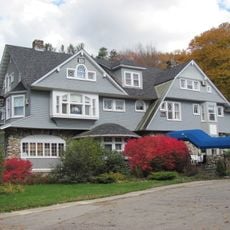
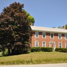
The town is compact and easy to navigate on foot, with schools and a hospital serving the community. Visitors will find a small-town setting with practical services and a relaxed pace.

A group of amateur telescope makers formed here in the 1920s, pioneering the craft of building telescopes outside professional workshops. This local hobby community became known across the region for their skill and innovation.

The community of curious travelers

AroundUs brings together thousands of curated places, local tips, and hidden gems, enriched daily by 60,000 contributors worldwide.

Start exploring
Location
Inception
1761
Elevation above the sea
162 m
Shares border with
Weathersfield
GPS coordinates
43.29722,-72.48333
Latest update
December 20, 2025 11:20
Around this place
Fort at Number 4
United States of America

Fort at Number 4

6.3 km
Stellafane Observatory
United States of America

Stellafane Observatory

3.6 km
Bartonsville Covered Bridge
United States of America

Bartonsville Covered Bridge

9.2 km
Cheshire Bridge
United States of America

Cheshire Bridge

6.1 km
Hartness House
United States of America

Hartness House

662 m
Eureka Schoolhouse
United States of America

Eureka Schoolhouse

3.9 km
United States of America

Mount Ephraim

5.7 km
United States of America

Park Street School

268 m
Parker Hill Rural Historic District
United States of America

Parker Hill Rural Historic District

8.2 km
United States of America

Baltimore Covered Bridge

4.1 km
Charlestown Town Hall
United States of America

Charlestown Town Hall

9.5 km
Gould's Mill Bridge
United States of America

Gould's Mill Bridge

3.6 km
Southview Housing Historic District
United States of America

Southview Housing Historic District

1.5 km
Charlestown Main Street Historic District
United States of America

Charlestown Main Street Historic District

8.3 km
Farwell School
United States of America

Farwell School

7.8 km
North Charlestown Historic District
United States of America

North Charlestown Historic District

7.9 km
Spencer Hollow School
United States of America

Spencer Hollow School

4.2 km
Gen. Lewis R. Morris House
United States of America

Gen. Lewis R. Morris House

6 km
Lockwood-Boynton House
United States of America

Lockwood-Boynton House

5.3 km
Augustus and Laura Blaisdell House
United States of America

Augustus and Laura Blaisdell House

9.3 km
Springfield Downtown Historic District
United States of America

Springfield Downtown Historic District

447 m
United States of America

Skitchewaug State Wildlife Management Area

4.9 km
United States of America

Crown Point Golf Course

4.9 km
United States of America

Titcomb Covered Bridge

8.3 km
United States of America

Smith's clothespin

254 m
United States of America

Work of art, sculpture

1.9 km
United States of America

Scenic viewpoint

4.1 km
United States of America

Scenic viewpoint

287 m
Show the full map
« Springfield - Industrial town in Windsor County, Vermont » is provided by Around Us (aroundus.com). Images and texts are derived from Wikimedia project under a Creative Commons license. You are allowed to copy, distribute, and modify copies of this page, under the conditions set by the license, as long as this note is clearly visible.

Discover hidden gems everywhere you go!

From secret cafés to breathtaking viewpoints, skip the crowded tourist spots and find places that match your style. Our app makes it easy with voice search, smart filtering, route optimization, and insider tips from travelers worldwide. Download now for the complete mobile experience.

Around Us App Screenshot

A unique approach to discovering new places

Le Figaro

All the places worth exploring

France Info

A tailor-made excursion in just a few clicks

20 Minutes

Around Us
Travel Guide & Maps
Download

Send to your phone

QR Code
1

Open the camera app on your mobile.

2

Point at the QR code with your camera. A notification will appear.

3

Tap the notification to open the link.