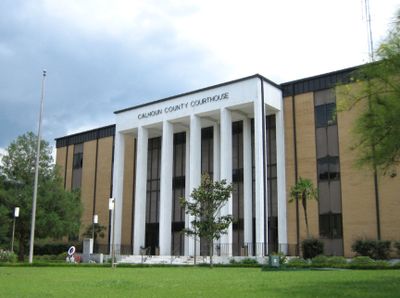
Calhoun County, County administrative division in Florida Panhandle, United States
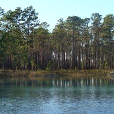
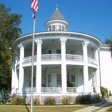
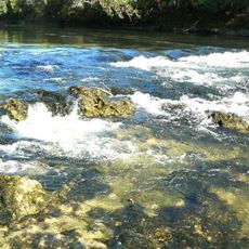
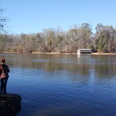
Calhoun County is an administrative region in Northwest Florida with the Chipola River flowing through its eastern portion and extensive forests throughout. The county spreads across 574 square miles of land with Blountstown serving as its seat.
The area was established in 1838 and named after South Carolina Senator John C. Calhoun. The original administrative center of St. Joseph no longer exists and was later replaced by Blountstown.
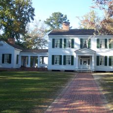
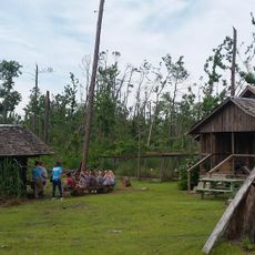
The Panhandle Pioneer Settlement displays daily life from earlier times through 18 historical buildings where visitors can see how people once worked and lived. The preserved rooms and objects tell the story of early settler habits in this region.
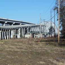
The region connects to neighboring areas through Florida State Roads 20 and 71, with Blountstown as the central hub. The nearest interstate access is located in adjacent counties.
The M&B Railroad Memorial Park houses a historic Baldwin locomotive Type 4-6-0 from 1911 that recalls the railway serving the region until 1972. The locomotive stands as a rare reminder of this important transportation link.
Location: Florida
Inception: January 26, 1838
Capital city: Blountstown
Reference: 12-013
Shares border with: Jackson County, Gadsden County, Liberty County, Gulf County, Bay County
Website: http://calhouncountyfl.org
GPS coordinates: 30.41000,-85.20000
Latest update: December 23, 2025 21:26
Apalachicola National Forest
46.1 km
Torreya State Park
29.9 kmDead Lakes State Recreation Area
30.1 kmThree Rivers State Park
44.6 kmYon Mound and Village Site
17.8 kmCayson Mound and Village Site
16.9 km
Trammell Bridge
19.3 km
Joseph W. Russ Jr. House
41 km
Look and Tremble
13.3 km
Marianna Historic District
41 km
St. Luke Baptist Church
40.5 km
Jackson County Courthouse
40.5 km
Old Gulf County Courthouse
32.8 km
Old Calhoun County Courthouse
15.5 km
Ely-Criglar House
40.9 km
Theophilus West House
41.1 kmOtis Hare Archeological Site
18.2 km
Torreya State Park
29 km
Robert Lee Norton House
35.9 km
Panhandle Pioneer Settlement
13.3 kmApalachicola River Water Management Area
32.6 kmCoconut Bluff
15.4 kmAlum Bluff
21.6 kmFrozen Bluff
16.6 kmRicko Bluff
21.9 kmKent Mill Lake
36 kmMerritts Mill Pond
41.2 kmScenic viewpoint
32.2 kmVisited this place? Tap the stars to rate it and share your experience / photos with the community! Try now! You can cancel it anytime.
Discover hidden gems everywhere you go!
From secret cafés to breathtaking viewpoints, skip the crowded tourist spots and find places that match your style. Our app makes it easy with voice search, smart filtering, route optimization, and insider tips from travelers worldwide. Download now for the complete mobile experience.
A unique approach to discovering new places❞
— Le Figaro
All the places worth exploring❞
— France Info
A tailor-made excursion in just a few clicks❞
— 20 Minutes