Graham County

Log in to your account

AroundUs is a community-driven map of interesting places, built by curious explorers like you. It grows with every review, story, and photo you share.
Connect to save your favorite spots, contribute locations, and create personalized routes.
Continue with Google
Continue with Apple
Continue with X
Continue with Facebook
Continue with email
By continuing, you accept our Terms and Conditions and our Privacy Policy
Create an account
Add to collection
Map
Suggest a change
Share

Graham County, Administrative county in Kansas, United States

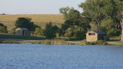
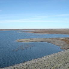
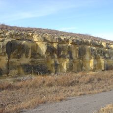
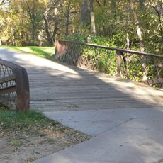
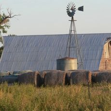
Graham County is an administrative area in northwestern Kansas with Hill City as its governmental center. The territory consists of prairie landscape and farmland crossed by several waterways.

The area was named after Captain John Graham, who died in the Battle of Chickamauga in 1863. The region later developed as farmland during the settlement of the American West.

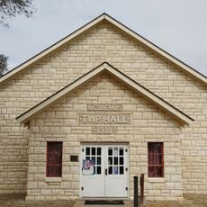
Nicodemus, located within this county, stands as one of the few remaining settlements founded by African Americans during the post-Civil War era. The community continues to shape how residents understand their region's past and identity.

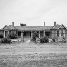
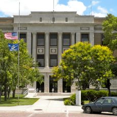
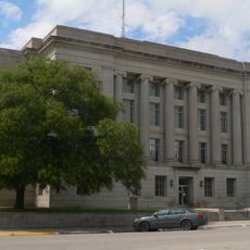
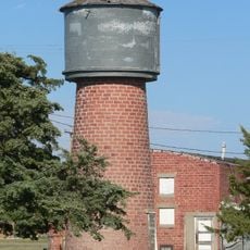
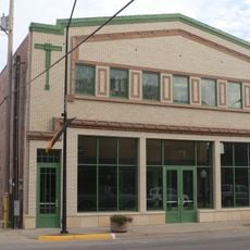
Hill City is the central location with the County Courthouse where administrative services and public offices are available. The flat terrain makes navigation straightforward and provides easy access to communities throughout the area.

The Solomon River and Saline River flow through this territory, creating the water landscape that shapes the region. These waterways were strategically important to early settlers and served as natural reference points.

Location: Kansas

Inception: February 26, 1867

Capital city: Hill City

Shares border with: Norton County, Trego County, Phillips County, Rooks County, Gove County, Sheridan County

Website: http://GrahamCountyKS.com

GPS coordinates: 39.35000,-99.88330

Latest update: December 10, 2025 16:02

Photos
Around this place
Cedar Bluff Reservoir
United States of America

Cedar Bluff Reservoir

63.4 km
Cedar Bluff State Park
United States of America

Cedar Bluff State Park

64.8 km
Cottonwood Ranch
United States of America

Cottonwood Ranch

25 km
Norton County meteorite
United States of America

Norton County meteorite

37.1 km
Lewis Field
United States of America

Lewis Field

71.5 km
Prairie Dog State Park
United States of America

Prairie Dog State Park

51.2 km
St. Joseph Catholic Church
United States of America

St. Joseph Catholic Church

25.8 km
Grainfield Opera House
United States of America

Grainfield Opera House

56.7 km
St. Joseph's Church and Parochial School
United States of America

St. Joseph's Church and Parochial School

71.2 km
Norton Downtown Historic District
United States of America

Norton Downtown Historic District

53.3 km
Shafer Barn
United States of America

Shafer Barn

35.4 km
Rooks County Courthouse
United States of America

Rooks County Courthouse

53.3 km
Lipp Barn
United States of America

Lipp Barn

41.3 km
Barbeau House
United States of America

Barbeau House

30.7 km
Justus Bissing Jr. Historic District
United States of America

Justus Bissing Jr. Historic District

70.8 km
Ellis Congregational Church
United States of America

Ellis Congregational Church

53.4 km
Norcatur City Hall
United States of America

Norcatur City Hall

60.3 km
Oxley Barn
United States of America

Oxley Barn

41.9 km
North Fork Solomon River Lattice Truss Bridge
United States of America

North Fork Solomon River Lattice Truss Bridge

52.1 km
Harry Keith Barn
United States of America

Harry Keith Barn

8.8 km
Pottawatomie County Fair Pavilion
United States of America

Pottawatomie County Fair Pavilion

64.7 km
Collyer Downtown Historic District
United States of America

Collyer Downtown Historic District

40.1 km
Nicodemus National Historic Site
United States of America

Nicodemus National Historic Site

23.5 km
Kirwin National Wildlife Refuge
United States of America

Kirwin National Wildlife Refuge

68.3 km
Fox Pavilion
United States of America

Fox Pavilion

71.5 km
Strand Theatre
United States of America

Strand Theatre

71.5 km
Chestnut Street Historic District
United States of America

Chestnut Street Historic District

53.8 km
Castle Rock Badlands
United States of America

Castle Rock Badlands

60.1 km
Show the full map
Reviews

Visited this place? Tap the stars to rate it and share your experience / photos with the community! Try now! You can cancel it anytime.

Administrative divisions
« Graham County - Administrative county in Kansas, United States » is provided by Around Us (aroundus.com). Images and texts are derived from Wikimedia project under a Creative Commons license. You are allowed to copy, distribute, and modify copies of this page, under the conditions set by the license, as long as this note is clearly visible.

Discover hidden gems everywhere you go!

From secret cafés to breathtaking viewpoints, skip the crowded tourist spots and find places that match your style. Our app makes it easy with voice search, smart filtering, route optimization, and insider tips from travelers worldwide. Download now for the complete mobile experience.

Around Us App Screenshot

A unique approach to discovering new places

Le Figaro

All the places worth exploring

France Info

A tailor-made excursion in just a few clicks

20 Minutes