Cedar Bluff State Park, State park with reservoir in Ellis County and Trego County, United States
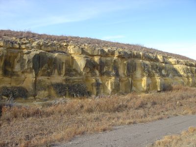
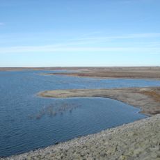
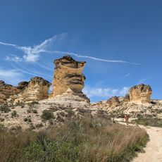
Cedar Bluff State Park spans 850 acres along Cedar Bluff Reservoir and features dramatic limestone cliffs rising about 100 feet (30 m) above the water. The rocky shoreline creates a distinctive landscape where water meets stone formations.
The area became important after Cedar Bluff Reservoir was completed in 1951 for flood control and irrigation purposes. Park development began in 1962, opening the grounds to the public for recreation.
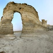
Threshing Machine Canyon displays limestone carvings left by travelers who passed through this region over time. The engravings tell the story of people moving across the land and marking their journey in stone.
The Bluffton Area has 96 utility campsites, rental cabins, and recreational facilities spread across the grounds. Two boat ramps and a covered fishing dock make water access straightforward for various activities.
Early settlers misnamed the area Cedar Bluff after mistaking the juniper trees on the rocks for cedar trees. This mix-up from long ago remains part of the place's identity today.
The community of curious travelers
AroundUs brings together thousands of curated places, local tips, and hidden gems, enriched daily by 60,000 contributors worldwide.