Enable Location

We need your location to show you interesting places around you

Discover nearby places

Find interesting locations and hidden gems around you

Precise directions

Get accurate directions and distances to places

Your location is never shared with other users. It's only used when you tap the location button.

Greenwood County

Log in to your account

Start exploring — it's free

Trusted by 61,508 travelers worldwide

Continue with Google
Continue with Apple
or

We will send you a code to connect

By continuing, you accept our Terms and Conditions and our Privacy Policy

Check your inbox

We've sent a pincode in your inbox. Please enter the code below.

Greenwood County, County region in Kansas, United States.

Description

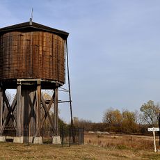
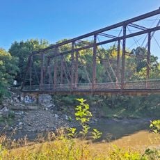
Greenwood County is an administrative division in southeastern Kansas with rolling hills and grassland terrain. The region includes several public recreational areas that provide space for outdoor activities.

History

The county was established in 1855 and named after Alfred Greenwood, a U.S. congressman from Arkansas. His support for Kansas statehood influenced the choice of name.

Culture

The county is shaped by farming families who have lived here for generations and share their traditions through local gatherings, especially around harvest time. These practices define the rhythm of community life today.

Practical

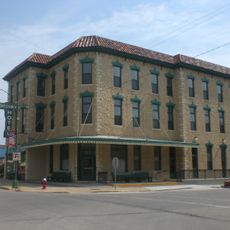
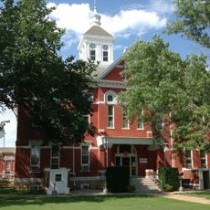
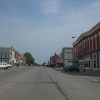
The county courthouse in Eureka is open on weekdays from 8 AM to 5 PM for administrative services. Visitors should note that official services are available during standard business hours.

Did you know?

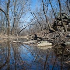
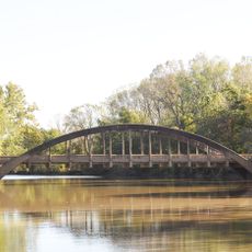
The county contains several water bodies that make it a regional center for fishing and water activities. These areas allow visitors to enjoy recreation directly in natural settings.

Location
Inception
August 25, 1855
Capital city
Eureka
Shares border with
Lyon County, Elk County, Coffey County, Woodson County, Wilson County, Butler County, Chase County
GPS coordinates
37.86670,-96.26670
Latest update
December 10, 2025 15:57

AroundUs brings together thousands of curated places, local tips, and hidden gems, enriched daily by 60,000 contributors worldwide. Discover all places nearby (Kansas).

Around this place
El Dorado Lake
United States of America

El Dorado Lake

48.9 km
El Dorado State Park
United States of America

El Dorado State Park

44.4 km
Cross Timbers State Park
United States of America

Cross Timbers State Park

30.8 km
Emporia Granada Theatre
United States of America

Emporia Granada Theatre

60.7 km
William Allen White House
United States of America

William Allen White House

60.9 km
Beaumont St. Louis and San Francisco Railroad Water Tank
United States of America

Beaumont St. Louis and San Francisco Railroad Water Tank

33.2 km
Greenwood Hotel
United States of America

Greenwood Hotel

5.6 km
Gold Dust Hotel
United States of America

Gold Dust Hotel

53.7 km
Robertson House
United States of America

Robertson House

5.1 km
Neosho River Bridge
United States of America

Neosho River Bridge

56.6 km
Burlington Carnegie Free Library
United States of America

Burlington Carnegie Free Library

59.1 km
Butler County Courthouse
United States of America

Butler County Courthouse

51.7 km
Burlington Opry
United States of America

Burlington Opry

59 km
Woodson County Courthouse
United States of America

Woodson County Courthouse

46.9 km
Crocker Ranch
United States of America

Crocker Ranch

43.9 km
El Dorado Carnegie Library
United States of America

El Dorado Carnegie Library

51.8 km
Elk Falls Pratt Truss Bridge
United States of America

Elk Falls Pratt Truss Bridge

55.3 km
Eureka Carnegie Library
United States of America

Eureka Carnegie Library

5.3 km
St. Andrew's Episcopal Church
United States of America

St. Andrew's Episcopal Church

60.8 km
Walt Mason House
United States of America

Walt Mason House

61.1 km
Yates Center Courthouse Square Historic District
United States of America

Yates Center Courthouse Square Historic District

46.7 km
Yates Center Carnegie Library
United States of America

Yates Center Carnegie Library

47.1 km
Brush Creek Bridge
United States of America

Brush Creek Bridge

38.7 km
Harris-Borman House
United States of America

Harris-Borman House

60.9 km
Richard Howe House
United States of America

Richard Howe House

59 km
Teter Rock
United States of America

Teter Rock

22.8 km
Soden's Grove Bridge
United States of America

Soden's Grove Bridge

58.3 km
Rocky Ford Bridge
United States of America

Rocky Ford Bridge

57.1 km
Show the full map
Administrative divisions
« Greenwood County - County region in Kansas, United States » is provided by Around Us (aroundus.com). Images and texts are derived from Wikimedia project under a Creative Commons license. You are allowed to copy, distribute, and modify copies of this page, under the conditions set by the license, as long as this note is clearly visible.

Discover hidden gems everywhere you go!

From secret cafés to breathtaking viewpoints, skip the crowded tourist spots and find places that match your style. Our app makes it easy with voice search, smart filtering, route optimization, and insider tips from travelers worldwide. Download now for the complete mobile experience.

Around Us App Screenshot

A unique approach to discovering new places

Le Figaro

All the places worth exploring

France Info

A tailor-made excursion in just a few clicks

20 Minutes

Around Us
Travel Guide & Maps
Download

Send to your phone

QR Code
1

Open the camera app on your mobile.

2

Point at the QR code with your camera. A notification will appear.

3

Tap the notification to open the link.