Enable Location

We need your location to show you interesting places around you

Discover nearby places

Find interesting locations and hidden gems around you

Precise directions

Get accurate directions and distances to places

Your location is never shared with other users. It's only used when you tap the location button.

Monroe County

Log in to your account

Start exploring — it's free

Trusted by 62,172 travelers worldwide

Continue with Google
Continue with Apple
or

We will send you a code to connect

By continuing, you accept our Terms and Conditions and our Privacy Policy

Check your inbox

We've sent a pincode in your inbox. Please enter the code below.

Monroe County, Administrative division in southwestern Illinois, United States.

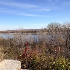
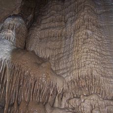
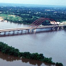
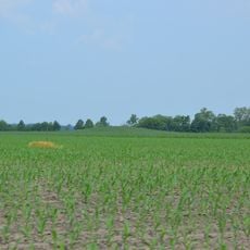
Monroe County occupies southwestern Illinois and features a landscape of limestone bluffs, caves, and natural springs. The terrain stretches across the Mississippi River floodplain with numerous sinkholes dotting the ground.

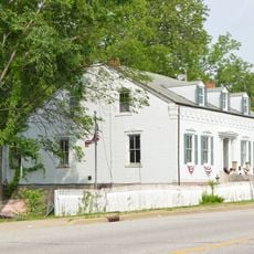
The county was established in 1816 and named after James Monroe, the fifth president. It grew from earlier French settlements that had been built in the early 1700s.

The area reflects German and Irish roots through local customs and celebrations held across its towns. These influences shape how people here mark important occasions and gather as communities.

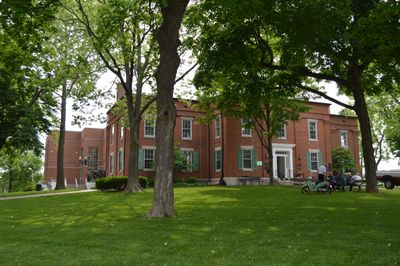
The county seat of Waterloo serves as the main hub for services and is connected by Interstate 255 and Highway 50. These routes provide direct access to the St. Louis area for residents and visitors.

The area contains roughly 500 limestone sinkholes that create a distinctive karst landscape uncommon in Illinois. This geological pattern shapes the ground beneath visitors' feet in unexpected ways.

The community of curious travelers

AroundUs brings together thousands of curated places, local tips, and hidden gems, enriched daily by 60,000 contributors worldwide.

Start exploring
Location
Inception
January 6, 1816
Capital city
Waterloo
Shares border with
St. Clair County, Ste. Genevieve County, Randolph County, Jefferson County, St. Louis County
GPS coordinates
38.28000,-90.18000
Latest update
December 7, 2025 19:24
Around this place
Jefferson Barracks Military Post
United States of America

Jefferson Barracks Military Post

25.5 km
Jefferson Barracks National Cemetery
United States of America

Jefferson Barracks National Cemetery

26.2 km
Cliff Cave County Park
United States of America

Cliff Cave County Park

22.4 km
Illinois Caverns State Natural Area
United States of America

Illinois Caverns State Natural Area

6.2 km
Jefferson Barracks Bridge
United States of America

Jefferson Barracks Bridge

24.6 km
Cathedral of Saint Peter
United States of America

Cathedral of Saint Peter

30.6 km
Kolmer Site
United States of America

Kolmer Site

21 km
Lunsford-Pulcher Archeological Site
United States of America

Lunsford-Pulcher Archeological Site

24.3 km
Koch, Missouri
United States of America

Koch, Missouri

24.3 km
United States of America

William and Florence Schmidt Art Center

34.7 km
Gov. Daniel Dunklin's Grave State Historic Site
United States of America

Gov. Daniel Dunklin's Grave State Historic Site

17.3 km
Gustave Koerner House
United States of America

Gustave Koerner House

31.4 km
Fountain Creek Bridge
United States of America

Fountain Creek Bridge

5.3 km
Belleville Historic District
United States of America

Belleville Historic District

31.4 km
United States of America

St. Clair County Courthouse

31 km
Gustave Greystone-Meissner House
United States of America

Gustave Greystone-Meissner House

17.7 km
Windsor Harbor Road Bridge
United States of America

Windsor Harbor Road Bridge

18.5 km
Waterloo Historic District
United States of America

Waterloo Historic District

6.6 km
Gundlach-Grosse House
United States of America

Gundlach-Grosse House

18.8 km
Kimmswick Historic District
United States of America

Kimmswick Historic District

18.8 km
Red Bud Historic District
United States of America

Red Bud Historic District

18.1 km
Turkey Hill Grange Hall
United States of America

Turkey Hill Grange Hall

30.4 km
Hotel Belleville
United States of America

Hotel Belleville

31.1 km
West Park Bowl
United States of America

West Park Bowl

18.5 km
Dupo Park Splash Pad
United States of America

Dupo Park Splash Pad

26.4 km
Jefferson Barracks
United States of America

Jefferson Barracks

26.4 km
Kidd Lake State Natural Area
United States of America

Kidd Lake State Natural Area

15.1 km
Lincoln Theatre
United States of America

Lincoln Theatre

31.2 km
Show the full map
« Monroe County - Administrative division in southwestern Illinois, United States » is provided by Around Us (aroundus.com). Images and texts are derived from Wikimedia project under a Creative Commons license. You are allowed to copy, distribute, and modify copies of this page, under the conditions set by the license, as long as this note is clearly visible.

Discover hidden gems everywhere you go!

From secret cafés to breathtaking viewpoints, skip the crowded tourist spots and find places that match your style. Our app makes it easy with voice search, smart filtering, route optimization, and insider tips from travelers worldwide. Download now for the complete mobile experience.

Around Us App Screenshot

A unique approach to discovering new places

Le Figaro

All the places worth exploring

France Info

A tailor-made excursion in just a few clicks

20 Minutes

Around Us
Travel Guide & Maps
Download

Send to your phone

QR Code
1

Open the camera app on your mobile.

2

Point at the QR code with your camera. A notification will appear.

3

Tap the notification to open the link.