Enable Location

We need your location to show you interesting places around you

Discover nearby places

Find interesting locations and hidden gems around you

Precise directions

Get accurate directions and distances to places

Your location is never shared with other users. It's only used when you tap the location button.

Polk County

Log in to your account

Start exploring — it's free

Trusted by 61,976 travelers worldwide

Continue with Google
Continue with Apple
or

We will send you a code to connect

By continuing, you accept our Terms and Conditions and our Privacy Policy

Check your inbox

We've sent a pincode in your inbox. Please enter the code below.

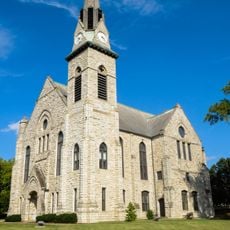
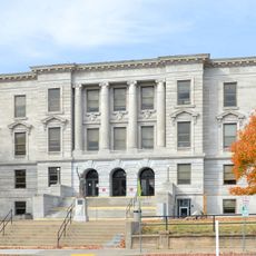
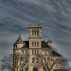
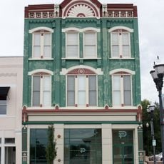
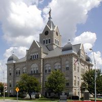
Polk County, County administration center in Bolivar, Missouri, US.

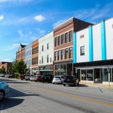
Polk County is an administrative division in Missouri centered at Bolivar, which serves as the seat for regional governance. The area encompasses agricultural lands, residential neighborhoods, and public buildings that function as administrative hubs.

Polk County was established on January 5, 1835, by the Missouri State Legislature, with Bolivar designated as its administrative center. This founding created the regional governance structure that continues today.

The county seat in Bolivar serves as a gathering place where residents attend commissioner meetings and engage with local matters. These public spaces shape the social rhythm of the region and provide a venue for civic participation.

The county offices in Bolivar house various services including property tax collection and vehicle registration. Visitors can access official resources online and obtain direct assistance with local administrative services.

The Polk County Conservation Administration manages environmental programs and natural resources through specialized departments. These initiatives shape how farming and forestry are practiced across the region.

The community of curious travelers

AroundUs brings together thousands of curated places, local tips, and hidden gems, enriched daily by 60,000 contributors worldwide.

Start exploring
Location
Inception
January 5, 1835
Capital city
Bolivar
Shares border with
Hickory County, Greene County, Dallas County, St. Clair County, Dade County, Cedar County
GPS coordinates
37.62000,-93.40000
Latest update
December 7, 2025 20:20
Around this place
Stockton Lake
United States of America

Stockton Lake

32.8 km
Fantastic Caverns
United States of America

Fantastic Caverns

37.2 km
Weaubleau structure
United States of America

Weaubleau structure

45.4 km
Pomme de Terre State Park
United States of America

Pomme de Terre State Park

28.9 km
Stone Chapel
United States of America

Stone Chapel

45.9 km
Commercial Street Historic District
United States of America

Commercial Street Historic District

44.5 km
Caplinger Mills Historic District
United States of America

Caplinger Mills Historic District

40.8 km
George Dimmitt Memorial Hospital
United States of America

George Dimmitt Memorial Hospital

24.9 km
Bentley House
United States of America

Bentley House

45.4 km
Springfield Public Square Historic District
United States of America

Springfield Public Square Historic District

46.3 km
Greene County Courthouse
United States of America

Greene County Courthouse

45.5 km
Gilmore Barn
United States of America

Gilmore Barn

34.5 km
Benton Avenue AME Church
United States of America

Benton Avenue AME Church

45.9 km
Bolivar Public Library
United States of America

Bolivar Public Library

1.2 km
U.S. Customhouse and Post Office
United States of America

U.S. Customhouse and Post Office

46 km
Lincoln School
United States of America

Lincoln School

46.1 km
Greenfield Opera House
United States of America

Greenfield Opera House

45.1 km
Springfield Seed Co. Office and Warehouse
United States of America

Springfield Seed Co. Office and Warehouse

46.3 km
Woods-Evertz Stove Company Historic District
United States of America

Woods-Evertz Stove Company Historic District

46.1 km
Bailey School
United States of America

Bailey School

45.8 km
Stockton Community Building
United States of America

Stockton Community Building

36 km
Gottfried Furniture Company Building
United States of America

Gottfried Furniture Company Building

46.4 km
D.M. Oberman Manufacturing Co. Building
United States of America

D.M. Oberman Manufacturing Co. Building

46 km
Boegel and Hine Flour Mill-Wommack Mill
United States of America

Boegel and Hine Flour Mill-Wommack Mill

34.4 km
Finkbiner Building
United States of America

Finkbiner Building

46.3 km
Jefferson Avenue Footbridge
United States of America

Jefferson Avenue Footbridge

44.2 km
SLSF Sac River Bridge
United States of America

SLSF Sac River Bridge

16 km
Caplinger Mills Bridge
United States of America

Caplinger Mills Bridge

40.3 km
Show the full map
Administrative divisions
« Polk County - County administration center in Bolivar, Missouri, US » is provided by Around Us (aroundus.com). Images and texts are derived from Wikimedia project under a Creative Commons license. You are allowed to copy, distribute, and modify copies of this page, under the conditions set by the license, as long as this note is clearly visible.

Discover hidden gems everywhere you go!

From secret cafés to breathtaking viewpoints, skip the crowded tourist spots and find places that match your style. Our app makes it easy with voice search, smart filtering, route optimization, and insider tips from travelers worldwide. Download now for the complete mobile experience.

Around Us App Screenshot

A unique approach to discovering new places

Le Figaro

All the places worth exploring

France Info

A tailor-made excursion in just a few clicks

20 Minutes

Around Us
Travel Guide & Maps
Download

Send to your phone

QR Code
1

Open the camera app on your mobile.

2

Point at the QR code with your camera. A notification will appear.

3

Tap the notification to open the link.